MyTopo
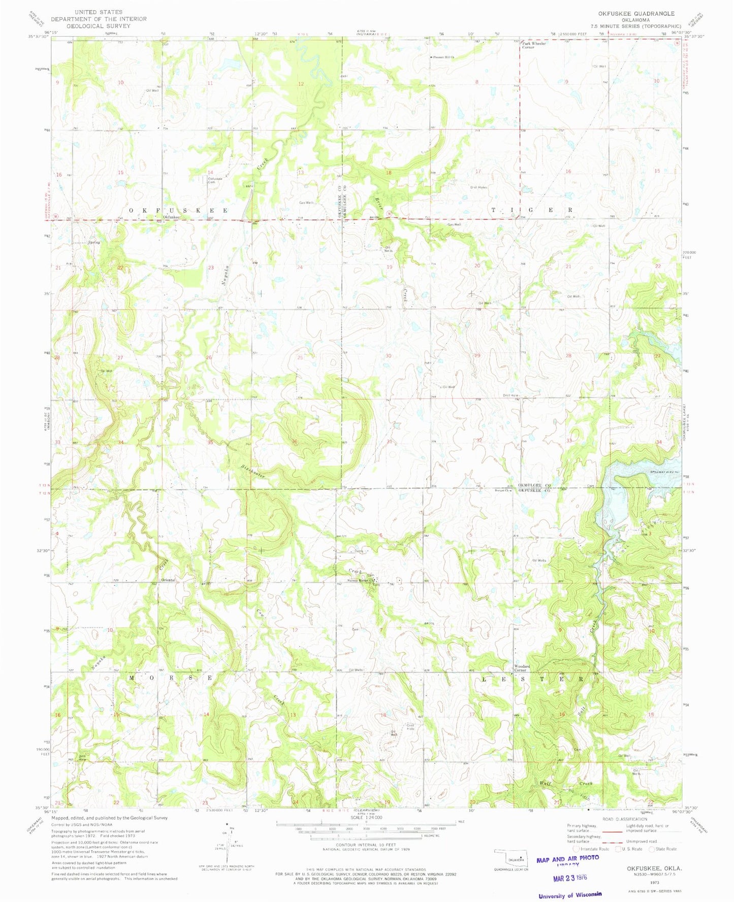
Classic USGS Okfuskee Oklahoma 7.5'x7.5' Topo Map
Couldn't load pickup availability
Historical USGS topographic quad map of Okfuskee in the state of Oklahoma. Map scale may vary for some years, but is generally around 1:24,000. Print size is approximately 24" x 27"
This quadrangle is in the following counties: Okfuskee, Okmulgee.
The map contains contour lines, roads, rivers, towns, and lakes. Printed on high-quality waterproof paper with UV fade-resistant inks, and shipped rolled.
Contains the following named places: Brier Creek, Cow Creek, Durant Church, Nuyaka Cemetery, Nuyaka Mission Church, Okfuskee, Okfuskee Free Cemetery, Okfuskee Tributaries Site N-1 Dam, Okfuskee Tributaries Site N-1 Reservoir, Okfuskee Tributaries Site N-10 Dam, Okfuskee Tributaries Site N-10 Reservoir, Okfuskee Tributaries Site N-2 Dam, Okfuskee Tributaries Site N-2 Reservoir, Okfuskee Tributaries Site N-4 Dam, Okfuskee Tributaries Site N-4 Reservoir, Okfuskee Tributaries Site N6 Dam, Okfuskee Tributaries Site N6 Reservoir, Oknoname 107033 Dam, Oknoname 107033 Reservoir, Oriental, Park Wheeler Corner, Philadelphia Creek, Pleasant Hill Church, Sixshooter Creek, Sunrise Volunteer Fire Department, Township of Lester, Township of Morse, Wolf Creek, Woodard Corner