MyTopo
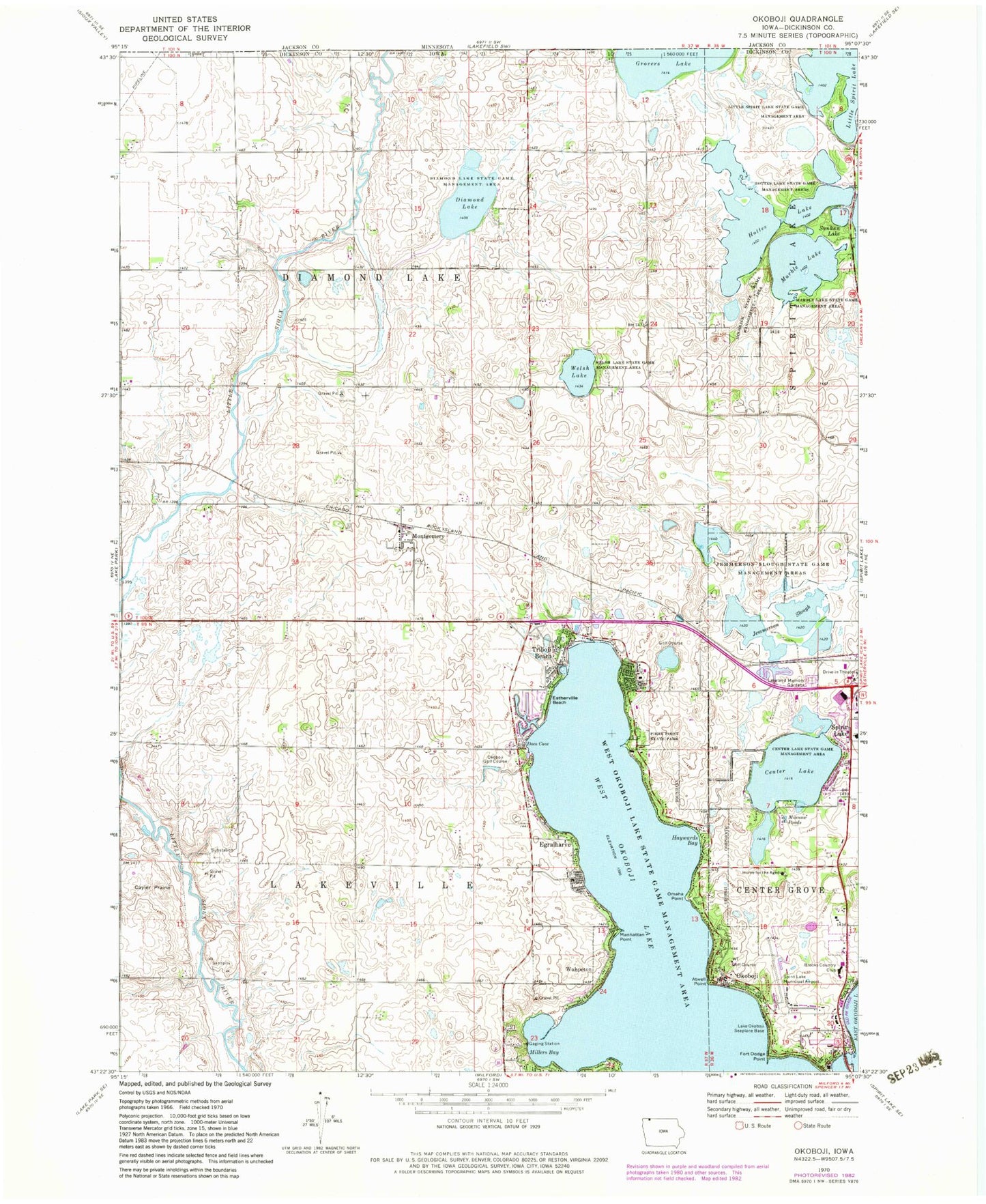
Classic USGS Okoboji Iowa 7.5'x7.5' Topo Map
Couldn't load pickup availability
Historical USGS topographic quad map of Okoboji in the state of Iowa. Typical map scale is 1:24,000, but may vary for certain years, if available. Print size: 24" x 27"
This quadrangle is in the following counties: Dickinson.
The map contains contour lines, roads, rivers, towns, and lakes. Printed on high-quality waterproof paper with UV fade-resistant inks, and shipped rolled.
Contains the following named places: Atwell Point, Cayler Prairie, Center Lake, Center Lake Wildlife Management Area, Diamond Lake, Diamond Lake Wildlife Management Area, Docs Cove, Egralharve, Estherville Beach, Fort Dodge Point, Kettleson Hogsback Wildlife Management Area, West Hottes Lake, Hottes Lake Wildlife Management Area, Howards Bay, Jemmerson Slough Wildlife Management Area, Spirit Lake Memorial Gardens, Little Spirit Lake Wildlife Management Area, Manhattan Point, Marble Lake, Marble Lake State Game Management Area, Millers Bay, Minnow Ponds, Montgomery, Okoboji, Omaha Point, Pikes Point State Park, Sunken Lake, Triboji Beach, Welsh Lake, Welsh Lake Wildlife Management Area, West Okoboji Lake, Oak Haven Care Facility, Dickinson County, Fairoak Beach, Omaha Beach, Brownells Beach, Pikes Point, Echo Bay, Des Moines Beach, Marble Cabin, Brooks Country Club, Lake Okoboji Seaplane Base, Okoboji Golf Course, Spirit Lake Municipal Airport, Township of Diamond Lake, Township of Lakeville, The Inn Post Office (historical), Montgomery Post Office (historical), Montgomery, Methodist Camp Post Office (historical), Manhattan Post Office (historical), Hayward Post Office (historical), Vicks Corner World, McBreen Marsh, Hattie Elston Area, Santee Prairie Area, Cayler Prairie State Preserve, Horseshoe Lake, East Hottes Lake, Egralharve Beach, Furman Point, Raebels Beach, Lazy Lagoon, North Bay, Colcord Point, Dixon Beach, United Methodist Camp, Center Lake Plaza, Moore Medical Services Center, Iowa Lakes Orthopaedics Center, Great Lakes Dental Center, Olsten Health Services Center, Christs Fellowship Church, Immanuel Lutheran Church, Lakeview Open Bible Church, Cenla Campgrounds, Manhattan Beach, Papoose Beach, Little Millers Point, Iowa Lakeside Laboratory, Little Millers Bay, Presbyterian Camp, Hiawatha Point, Okoboji Lutheran Bible Camp, Manhattan Beach Resort, Okoboji Post Office, Okoboji Police Department, Westport Sesquicentennial School, Kenue Park, Ranch Amusement Park, Speier Park, Higgins Museum, Okoboji Bridge, Granger Cabin Historical Marker, Indian Hills Golf Club, Okoboji View Golf Course, The Inn Golf Course, Village East Resort, Beaches Resort, City of Okoboji, Arnolds Park / Okoboji Fire Department, Walker Farms, Brandt Farms