MyTopo
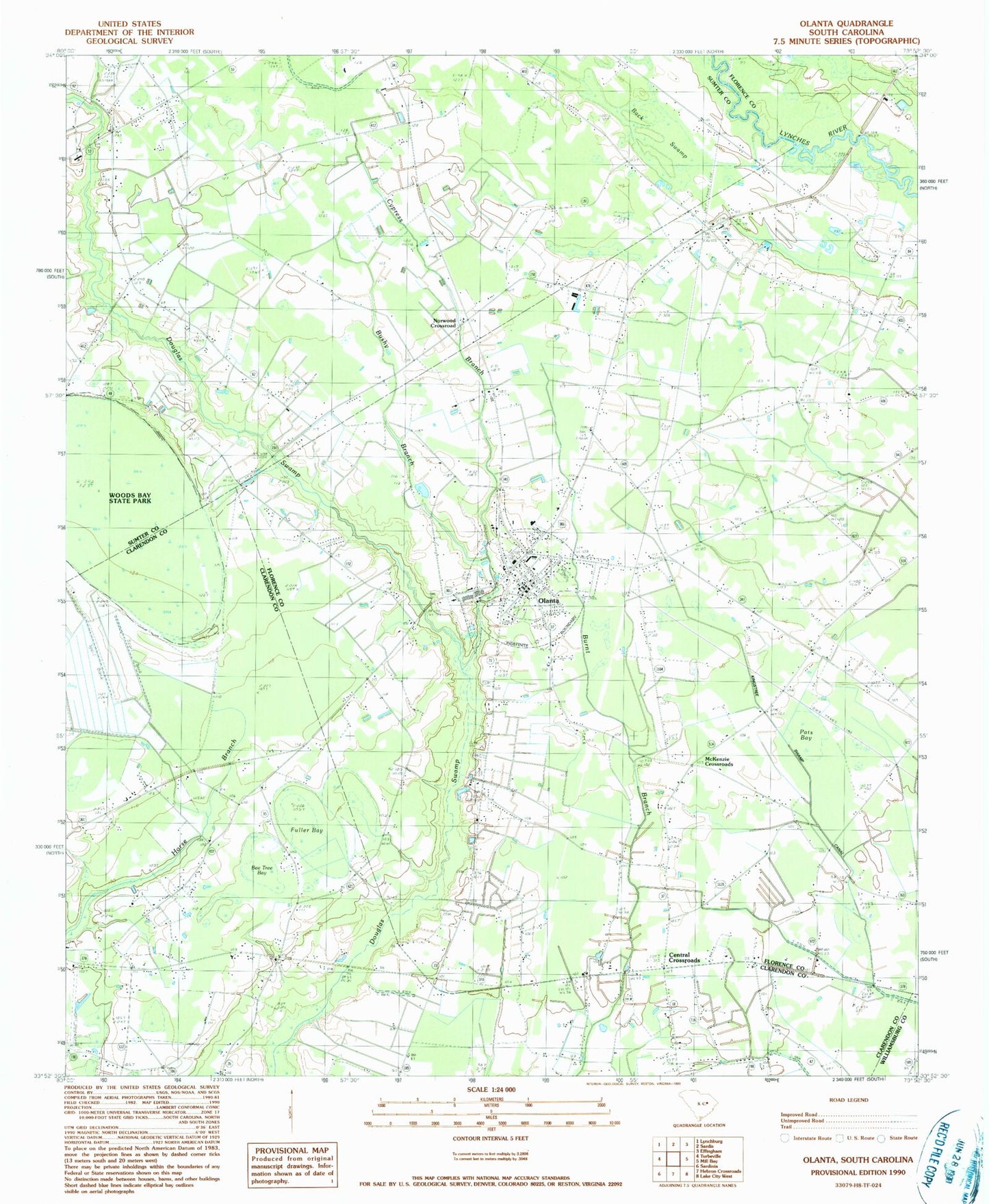
Classic USGS Olanta South Carolina 7.5'x7.5' Topo Map
Couldn't load pickup availability
Historical USGS topographic quad map of Olanta in the state of South Carolina. Map scale may vary for some years, but is generally around 1:24,000. Print size is approximately 24" x 27"
This quadrangle is in the following counties: Clarendon, Florence, Sumter, Williamsburg.
The map contains contour lines, roads, rivers, towns, and lakes. Printed on high-quality waterproof paper with UV fade-resistant inks, and shipped rolled.
Contains the following named places: Back Swamp, Bee Tree Bay, Bethany Cemetery, Bethel Cemetery, Bethel Church, Bethel School, Beulah Mission Church, Bushy Branch, Byrd Field, Central Crossroads, Central School, Cypress Branch, Fuller Bay, Jerusalem Church, Jordan Chapel Baptist Church, McKenzie Crossroads, Mimms Crossroads, Motts Crossroads, New Jerusalem School, New Town Cemetery, New Town Church, Norwood Crossroad, Oak Grove Church, Oak Grove School, Olanta, Olanta Cemetery, Olanta Division, Olanta Elementary School, Olanta First Pentecostal Holiness Church, Olanta Police Department, Olanta Post Office, Olanta Presbyterian Church, Olanta Public Library, Olanta Rural Fire Department, Pats Bay, Pine Dale School, Rush Cemetery, Saint John School, Saint Johns Church, Saint Johns School, Saint Mark Church, Saint Mark School, Sumter Fire Department Byrds Station 18, Town of Olanta, Union Hill Church, Union Hill School, Welsh Bridge, Woods Bay State Park, Woods Millpond, Zion Church, ZIP Code: 29114