MyTopo
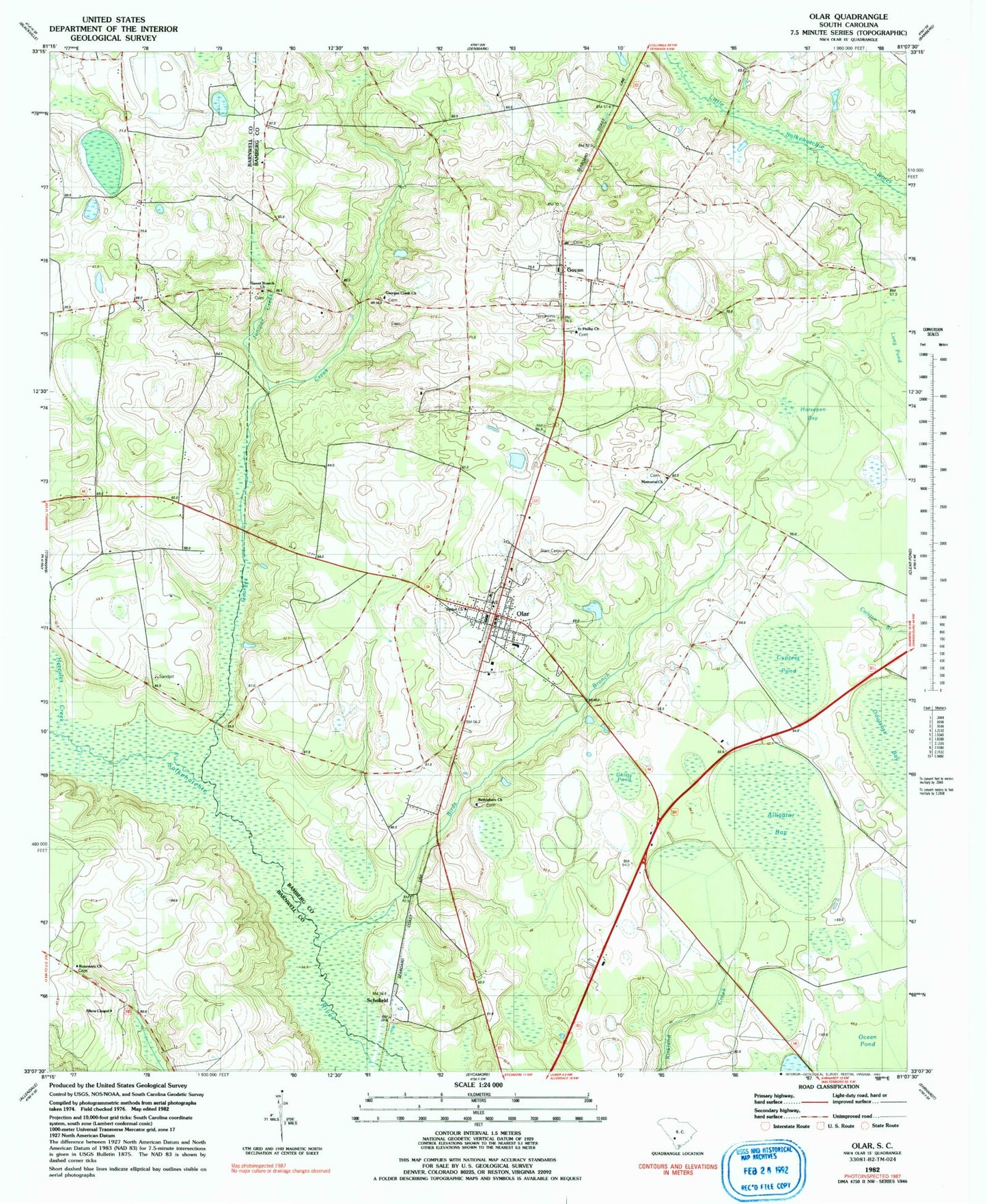
Classic USGS Olar South Carolina 7.5'x7.5' Topo Map
Couldn't load pickup availability
Historical USGS topographic quad map of Olar in the state of South Carolina. Map scale may vary for some years, but is generally around 1:24,000. Print size is approximately 24" x 27"
This quadrangle is in the following counties: Bamberg, Barnwell.
The map contains contour lines, roads, rivers, towns, and lakes. Printed on high-quality waterproof paper with UV fade-resistant inks, and shipped rolled.
Contains the following named places: Allens Chapel Baptist Church, Alligator Bay, Barbers Branch School, Bethel Church, Bethlehem Baptist Church, Birds Branch, Chitty Pond, Cypress Pond, Duck Pond Bay, Eubanks Pond Dam D-2820, First Baptist Church, Georges Creek, Georges Creek Baptist Church, Govan, Govan Baptist Church, Govan Fire Department Station 5, Govan Post Office, Govan School, Hercules Creek, Holiness Church, Horsepen Bay, Juniper Branch, Long Pond, Memorial Baptist Church, Midok Place School, Nimmons Cemetery, Oak Grove School, Olar, Olar Division, Olar Fire Department Station 8, Olar Post Office, Olar School, Rosemary Baptist Church, Rosemary School, Rushes Mill, Saint Phillip Church, Schofield, Starr Cemetery, Sweet Branch Baptist Church, Sweet Branch School, Town of Govan, Town of Olar, ZIP Code: 29843