MyTopo
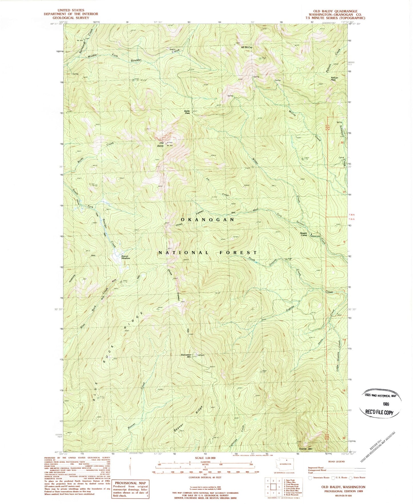
Classic USGS Old Baldy Washington 7.5'x7.5' Topo Map
Couldn't load pickup availability
Historical USGS topographic quad map of Old Baldy in the state of Washington. Map scale may vary for some years, but is generally around 1:24,000. Print size is approximately 24" x 27"
This quadrangle is in the following counties: Okanogan.
The map contains contour lines, roads, rivers, towns, and lakes. Printed on high-quality waterproof paper with UV fade-resistant inks, and shipped rolled.
Contains the following named places: Baldy Pass, Beaver Meadow, Beaver Ridge, Bernhardt Creek, Blue Buck Ridge, Blue Buck Trail, Cathedral Driveway, Golden Stairway Trail, Jim Creek, Little Granite Creek, McCay Trail, Mount McCay, North Granite Creek, Old Baldy, Pearrygin Trail, Pelican Pass, Pretty Bird Trail, Ryan Cabin, Shrew Creek, Shrew Creek Trail, South Fork Trail, Starvation Mountain, Wagon Camp, Wilder Creek