MyTopo
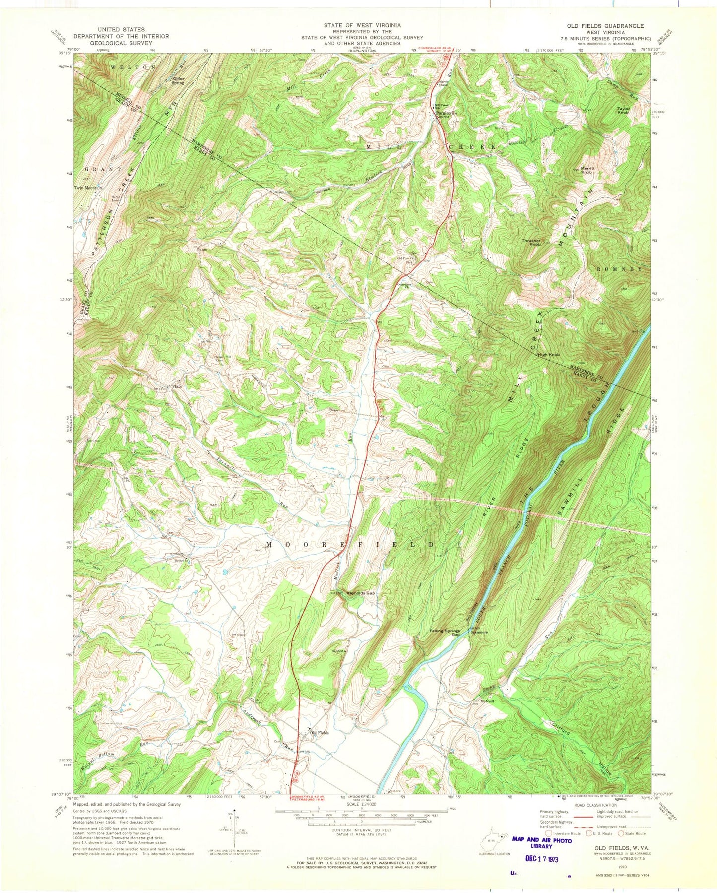
Classic USGS Old Fields West Virginia 7.5'x7.5' Topo Map
Couldn't load pickup availability
Historical USGS topographic quad map of Old Fields in the state of West Virginia. Typical map scale is 1:24,000, but may vary for certain years, if available. Print size: 24" x 27"
This quadrangle is in the following counties: Grant, Hampshire, Hardy, Mineral.
The map contains contour lines, roads, rivers, towns, and lakes. Printed on high-quality waterproof paper with UV fade-resistant inks, and shipped rolled.
Contains the following named places: Anderson Run, Bethel Church, Elliber Spring, Falling Springs Gap, Flats, Green Hill Cemetery, Marvin Chapel, Merritt Knob, Mill Creek Elementary School (historical), Mudlick Run, Old Pine Church, Otterdin Church, Patterson Creek Mountain, Purgitsville, Reynolds Gap, River Ridge, Sawmill Ridge, Stony Run, Thrasher Knob, Toombs Hollow, Turnmill Run, Twin Mountain, Walnut Bottom Run, McNeill, Sycamore, Clifford Hollow, High Knob, Old Fields, Taylor Knob, Bethel School (historical), Mount View School (historical), New Lane School (historical), Powder Lick School (historical), Thrasher Spring School (historical), High Spring, Leslie This Spring, Newbrough Spring, Welton Spring, Welton Spring, Welton Spring, McNeil Spring, Bethel Cemetery, Old Fields Church, Old Fields Post Office, Old Fields School (historical), Old Pine Cemetery, Purgitsville Post Office, Old Fields District, Old Fields Church Cemetery, South Branch Wildlife Management Area