MyTopo
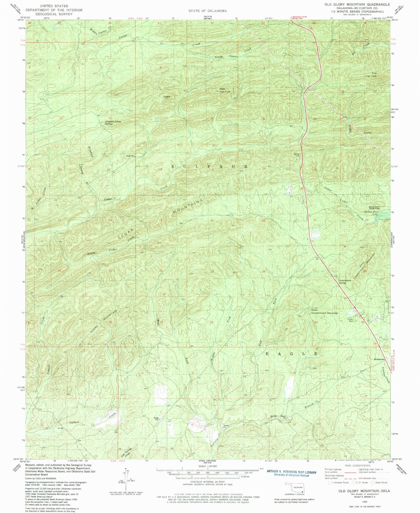
Classic USGS Old Glory Mountain Oklahoma 7.5'x7.5' Topo Map
Couldn't load pickup availability
Historical USGS topographic quad map of Old Glory Mountain in the state of Oklahoma. Map scale may vary for some years, but is generally around 1:24,000. Print size is approximately 24" x 27"
This quadrangle is in the following counties: McCurtain.
The map contains contour lines, roads, rivers, towns, and lakes. Printed on high-quality waterproof paper with UV fade-resistant inks, and shipped rolled.
Contains the following named places: Briar Branch, Brigham Young Branch, Brigham Young Springs, Cedar Mountains, East Fork Lukfata Creek, East Government Mountain, East High Peak, Government Spring, Government Springs, Hochatown, Hochatown Cemetery, Hochatown Volunteer Fire Department, KKBI-FM (Broken Bow), Middle Carter Creek, Middle Fork Lukfata Creek, Okmoname 089009 Reservoir, Oknoname 089009 Dam, Old Glory Mountain, South Carter Creek, South Cedar Creek, West Fork Lukfata Creek, West Government Mountain, West High Peak, ZIP Code: 74728