MyTopo
Classic USGS Old Panola Texas 7.5'x7.5' Topo Map
Couldn't load pickup availability
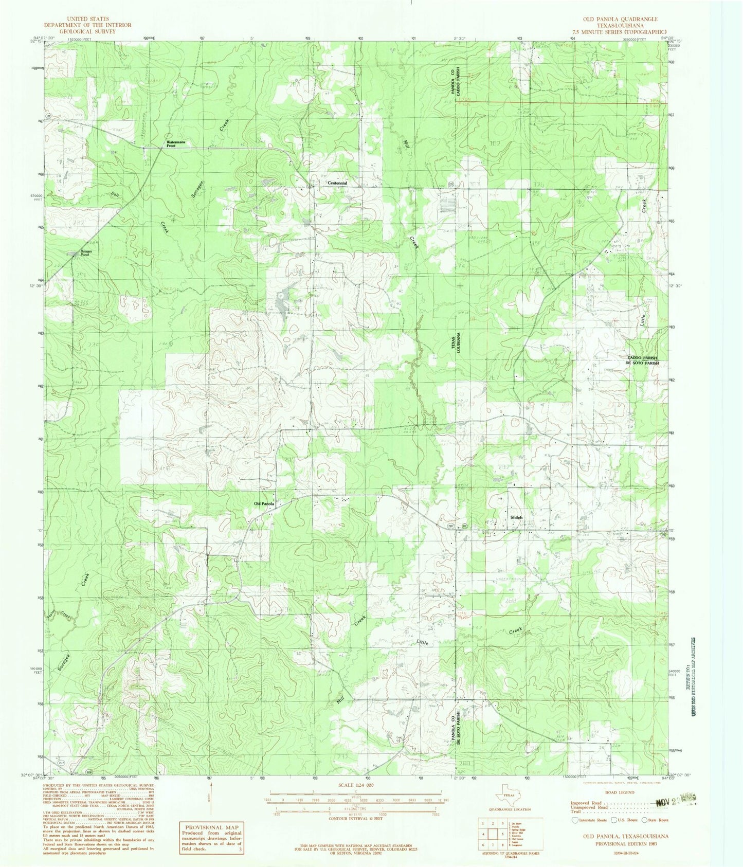
Historical USGS topographic quad map of Old Panola in the states of Texas, Louisiana. Map scale may vary for some years, but is generally around 1:24,000. Print size is approximately 24" x 27"
This quadrangle is in the following counties: Caddo, De Soto, Panola.
The map contains contour lines, roads, rivers, towns, and lakes. Printed on high-quality waterproof paper with UV fade-resistant inks, and shipped rolled.
Contains the following named places: Bagley Lake, Bagley Lake Dam, Bouges Pond, Centennial, Centennial Cemetery, Harmony Church, Little Creek, Little Hope Church, Old Panola, Panola Church, Panola Mission, Paradise Church, Pierce Church, Salt Creek, Shiloh Baptist Church, Shiloh Methodist Church, Taylor Creek, White School