MyTopo
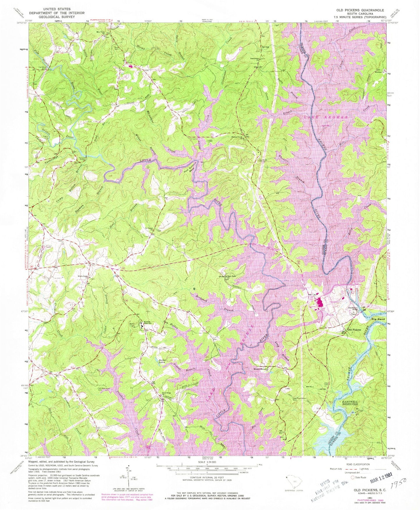
Classic USGS Old Pickens South Carolina 7.5'x7.5' Topo Map
Couldn't load pickup availability
Historical USGS topographic quad map of Old Pickens in the state of South Carolina. Typical map scale is 1:24,000, but may vary for certain years, if available. Print size: 24" x 27"
This quadrangle is in the following counties: Oconee, Pickens.
The map contains contour lines, roads, rivers, towns, and lakes. Printed on high-quality waterproof paper with UV fade-resistant inks, and shipped rolled.
Contains the following named places: Barkshed Branch, Beaman Branch, Betty Branch, Big Bend, Big Creek, Camp Bottom Branch, Caney Branch, Cary Cemetery, Cater Branch, Craig Memorial Cemetery, Emerson Bridge, Flat Shoals Bridge, Fork Bottom Bend, Frenge Branch, High Falls, Hunnicut Bridge, Kelly Creek, Keowee High School, Long Branch, Mile Creek, Neal Branch, New Foundation Cemetery, Nimmons Bridge, Old New Hope Graveyard, Old Pickens Bridge, Owens Chapel, Parker Lakes, Rogers Cemetery, Ross Cemetery, Tanyard Bridge, Todd Branch, Von Hollen Creek, Whetner Branch, Whetstone Creek, Wilson Branch, Crow Creek, Davis Branch, Stamp Creek, Yarborough Branch, South Carolina Noname 39017 Dam, Lake Keowee, Boones Creek School (historical), DAR Monument, Dogwood Heights, Fernwood Acres, Fort George School (historical), Isaqueena School Number 1 (historical), Isaqueena School Number 2 (historical), Keowee School (historical), Lakeside Estates, Lakeside Mobile Home Park, Mount Sinai Church (historical), New Foundation Church (historical), Nimmons Bridge (historical), Norton School (historical), Old Pickens Church, Robertsons Ford, Saxony Forest, Sugar Hill, White Harbor, Fort Prince George (historical), Gap Hill Landing, Keowee Baptist Church Graveyard, Mile Creek County Park, Mile Creek Landing, High Falls Church of God Graveyard, Isaqueena Cemetery, Mountain View Wesleyan Church Graveyard, New Hope Baptist Church Graveyard, Old Pickens Cemetery, Stamp Creek Baptist Church Graveyard, Wolf Stake Baptist Church Graveyard, High Falls Church, Isaqueena Church, Keowee Baptist Church, Morgan Memorial Church, Cornhouse Creek, Flat Shoals River, Mountain View Church, New Hope Baptist Church, Oconee Creek, Old Pickens, Saint Peters Church, Stamp Creek Baptist Church, Wolf Stake Baptist Church, Keowee Ebenezer Fire Department Oconee County Station 11, Keowee Fire Department, Hawks Nest Farm Airport, Keowee Fire Department Station 2, Keowee Key Census Designated Place