MyTopo
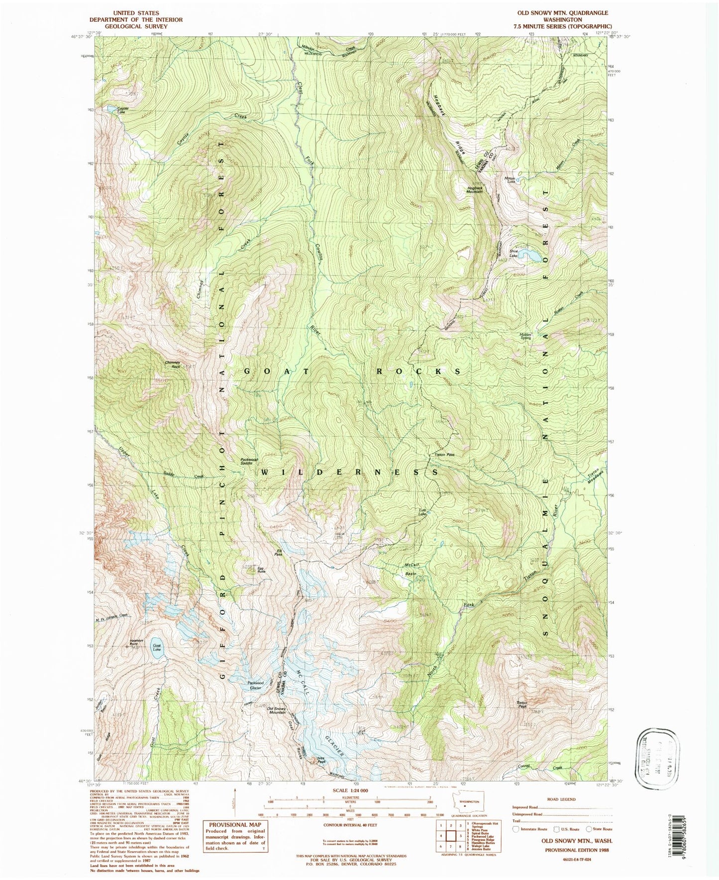
USGS Classic Old Snowy Mountain Washington 7.5'x7.5' Topo Map
Couldn't load pickup availability
Historical USGS topographic quad map of Old Snowy Mountain in the state of Washington. Scale: 1:24000. Print size: 24" x 27"
This quadrangle is in the following counties: Lewis, Yakima.
The map contains contour lines, roads, rivers, towns, lakes, and grids including latitude / longitude and UTM / MGRS. Printed on high-quality waterproof paper with UV fade-resistant inks.
Contains the following named places: Chimney Creek, Chimney Rock, Clear Lost Trail, Coyote Creek, Coyote Lake, Coyote Trail, Egg Butte, Elk Pass, Goat Lake, Goat Ridge, Hawkeye Point, Hidden Spring, Hogback Mountain, Hogback Ridge, Ives Peak, Lily Basin Trail, Lutz Lake, McCall Basin, McCall Glacier, Miriam Lake, Old Snowy Mountain, Packwood Glacier, Packwood Saddle, Saddle Creek, Shoe Lake, Shoe Lake Trail, Tieton Pass, Tieton Peak, Pigtail Peak, Dana Yelverton Shelter, Goat Rocks Wilderness