MyTopo
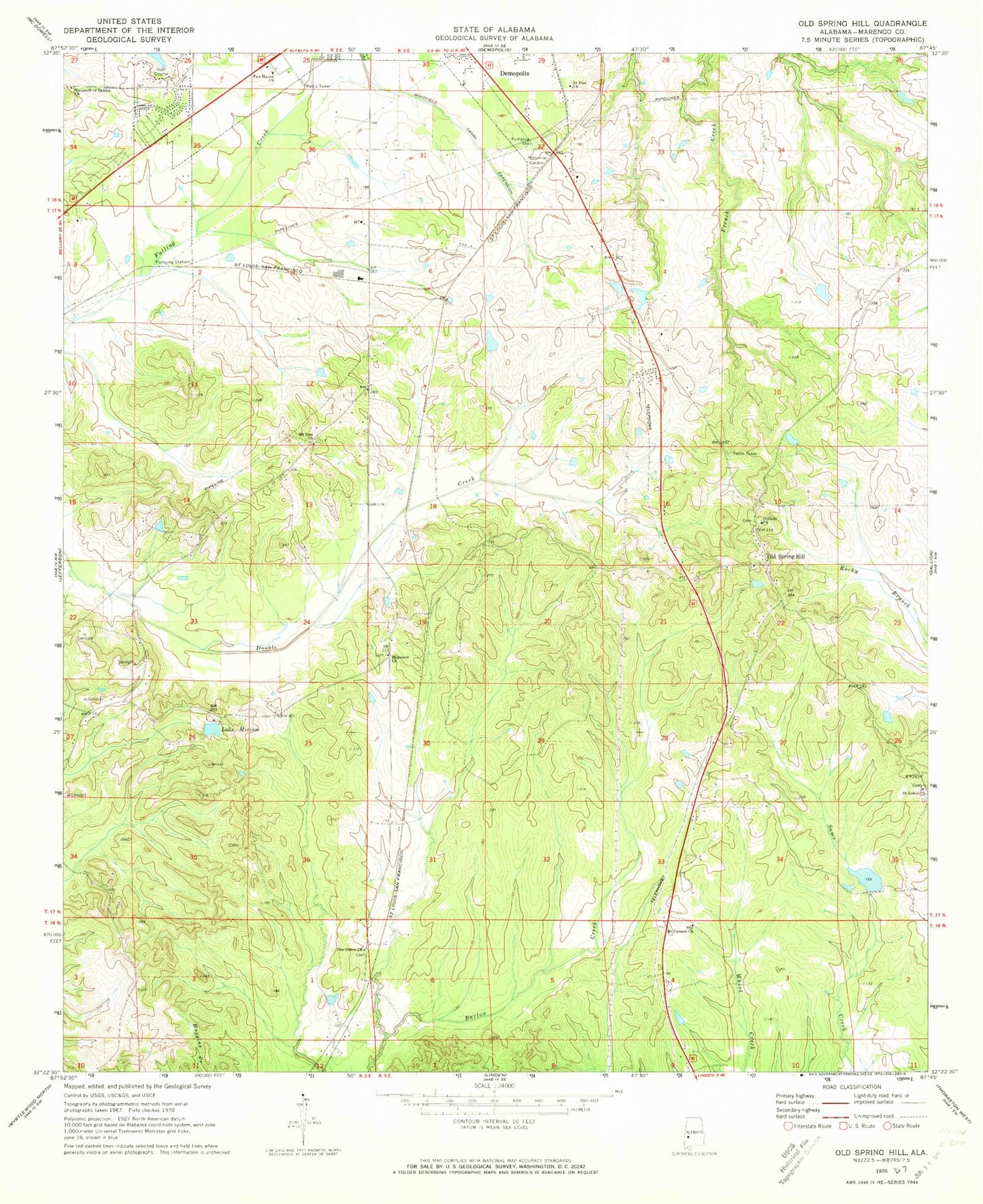
Classic USGS Old Spring Hill Alabama 7.5'x7.5' Topo Map
Couldn't load pickup availability
Historical USGS topographic quad map of Old Spring Hill in the state of Alabama. Map scale may vary for some years, but is generally around 1:24,000. Print size is approximately 24" x 27"
This quadrangle is in the following counties: Marengo.
The map contains contour lines, roads, rivers, towns, and lakes. Printed on high-quality waterproof paper with UV fade-resistant inks, and shipped rolled.
Contains the following named places: City of Demopolis, Demopolis Memorial Gardens Cemetery, Fairhaven Baptist Church, Gilfield Baptist Church, Gilfield Cemetery, Hopewell Cemetery, Hopewell Church, Lake Miriam, Lake Miriam Dam, Mount Zion Cemetery, Mount Zion Church, Nazareth of Galilee Baptist Church, Old Mount Canaan Church, Old Spring Hill, Old Spring Hill Memorial Church, Old Spring Hill Methodist Cemetery, Old Springhill Volunteer Fire Department, Pine Grove Cemetery, Pine Grove Church, Powell Creek Lake Number Nine, Powell Creek Number 9 Dam, Saint Luke Baptist Church, Saint Luke Cemetery, Saint Paul Baptist Church, Simmons Landing, Whitfield Canal Extension