
MyTopo
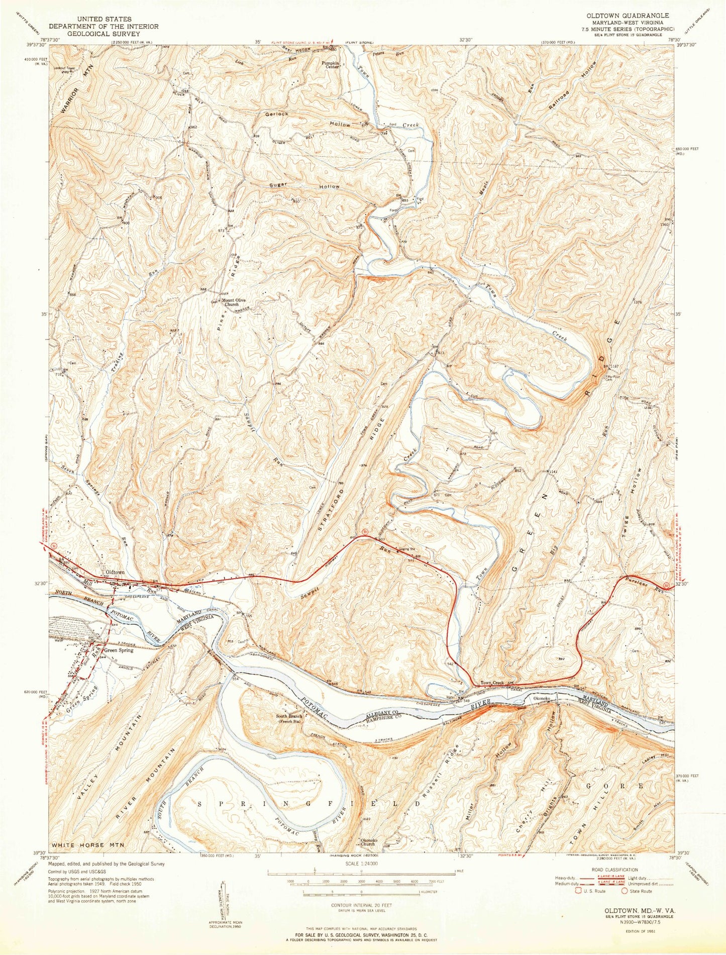
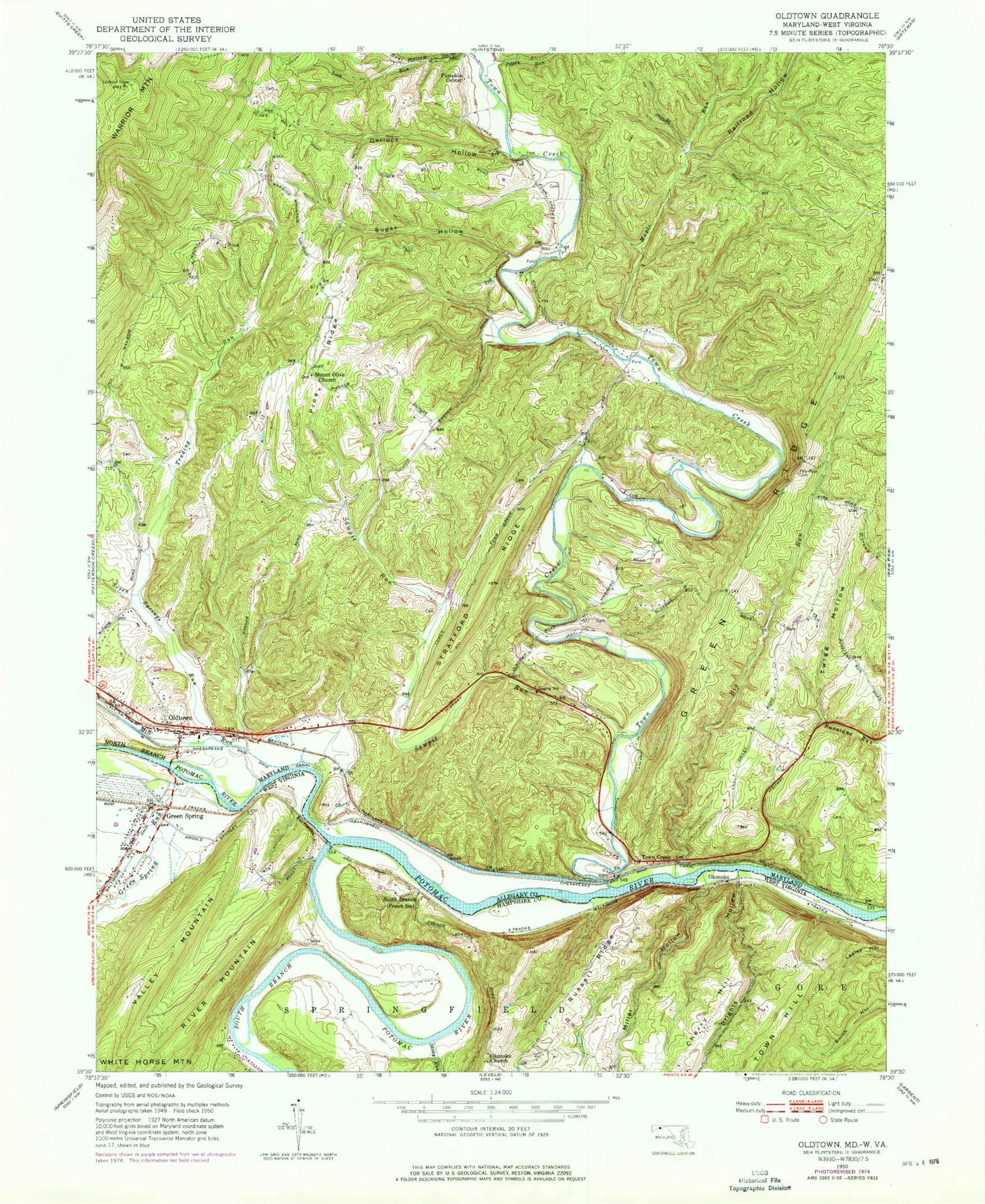
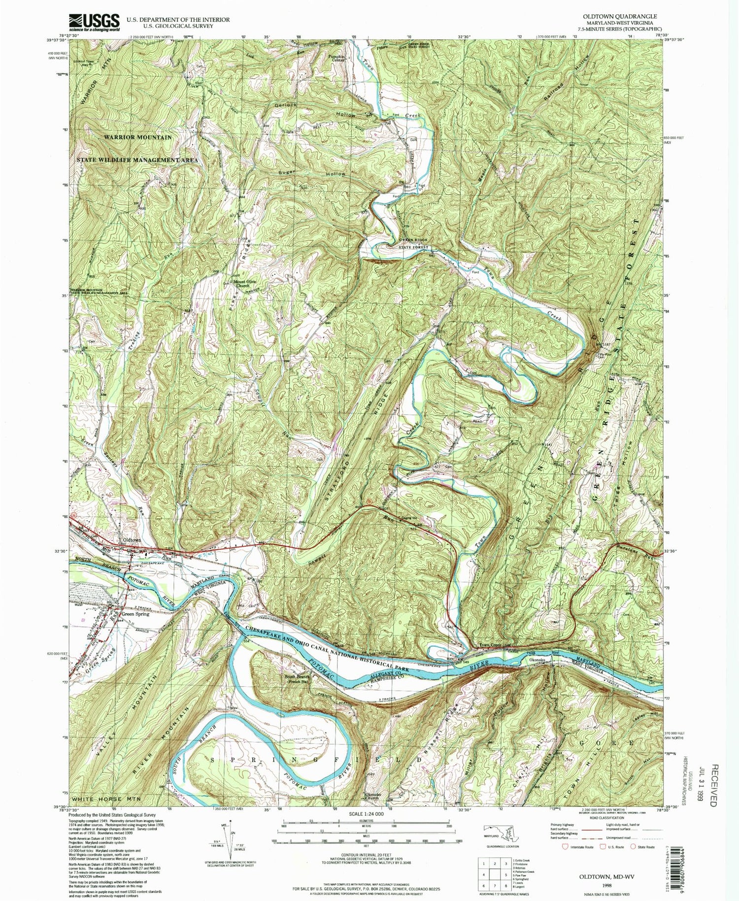
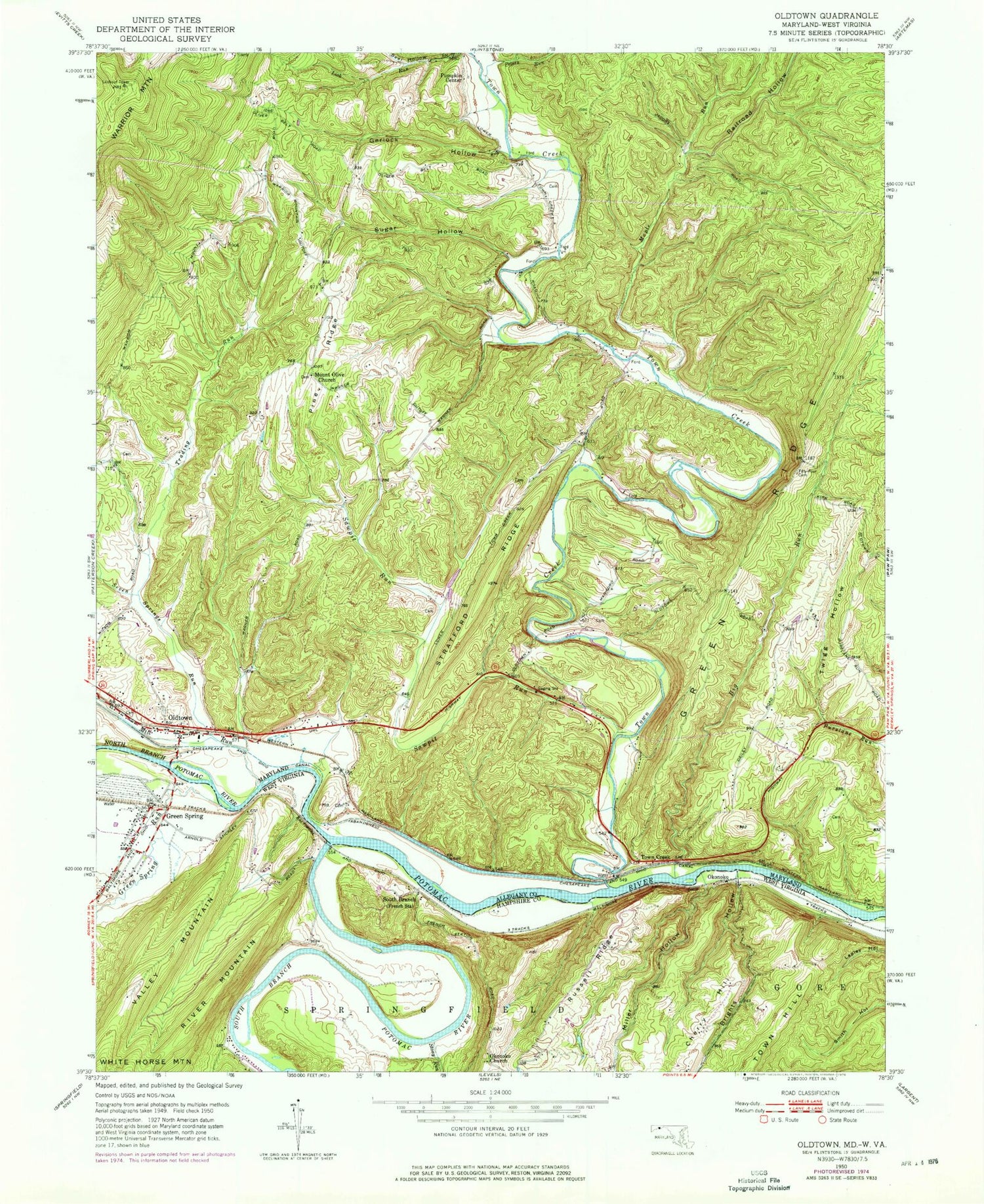
Classic USGS Oldtown Maryland 7.5'x7.5' Topo Map
Couldn't load pickup availability
Historical USGS topographic quad map of Oldtown in the states of Maryland, West Virginia. Typical map scale is 1:24,000, but may vary for certain years, if available. Print size: 24" x 27"
This quadrangle is in the following counties: Allegany, Hampshire.
The map contains contour lines, roads, rivers, towns, and lakes. Printed on high-quality waterproof paper with UV fade-resistant inks, and shipped rolled.
Contains the following named places: Big Run, Fifty - Four Cemetery, Gerlock Hollow, Maple Run, Mill Run, Mount Olive Church, North Branch Potomac River, Peters Run, Pine Ridge, Railroad Hollow, Sawpit Run, Seven Springs Run, Stratford Ridge, Sugar Hollow, Town Creek, Trading Run, Twigs Hollow, Warrior Mountain, Pumpkin Center, Town Creek, Oldtown, Paul Roeder Farm Pond Dam, Paul Roeder Farm Pond, Lock 67, Lock 68, Lock 69, Lock 70, Lock 71, Oldtown Baptist Church, Oldtown K-12 School, Oldtown Post Office, Oldtown-Battie Mixon Picnic Area, Picardy, Town Creek Aqueduct, Town Creek Aqueduct Campground, District 2 Oldtown, Oldtown Catholic Cemetery, Oldtown United Methodist Cemetery, Veterans of Foreign Wars Burial Park, Oldtown Volunteer Fire Department, Oldtown Census Designated Place, Brights Hollow, Green Spring, Green Spring Run, Miller Hollow, Okonoko Church, Russell Ridge, South Branch, Stony Run, South Branch Potomac River, Okonoko, Green Spring, Green Spring Elementary School (historical), Green Spring Post Office, Springfield Valley Volunteer Fire Department, Big Run, Fifty - Four Cemetery, Gerlock Hollow, Maple Run, Mill Run, Mount Olive Church, North Branch Potomac River, Peters Run, Pine Ridge, Railroad Hollow, Sawpit Run, Seven Springs Run, Stratford Ridge, Sugar Hollow, Town Creek, Trading Run, Twigs Hollow, Warrior Mountain, Pumpkin Center, Town Creek, Oldtown, Paul Roeder Farm Pond Dam, Paul Roeder Farm Pond, Lock 67, Lock 68, Lock 69, Lock 70, Lock 71, Oldtown Baptist Church, Oldtown K-12 School, Oldtown Post Office, Oldtown-Battie Mixon Picnic Area, Picardy, Town Creek Aqueduct, Town Creek Aqueduct Campground, District 2 Oldtown, Oldtown Catholic Cemetery, Oldtown United Methodist Cemetery, Veterans of Foreign Wars Burial Park, Oldtown Volunteer Fire Department, Oldtown Census Designated Place, Brights Hollow, Green Spring, Green Spring Run, Miller Hollow, Okonoko Church, Russell Ridge, South Branch, Stony Run, South Branch Potomac River, Okonoko, Green Spring, Green Spring Elementary School (historical), Green Spring Post Office, Springfield Valley Volunteer Fire Department