MyTopo
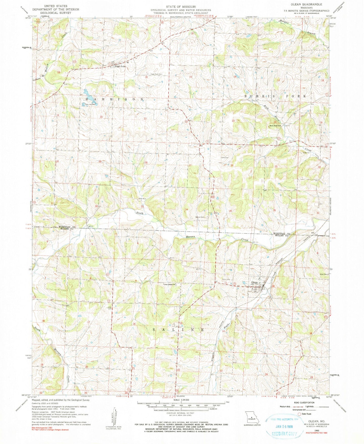
Classic USGS Olean Missouri 7.5'x7.5' Topo Map
Couldn't load pickup availability
Historical USGS topographic quad map of Olean in the state of Missouri. Map scale may vary for some years, but is generally around 1:24,000. Print size is approximately 24" x 27"
This quadrangle is in the following counties: Miller, Moniteau.
The map contains contour lines, roads, rivers, towns, and lakes. Printed on high-quality waterproof paper with UV fade-resistant inks, and shipped rolled.
Contains the following named places: Allen Cemetery, Beard Creek, Bond Lake Dam, California Rural Fire Protection District High Point Fire Station, Colburn Branch, Enon School, Goodmans, Grant School, Gray Cemetery, Green Ridge Baptist Church Cemetery, Green Ridge Church, High Point, High Point Cemetery, High Point Elementary School, Hite Cemetery, Lincoln School, Manning School, Olean, Olean Cemetery, Olean Post Office, Pleasant Mount, Prairie Hill School, Rock Enon Church, Sand Hill School, Sherman School, Taylor School, Tiff Mine, Town of Olean, Township of Harrison, Walker Cemetery