MyTopo
Classic USGS O'Leary Peak Arizona 7.5'x7.5' Topo Map
Couldn't load pickup availability
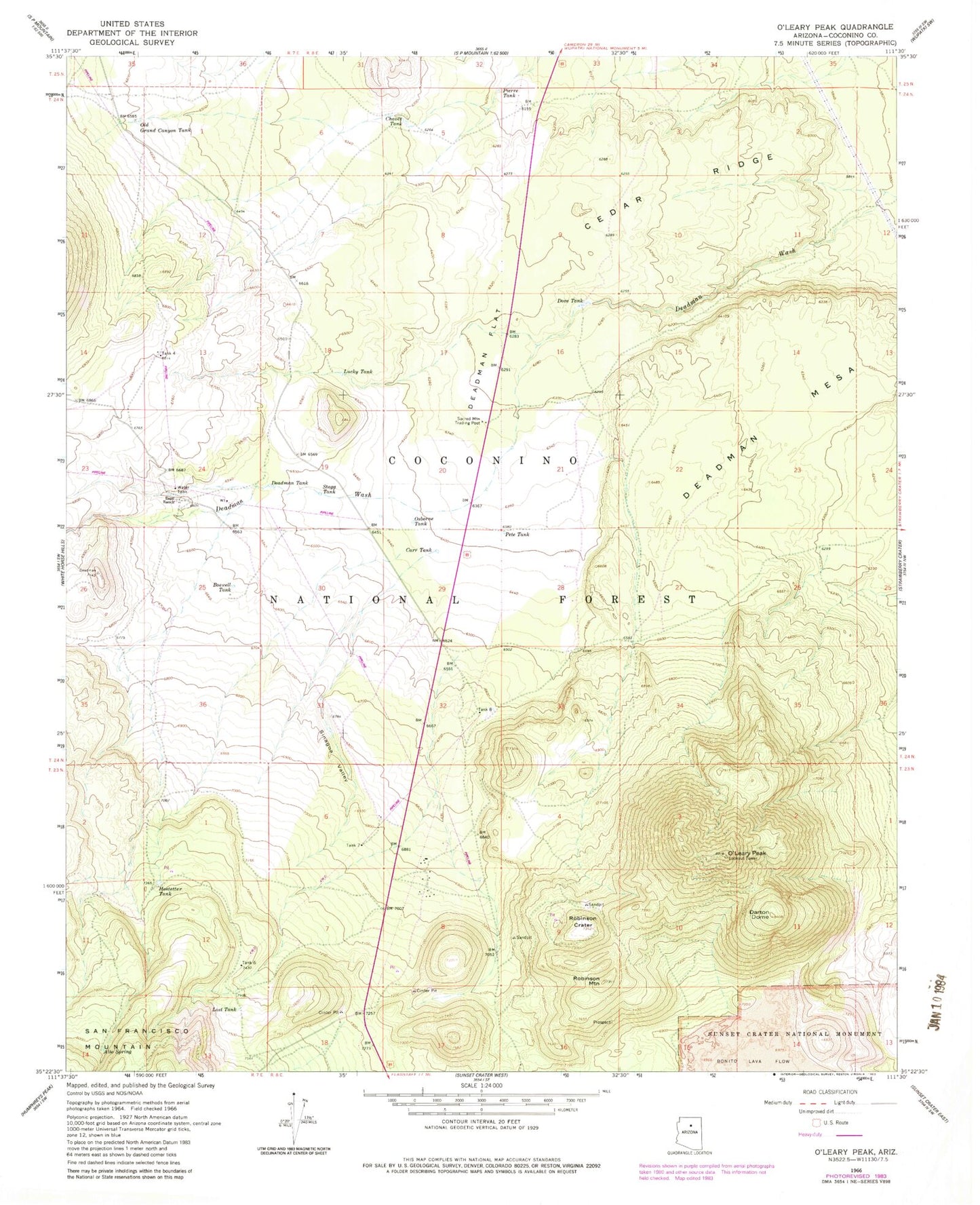
Historical USGS topographic quad map of O'Leary Peak in the state of Arizona. Map scale may vary for some years, but is generally around 1:24,000. Print size is approximately 24" x 27"
This quadrangle is in the following counties: Coconino.
The map contains contour lines, roads, rivers, towns, and lakes. Printed on high-quality waterproof paper with UV fade-resistant inks, and shipped rolled.
Contains the following named places: Alto Spring, Bedground Ridge, Boswell Tank, Carr Tank, Cedar Ridge, Chavez Tank, Chicos Tank, Darton Dome, Deadman Flat, Deadman Mesa, Deadman Tank, Dove Tank, Espil Ranch, French Tank, Hostetter Tank, Lost Tank, Lucky Tank, Medicine Valley, Old Grand Canyon Tank, O'Leary Peak, O'Leary Peak Lookout Tower, Osborne Tank, Pete Tank, Pierre Tank, Robinson Crater, Robinson Mountain, Sacred Mountain Trading Post, Sawmill Tank, Sinagua Valley, Stagg Tank, Tank Eight, Tank Four, Tank Seven, Tank Six