MyTopo
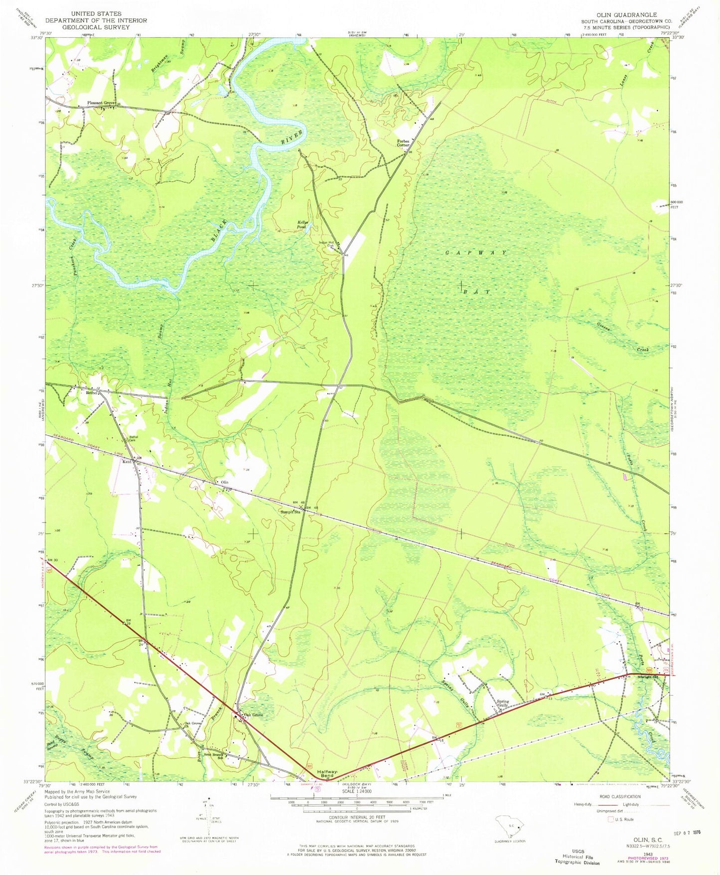
Classic USGS Olin South Carolina 7.5'x7.5' Topo Map
Couldn't load pickup availability
Historical USGS topographic quad map of Olin in the state of South Carolina. Map scale may vary for some years, but is generally around 1:24,000. Print size is approximately 24" x 27"
This quadrangle is in the following counties: Georgetown.
The map contains contour lines, roads, rivers, towns, and lakes. Printed on high-quality waterproof paper with UV fade-resistant inks, and shipped rolled.
Contains the following named places: Andrews Division, Bethel, Bethel Cemetery, Bethel Church, Black River Swamp, Bond Swamp, Britt Branch School, Britt School, Forbes Corner, Gapway Bay, Georgetown Fire Department Station 5, Halfway Bend, Hopewell Church, Indian Hut Club, Indian Hut Swamp, Kellys Pond, Kent, Mount Pisgah Church, Newlight Church, Oak Grove, Oak Grove Church, Oak Grove School, Olin, Pleasant Grove, Puncheon Creek, Sampit Station, Spring Gully, WGTN-FM (Andrews)