MyTopo
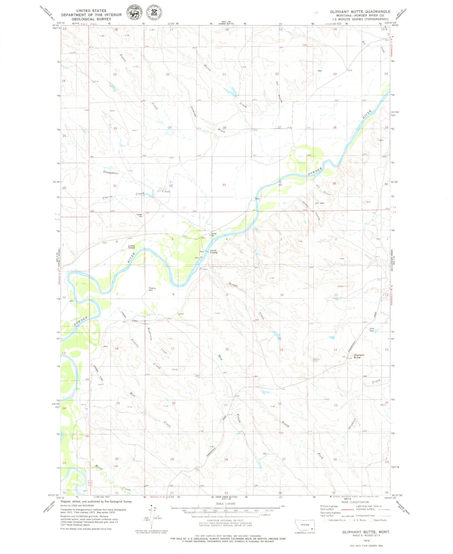
Classic USGS Oliphant Butte Montana 7.5'x7.5' Topo Map
Couldn't load pickup availability
Historical USGS topographic quad map of Oliphant Butte in the state of Montana. Map scale may vary for some years, but is generally around 1:24,000. Print size is approximately 24" x 27"
This quadrangle is in the following counties: Powder River.
The map contains contour lines, roads, rivers, towns, and lakes. Printed on high-quality waterproof paper with UV fade-resistant inks, and shipped rolled.
Contains the following named places: 01S53E21DDCB01 Well, 01S53E29CA__01 Well, 01S53E29DBBD01 Well, 01S53E34CBCD01 Well, 02S52E24DBDA01 Well, 02S53E28AABA01 Well, 02S53E30ADCD01 Well, Cherry Creek, Dry Coulee, Dry Creek, Dry Gulch, Foster Creek, Hay Creek, Hillside Draw, Horse Creek, Jurica School, Mason Creek, Matt Creek, Mushroom Creek, North Fork Hay Creek, Oliphant Butte, Olson Coulee, Prairie Creek, Rough Creek, Sixmile Crossing, Slaughter Creek, Tepee Hill