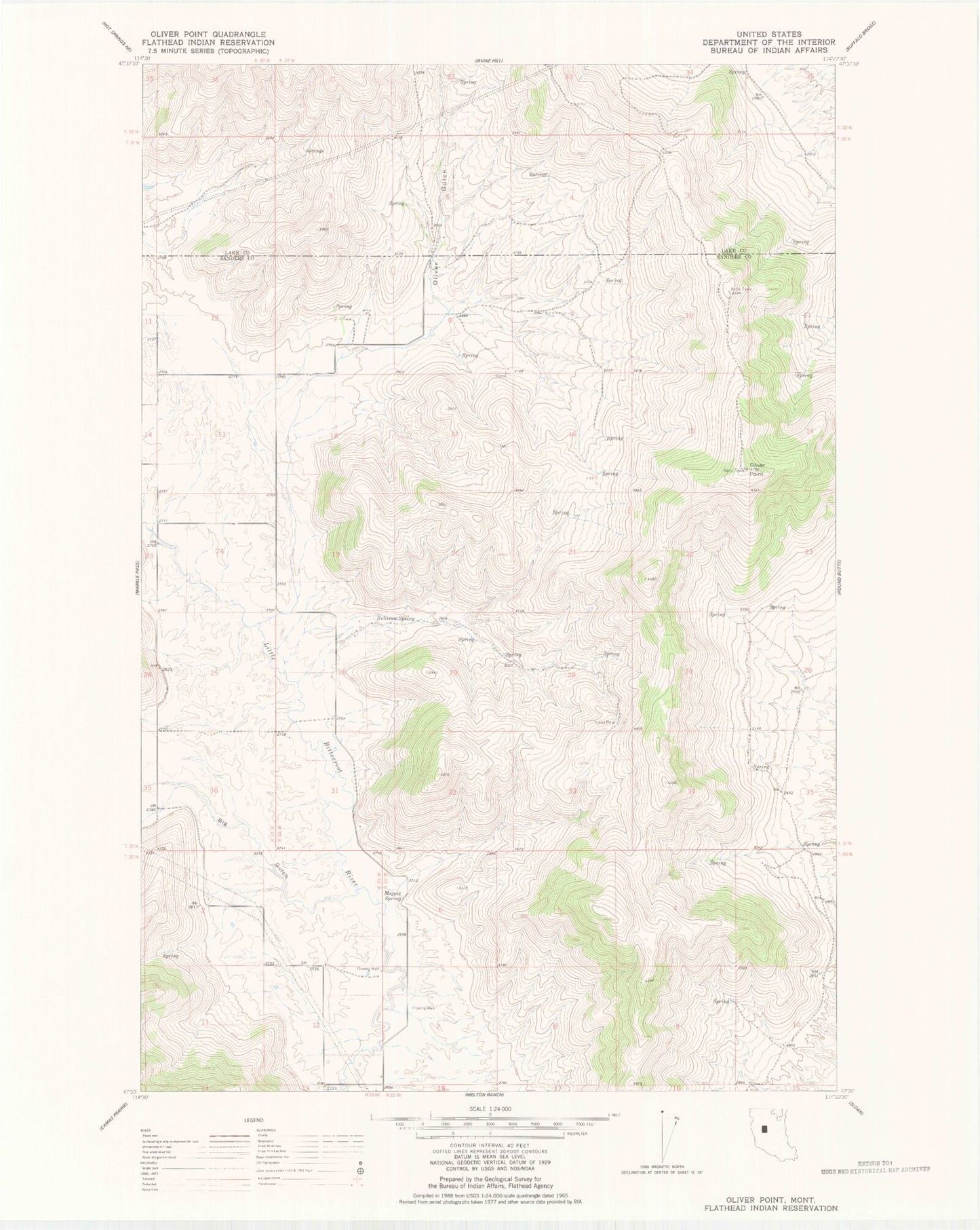
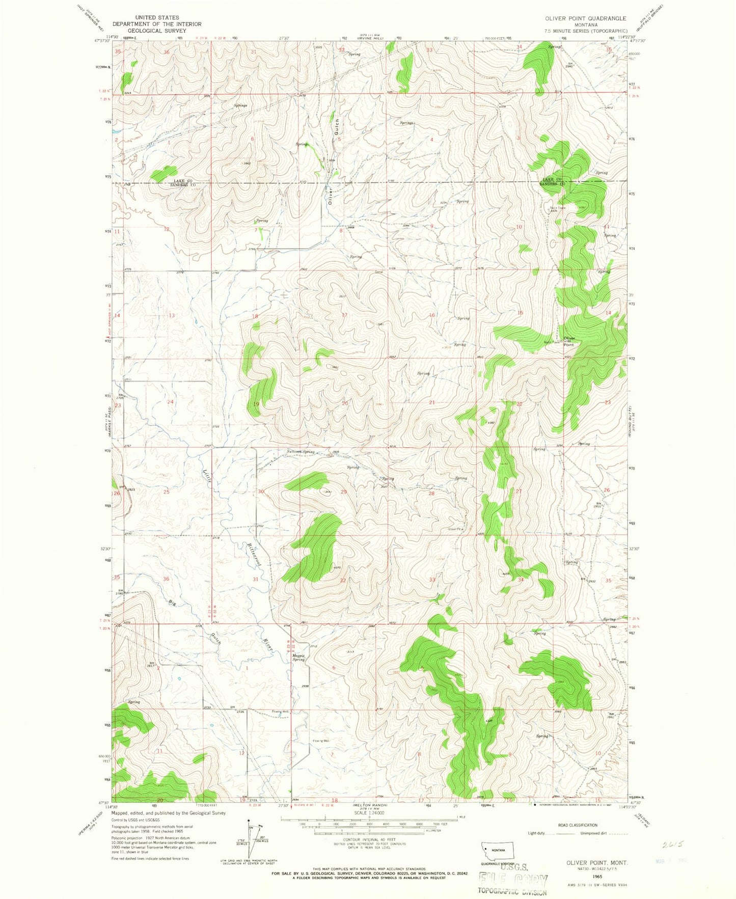
MyTopo
Classic USGS Oliver Point Montana 7.5'x7.5' Topo Map
Couldn't load pickup availability
Historical USGS topographic quad map of Oliver Point in the state of Montana. Map scale may vary for some years, but is generally around 1:24,000. Print size is approximately 24" x 27"
This quadrangle is in the following counties: Lake, Sanders.
The map contains contour lines, roads, rivers, towns, and lakes. Printed on high-quality waterproof paper with UV fade-resistant inks, and shipped rolled.
Contains the following named places: 20N23W12AAA_01 Well, 21N22W07DCAA01 Well, 21N22W30BAD_01 Well, 21N22W30BDAA01 Well, 21N22W30CDA_01 Well, 21N23W13CCBC01 Well, 21N23W13CCD_01 Well, 21N23W13CCD_02 Well, 21N23W24ADC_01 Well, Big Gulch, Magpie Spring, Oliver Gulch, Oliver Gulch Post Office, Oliver Point, Sullivan Spring