MyTopo
Classic USGS Oliver Reservoir Nebraska 7.5'x7.5' Topo Map
Regular price
$16.95
Regular price
Sale price
$16.95
Unit price
per
Couldn't load pickup availability
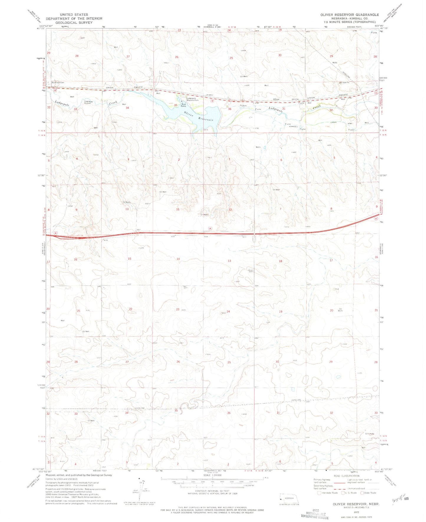
Historical USGS topographic quad map of Oliver Reservoir in the state of Nebraska. Map scale may vary for some years, but is generally around 1:24,000. Print size is approximately 24" x 27"
This quadrangle is in the following counties: Kimball.
The map contains contour lines, roads, rivers, towns, and lakes. Printed on high-quality waterproof paper with UV fade-resistant inks, and shipped rolled.
Contains the following named places: Bushnell Cemetery, Kimball Eastbound Travel Information Center, Kimball Irrigation District Dam, Kimball Rest Area, Lodgepole Wayside Park, Nebraska Historical Marker, Oliver, Oliver Reservoir, Oliver Reservoir Camping Area, Oliver Reservoir State Recreation Area