MyTopo
Classic USGS Olivet Michigan 7.5'x7.5' Topo Map
Couldn't load pickup availability
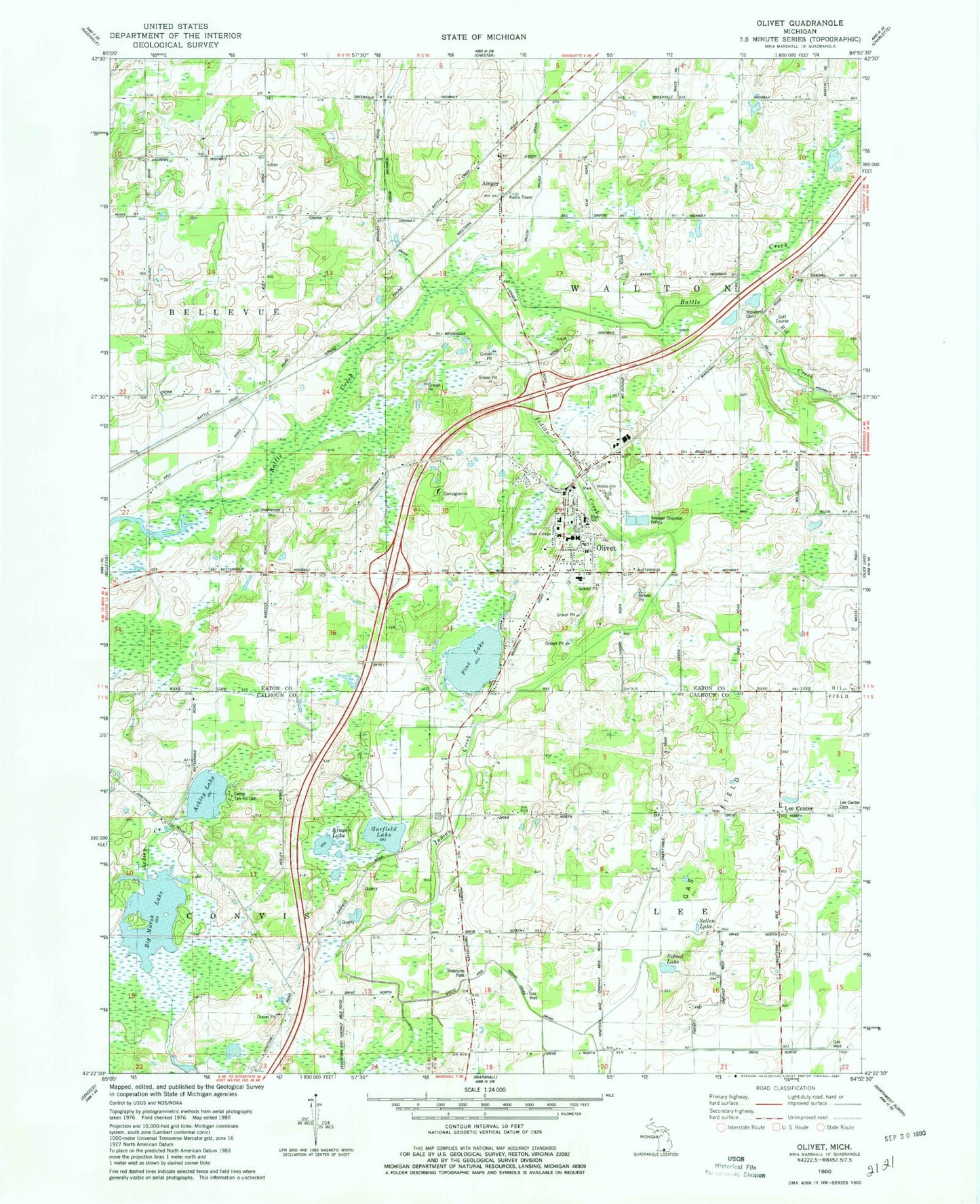
Historical USGS topographic quad map of Olivet in the state of Michigan. Map scale may vary for some years, but is generally around 1:24,000. Print size is approximately 24" x 27"
This quadrangle is in the following counties: Calhoun, Eaton.
The map contains contour lines, roads, rivers, towns, and lakes. Printed on high-quality waterproof paper with UV fade-resistant inks, and shipped rolled.
Contains the following named places: Ackley Lake, Ainger, Ainger Bible Church, Ainger Post Office, Art Building, Big Creek, Big Marsh Lake, Blair Hall, Bosworth Cemetery, Burrage Library, C S Mott Academic Center, Camp Tah-Ko-Dah, City of Olivet, Dillon Relaid Drain, Dole Hall, Fern Persons Elementary School, First Congregational Church Historical Marker, Frederick S Upton Center, Garfield Lake, Hance House, Harbor Springs Fire Department, Indian Creek, Kinyon Lake, Lee Center, Lee Center Cemetery, Lester K Kirk Center, MacKay Gymnasium, Margaret Upton Conservatory of Music, Marshall Internal and Family Medicine, Olivet, Olivet City Cemetery, Olivet City Hall, Olivet College, Olivet College Historical Marker, Olivet Congregational Church, Olivet Country Club, Olivet Fire Department, Olivet First Assembly of God Church, Olivet High School, Olivet Police Department, Olivet Post Office, Olivet Station, Pine Lake, Ruth Rawlings Mott Auditorium, School Lake, Sellen Lake, Shipherd Hall, Township of Lee, Township of Walton, WOCR-FM (Olivet), ZIP Code: 49076