
MyTopo
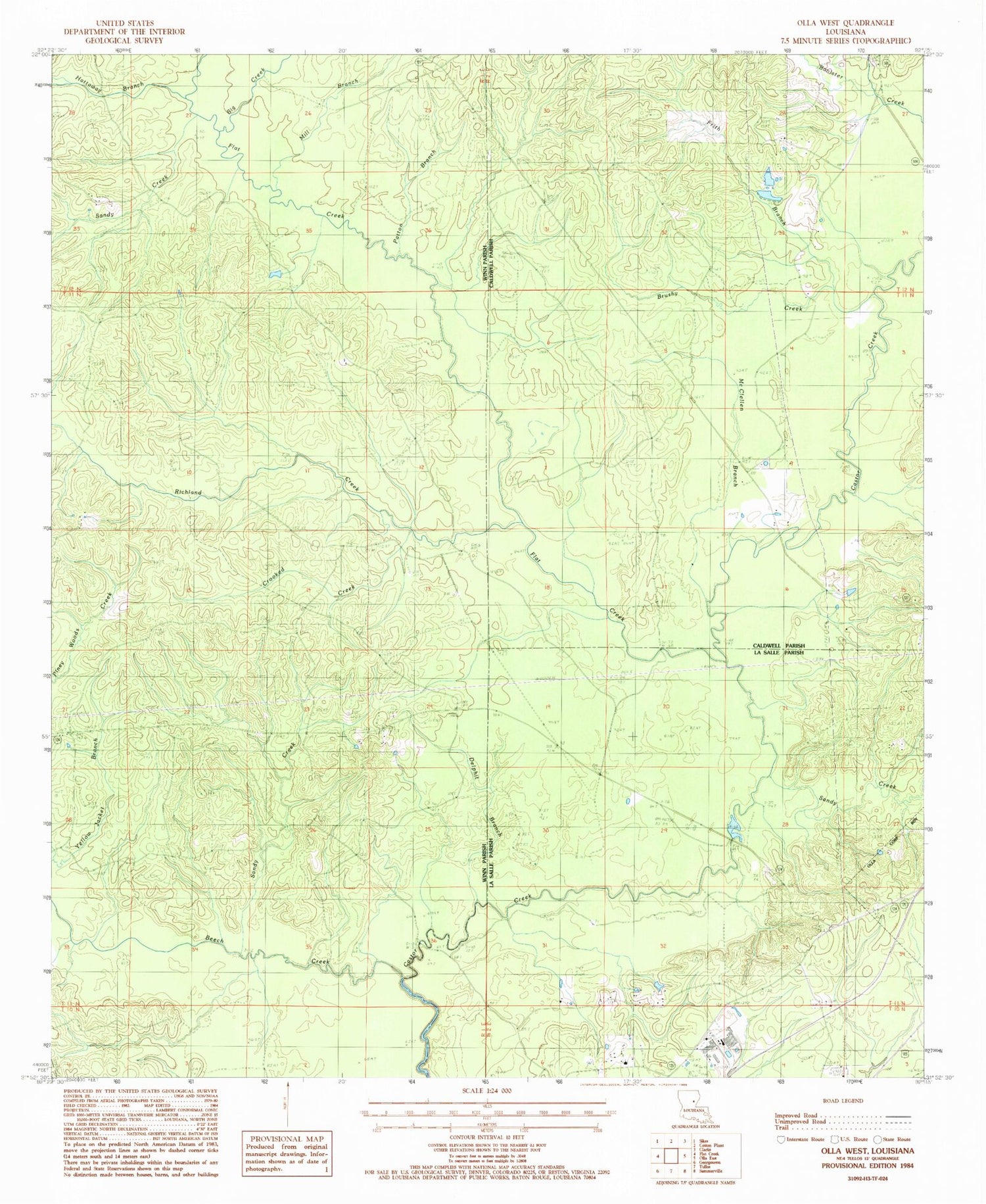
Classic USGS Olla West Louisiana 7.5'x7.5' Topo Map
Couldn't load pickup availability
Historical USGS topographic quad map of Olla West in the state of Louisiana. Map scale may vary for some years, but is generally around 1:24,000. Print size is approximately 24" x 27"
This quadrangle is in the following counties: Caldwell, LaSalle, Winn.
The map contains contour lines, roads, rivers, towns, and lakes. Printed on high-quality waterproof paper with UV fade-resistant inks, and shipped rolled.
Contains the following named places: Adams Cemetery, Beech Creek, Big Creek, Brushy Creek, Crooked Creek, Delphit Branch, Flat Creek, Frith Branch, Hattaway Branch, Kees Cemetery, McBroom Cemetery, McBroom Gas Field, McClellen Branch, Mill Branch, Nelson Cemetery, Patton Branch, Pinehill Baptist Church, Pinehill Cemetery, Richland Creek, Richland Creek Gas Field, Sandy Creek, Sandy Creek Gas Field, Whitehead Cemetery, Zion Hill Baptist Church


