MyTopo
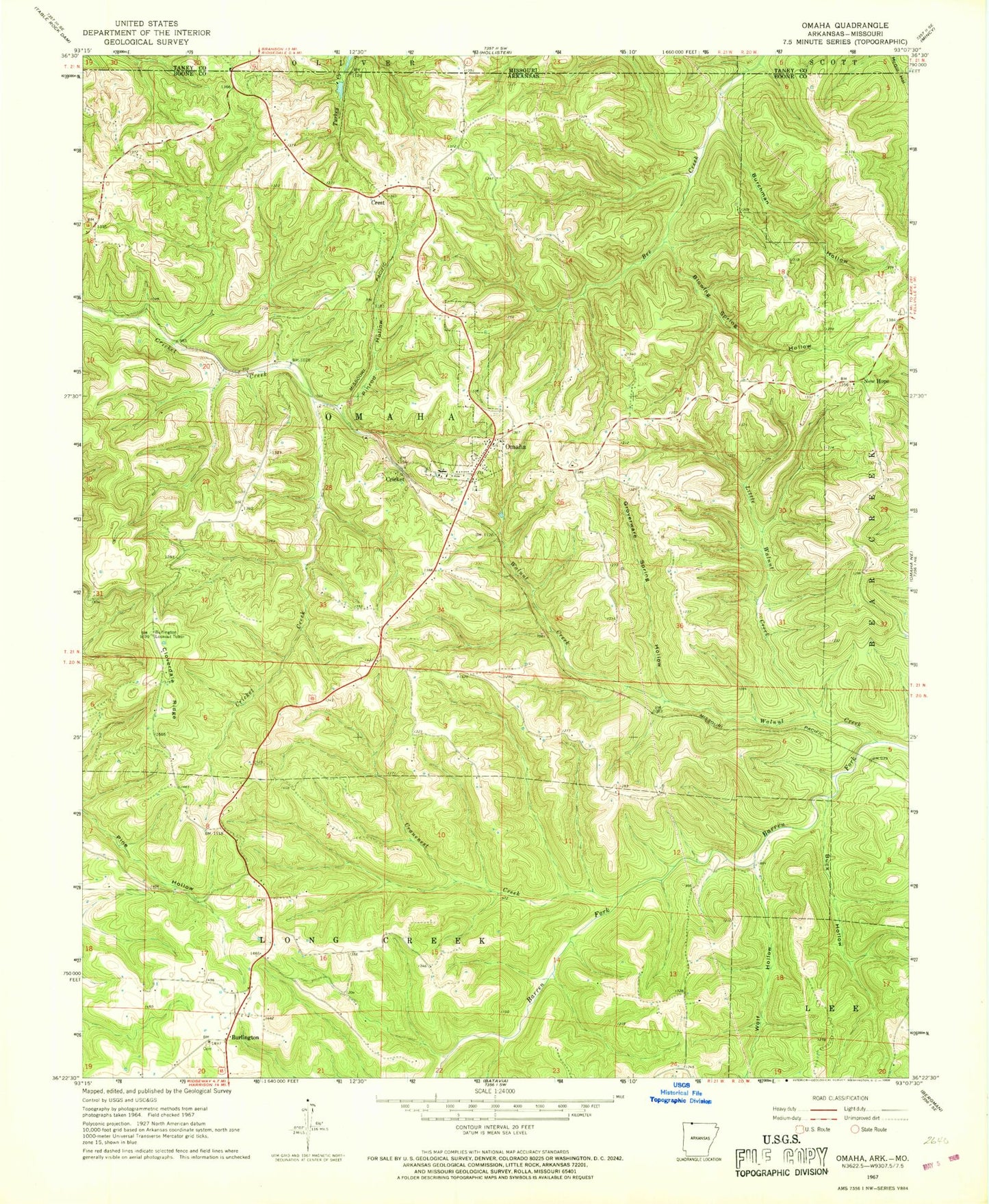
Classic USGS Omaha Arkansas 7.5'x7.5' Topo Map
Couldn't load pickup availability
Historical USGS topographic quad map of Omaha in the states of Arkansas, Missouri. Map scale may vary for some years, but is generally around 1:24,000. Print size is approximately 24" x 27"
This quadrangle is in the following counties: Boone, Taney.
The map contains contour lines, roads, rivers, towns, and lakes. Printed on high-quality waterproof paper with UV fade-resistant inks, and shipped rolled.
Contains the following named places: Blowing Spring Hollow, Buck Hollow, Burchman Hollow, Burlington, Burlington Baptist Church, Burlington Lookout Tower, Cloverdale Ridge, Cranenest Creek, Crest, Cricket, Groverware Spring Hollow, KHOZ-FM (Harrison), Little Walnut Creek, New Hope, New Hope Baptist Church, Omaha, Omaha Church of Christ, Omaha Elementary School, Omaha Fire Department, Omaha High School, Omaha Middle School, Omaha Post Office, Pinrod Hollow, Shaw Lake, Shaw Lake Dam, Town of Omaha, Township of Long Creek, Township of Omaha, Walnut Creek, Wolf Hollow, ZIP Code: 72662