
MyTopo
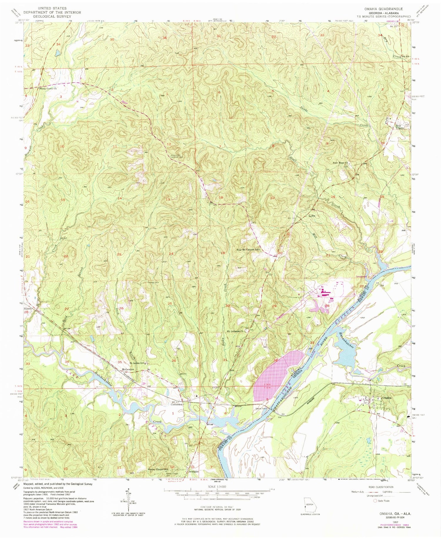
Classic USGS Omaha Georgia 7.5'x7.5' Topo Map
Couldn't load pickup availability
Historical USGS topographic quad map of Omaha in the states of Georgia, Alabama. Map scale may vary for some years, but is generally around 1:24,000. Print size is approximately 24" x 27"
This quadrangle is in the following counties: Russell, Stewart.
The map contains contour lines, roads, rivers, towns, and lakes. Printed on high-quality waterproof paper with UV fade-resistant inks, and shipped rolled.
Contains the following named places: Bluff Creek, Bluff Creek Access Area, Briar Creek, Briar Creek Park, Buck Creek, Cottonton, Cottonton Elementary School, Cottonton Post Office, Cottonton Volunteer Fire Department Station 1, Cottonton Volunteer Fire Department Station 2, Fitzgeralds Landing, Hannahatchee Creek, Hatchechubbee Creek, Hatchechubbee Creek Park, Hirsch, Holy Trinity, Holy Trinity Post Office, Howards Landing, Jernigan, Jernigan Church, Joseph Wilson Smith Bridge, Loflin, Mahrt, Mays Landing, McClouds Ferry, McLendon, Mill Creek, Mount Canaan Church, Mount Lebanon Baptist Church, Murrell Hill Lookout Tower, New Hope Church, New Mount Cannon School, Newsoms Pond, Omaha, Omaha Post Office, Rocky Creek, Saint James Church, Saint James Elementary School, Saint Josephs Church, Saint Josephs Seminary, Saint Paul Church Cemetery, Sand Branch, Sawokli, Shady Grove Church, Spring Grove, Thomas Cemetery, Towns Landing, Wesley Chapel Cemetery, Wesley Chapel School, ZIP Code: 36859


