MyTopo
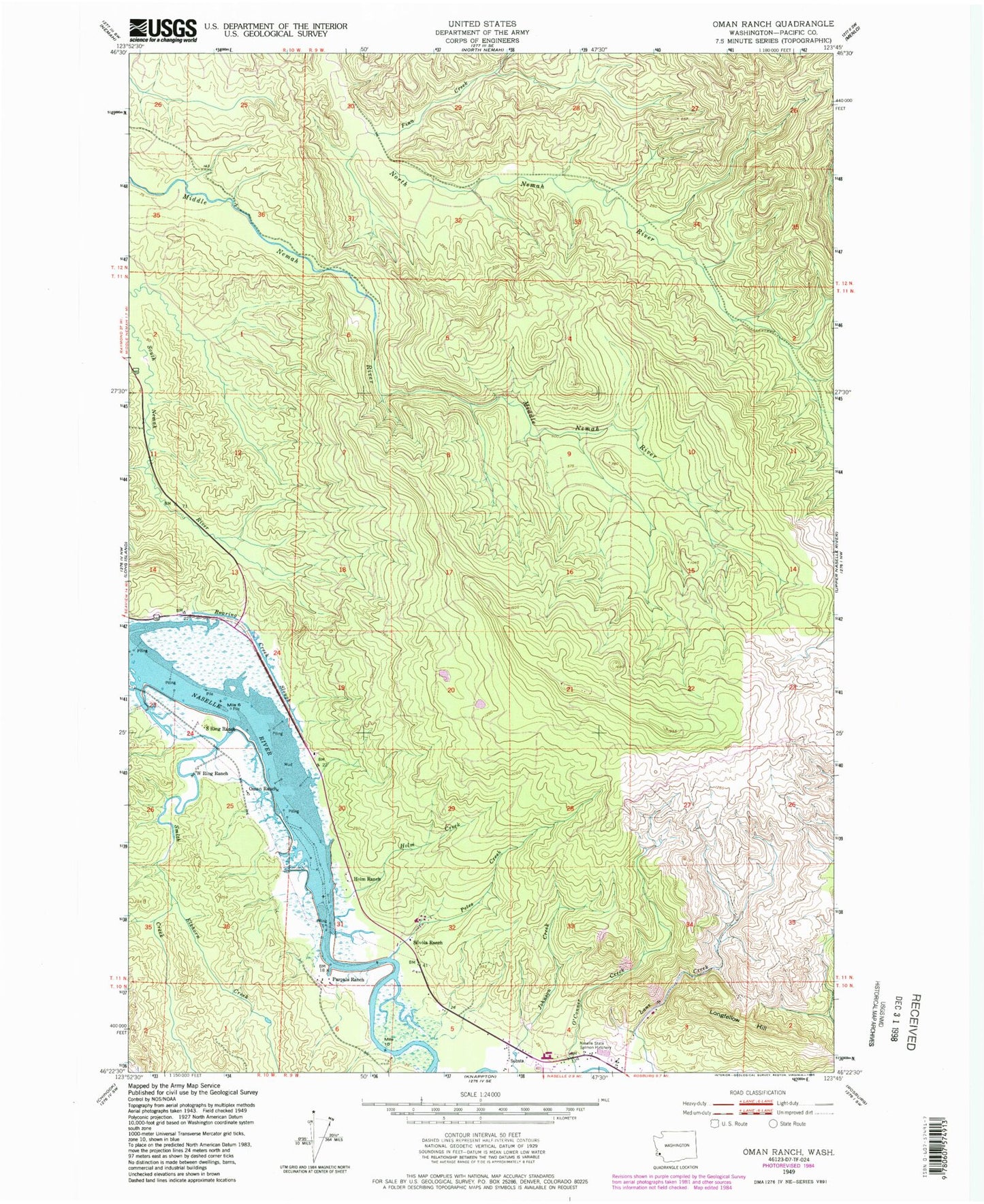
Classic USGS Oman Ranch Washington 7.5'x7.5' Topo Map
Couldn't load pickup availability
Historical USGS topographic quad map of Oman Ranch in the state of Washington. Map scale may vary for some years, but is generally around 1:24,000. Print size is approximately 24" x 27"
This quadrangle is in the following counties: Pacific.
The map contains contour lines, roads, rivers, towns, and lakes. Printed on high-quality waterproof paper with UV fade-resistant inks, and shipped rolled.
Contains the following named places: Cowan Peak Lookout, Elkhorn Creek, Finn Creek, Holm Creek, Holm Ranch, Johnsons Landing, Longfellow Hill, Naselle - Grays River Valley Elementary School, Naselle Air Force Station, Naselle Quarry, Naselle State Salmon Hatchery, Naselle Substation, Naselle Youth Camp School, Oman Ranch, Parpala Ranch, Petes Creek, Ring Ranch, Roaring Creek Slough, S Ring Ranch, Silvola Ranch, Smith Creek, Wirkkala Dam Number One, Wirkkala Dam Number Two, Wirkkala Ponds, ZIP Code: 98638