MyTopo
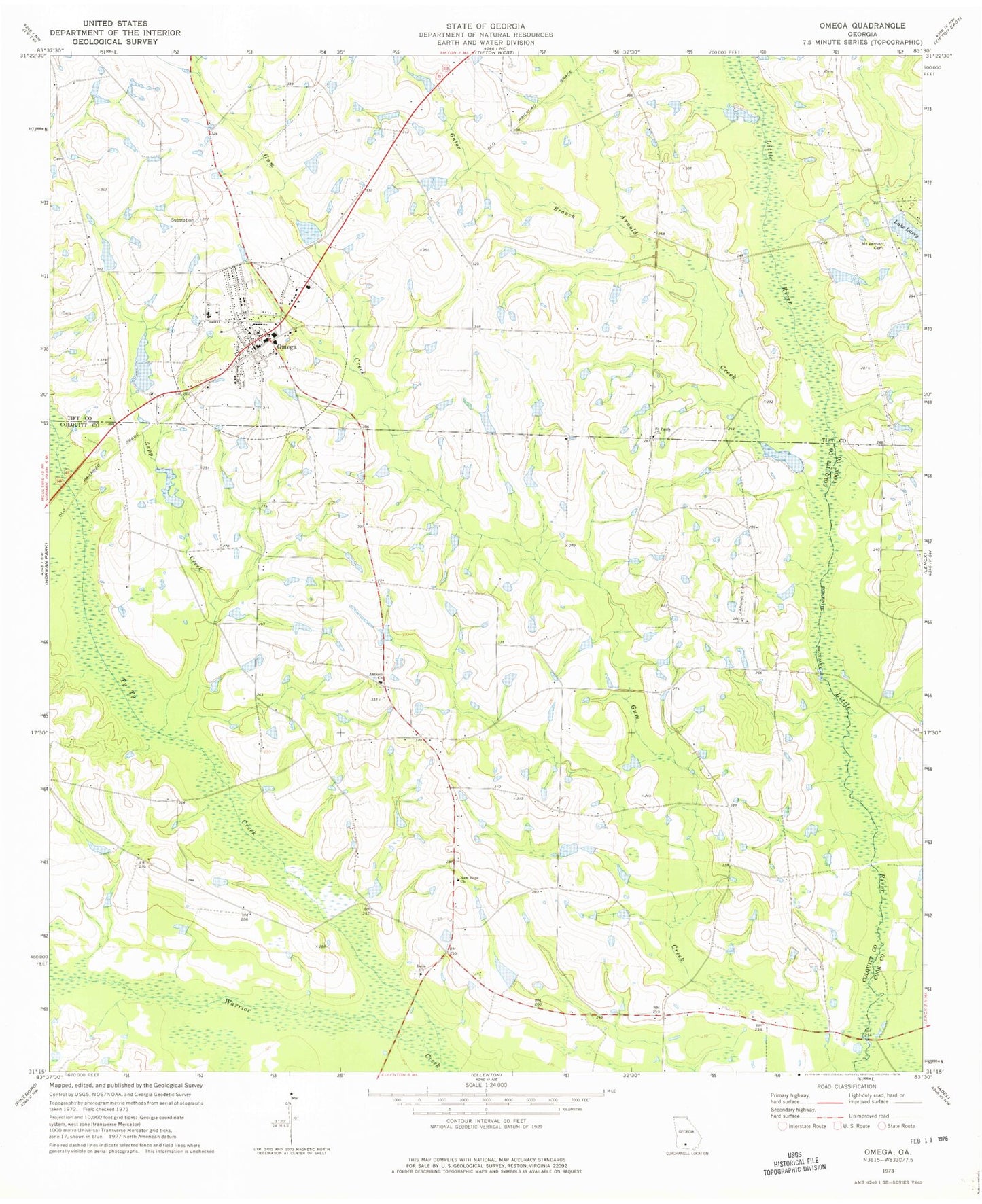
Classic USGS Omega Georgia 7.5'x7.5' Topo Map
Couldn't load pickup availability
Historical USGS topographic quad map of Omega in the state of Georgia. Map scale may vary for some years, but is generally around 1:24,000. Print size is approximately 24" x 27"
This quadrangle is in the following counties: Colquitt, Cook, Tift.
The map contains contour lines, roads, rivers, towns, and lakes. Printed on high-quality waterproof paper with UV fade-resistant inks, and shipped rolled.
Contains the following named places: Antioch Baptist Church Cemetery, Antioch Church, Arnold Creek, City of Omega, Colquitt County Volunteer Firefighters Association Fire Station 22 Livingston Bridge, Cross Roads School, Cypress Pond School, Gator Branch, Kinard Bridge, Lake Larry, Lake Larry Dam, Leila Cemetery, Leila Church, Lindsey Lake, Lindsey Lake Dam, Lotts Bridge, McMillan Cemetery, Mount Vernon Cemetery, New Hope Church, Old Cypress Pond School, Omega, Omega Division, Omega Elementary School, Omega Police Department, Omega Post Office, Omega Volunteer Fire Department, Patrick Lake, Patrick Lake Dam, Ponder Lake, Powells Bridge, Rutland Lake, Rutland Lake Dam, Rutland Lake South, Rutland Lake South Dam, Saint Pauls Church, Sapp Creek, Sumner School, Ty Ty Creek, Union Grove Church, Willington Lake, Willington Lake Dam, ZIP Code: 31775