MyTopo
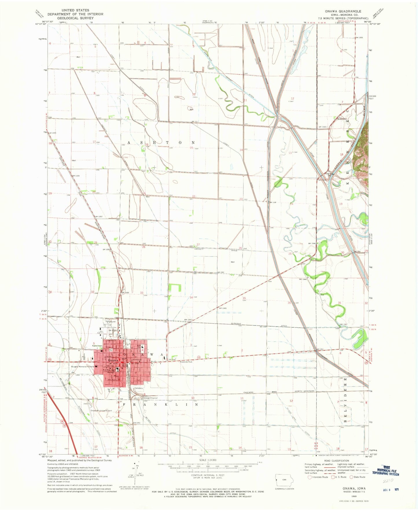
Classic USGS Onawa Iowa 7.5'x7.5' Topo Map
Couldn't load pickup availability
Historical USGS topographic quad map of Onawa in the state of Iowa. Map scale may vary for some years, but is generally around 1:24,000. Print size is approximately 24" x 27"
This quadrangle is in the following counties: Monona.
The map contains contour lines, roads, rivers, towns, and lakes. Printed on high-quality waterproof paper with UV fade-resistant inks, and shipped rolled.
Contains the following named places: Ashton, Burgess Health Medical Center, Burgess Memorial Hospital Heliport, Central Elementary School, City of Onawa, Community of Christ Church, Congregational Church, Elmwood Care Center, Evangelical Free Church, Faith Lutheran Church, Family Medical Clinic, First Christian Church, Franklin Number Seven School, Gard Creek, Gaukel Park, Hackett Ditch, Kennebec, Kennebec Post Office, Kingdom Hall of Jehovahs Witnesses, Kiwanis Museum Complex, Liberty Park, Losey Ditch, Monona County Arboretum, Monona County Courthouse, Monona County Fairgrounds, Monona County Historical Museum, Monona County Sheriff's Office, Monona County Veterans Memorial Museum, Onawa, Onawa Cemetery, Onawa Country Club, Onawa Family Dentistry Center, Onawa Fire Department Station 2, Onawa Municipal Airport, Onawa Police Department, Onawa Post Office, Onawa Public Library, Onawa Volunteer Fire Department, Pratt Ditch, Ropes Park, Saint John's Catholic Church, Seventh Day Adventist Church, Township of Ashton, United Methodist Church, United Pentecostal Church, West Monona Elementary School, West Monona High School, West Monona Middle School, ZIP Code: 51040