MyTopo
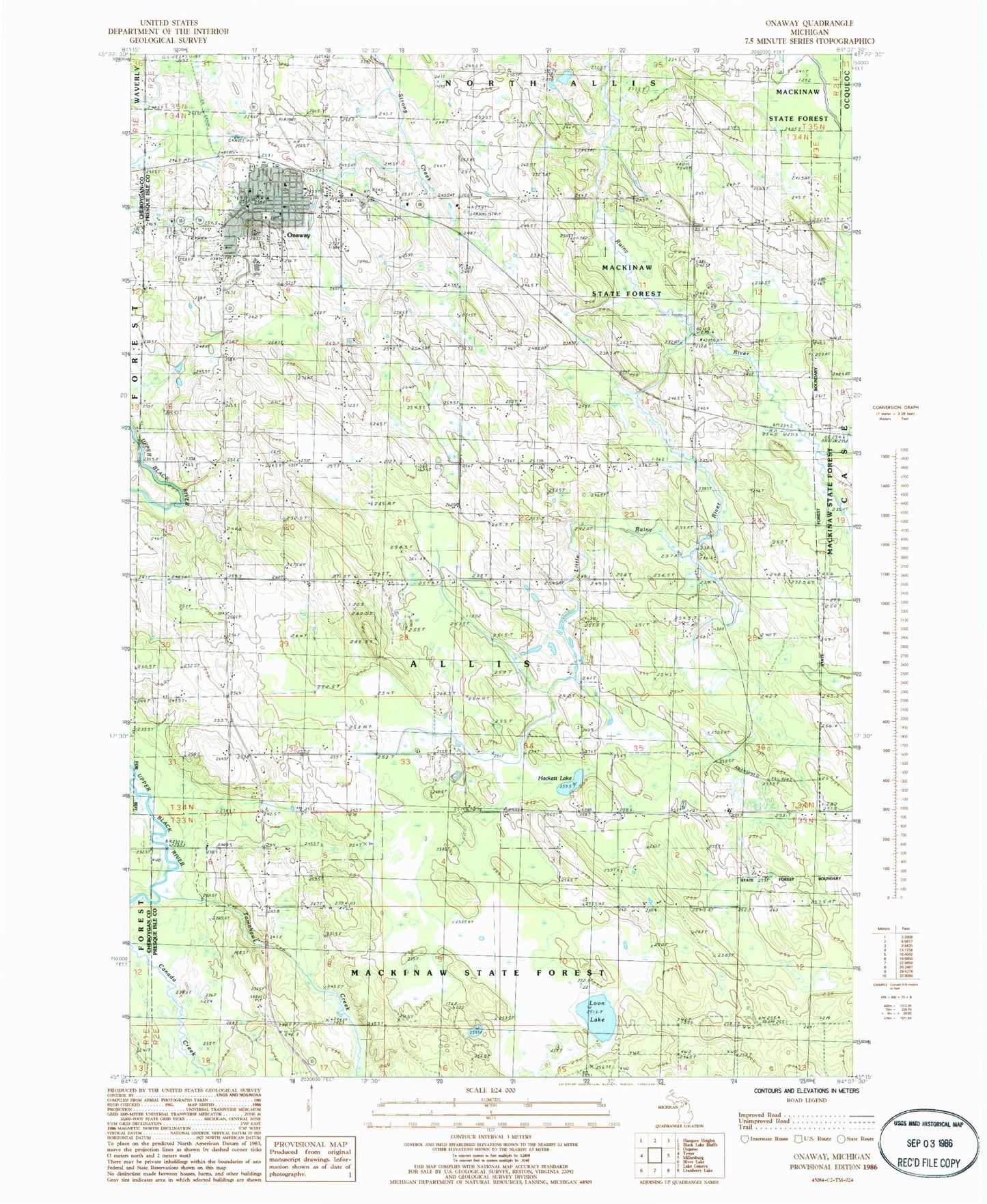
Classic USGS Onaway Michigan 7.5'x7.5' Topo Map
Couldn't load pickup availability
Historical USGS topographic quad map of Onaway in the state of Michigan. Map scale may vary for some years, but is generally around 1:24,000. Print size is approximately 24" x 27"
This quadrangle is in the following counties: Cheboygan, Presque Isle.
The map contains contour lines, roads, rivers, towns, and lakes. Printed on high-quality waterproof paper with UV fade-resistant inks, and shipped rolled.
Contains the following named places: Allis Cemetery, Case Post Office, Case Station, City of Onaway, Community of Christ, East Branch Rainy River, Edna Lound Recreational Park, Elmwood Cemetery, First Baptist Church, Forest Waverly Fire Department, Hackett Lake, Hackett Lake School, Holy Cross Lutheran Church, Leo E Goetz County Airport, Little Rainy River, Little Traverse Primary Care, Loon Lake, Onaway, Onaway Area Ambulance Service, Onaway Area Community Schools, Onaway Assembly of God Church, Onaway Baptist Church, Onaway Branch Library, Onaway Fire Department, Onaway Medical Center, Onaway Motor Speedway, Onaway Post Office, Onaway Station, Saint Paul's Catholic Cemetery, Saint Paul's Catholic Church, Seventh-Day Adventist Church, Seventh-Day Adventist School, Stoney Links Golf Course, Tomahawk Creek, Tomahawk School, Township of Allis, United Methodist Church, ZIP Code: 49765