MyTopo
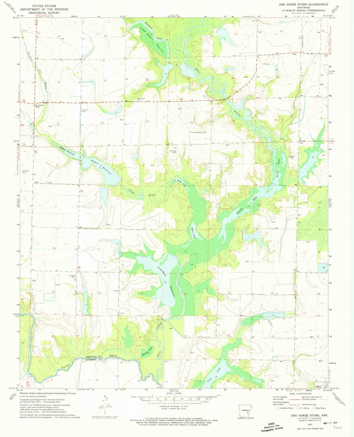
Classic USGS One Horse Store Arkansas 7.5'x7.5' Topo Map
Couldn't load pickup availability
Historical USGS topographic quad map of One Horse Store in the state of Arkansas. Map scale may vary for some years, but is generally around 1:24,000. Print size is approximately 24" x 27"
This quadrangle is in the following counties: Arkansas, Jefferson.
The map contains contour lines, roads, rivers, towns, and lakes. Printed on high-quality waterproof paper with UV fade-resistant inks, and shipped rolled.
Contains the following named places: Chaney Lake, Chaney Lake Dam, Cooper School, Flag Lake, Haller Cemetery, Haller Lake, Hurricane Bayou, Jacobs Lake, Johnson School, Lake Wilson, Lake Wilson Dam, Little Pecan Lake, Loyd Rodgers Reservoir, Lumsden Lake, Lumsden Lake Dam, Lumsdens Reservoir, Lumsdens Reservoir Dam, McKinley Reservoir, McKinley Reservoir Dam, Mill Bayou, One Horse Store, One Horse Volunteer Fire Department, Pampas School, Pecan Bayou, Pecan Lake, Prairie School, Rodgers Lake Number One, Rodgers Lake Number One Dam, Rodgers Lake Number Two, Rodgers Lake Number Two Dam, Sid's Place Airport, Sollars Reservoir, Stanley Point School, Township of Bayou Meto, Township of Stanley, Van Camp Cemetery, Wegert Reservoir, Wegert Reservoir Dam, Wheeler Lake