
MyTopo
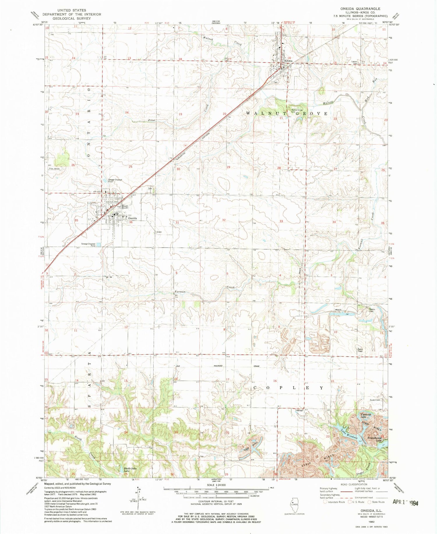
Classic USGS Oneida Illinois 7.5'x7.5' Topo Map
Couldn't load pickup availability
Historical USGS topographic quad map of Oneida in the state of Illinois. Map scale may vary for some years, but is generally around 1:24,000. Print size is approximately 24" x 27"
This quadrangle is in the following counties: Knox.
The map contains contour lines, roads, rivers, towns, and lakes. Printed on high-quality waterproof paper with UV fade-resistant inks, and shipped rolled.
Contains the following named places: Altona, Altona - Oneida - Wataga Ambulance Service, Altona Cemetery, Altona Elementary School, Altona Fire Protection District, Altona Post Office, Austin School, City of Oneida, Cummings School, Ferris School, Finley School, Fishhook Lake, Fosmire School, Hannam School, Hobbs School, Knox County Landfill, Lake Windsor, Lake Windsor Dam, Larson Cemetery, Martin Cemetery, McKie School, Mud Run, Old Scotch Cemetery, Oneida, Oneida - Wataga Fire Protection District, Oneida Cemetery, Oneida Elementary School, Oneida Post Office, Pilot Creek, Pilot Grove, Pilot Knob, Rhodes School, Roundhouse Lake, Roundhouse Lake Dam, Shebb Oaks Lake, Shebb Oaks Lake Dam, Township of Copley, Township of Walnut Grove, Village of Altona, Walnut Grove Cemetery, Windmill School, ZIP Codes: 61414, 61467


