MyTopo
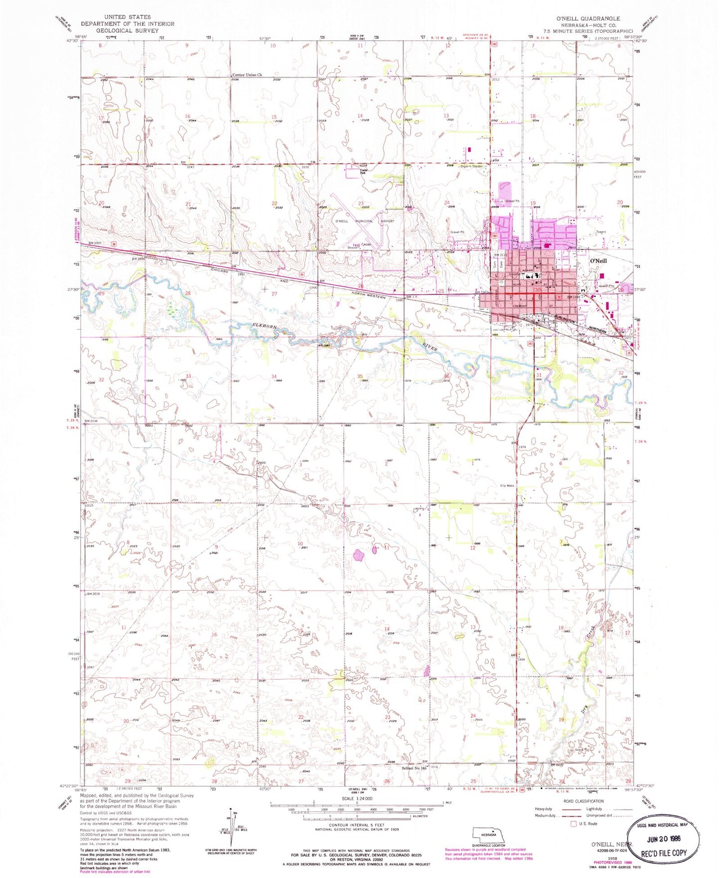
Classic USGS O'Neill Nebraska 7.5'x7.5' Topo Map
Couldn't load pickup availability
Historical USGS topographic quad map of O'Neill in the state of Nebraska. Map scale may vary for some years, but is generally around 1:24,000. Print size is approximately 24" x 27"
This quadrangle is in the following counties: Holt.
The map contains contour lines, roads, rivers, towns, and lakes. Printed on high-quality waterproof paper with UV fade-resistant inks, and shipped rolled.
Contains the following named places: Assembly of God Church, Avera Saint Anthony's Hospital, Beautiful Savior Lutheran Church, Cargill Incorporated Elevator, Carney Park, Carney Park Campground, Center Union Church, Christ Lutheran Church, City of O'Neill, Countryside Baptist Fellowship, Douthit Trailer Court, Faith Community Church, First Christian Church, First Presbyterian Church, First United Methodist Church, Ford Park, Grattan Township Library, Holt County Courthouse, Holt County Medical Clinic, Holt County Sheriff's Office, Jehovahs Witnesses Kingdom Hall, KBRX-AM (O'Neill), Kipples Trailer Court, Lions Kiddie Park, McDonalds Trailer Court, Moses P Kinkaid Building, O'Neill, O'Neill Baptist Church, O'Neill Berean Fundamental Church, O'Neill Country Club, O'Neill Elementary School, O'Neill Family Practice, O'Neill High School, O'Neill Irish Capital of Nebraska Historical Marker, O'Neill Nursing Center, O'Neill Police Department, O'Neill Post Office, O'Neill Volunteer Fire Department, Saint Marys Elementary School, Saint Marys High School, Saint Patrick Catholic Church, Schaffer Park, School Number 165, Tara Hill Park, The O'Neill Municipal Airport-John L Baker Field, Township of Grattan, Waymanns Trailer Court, Word of Life Assembly of God Church, Zaks Trailer Court