MyTopo
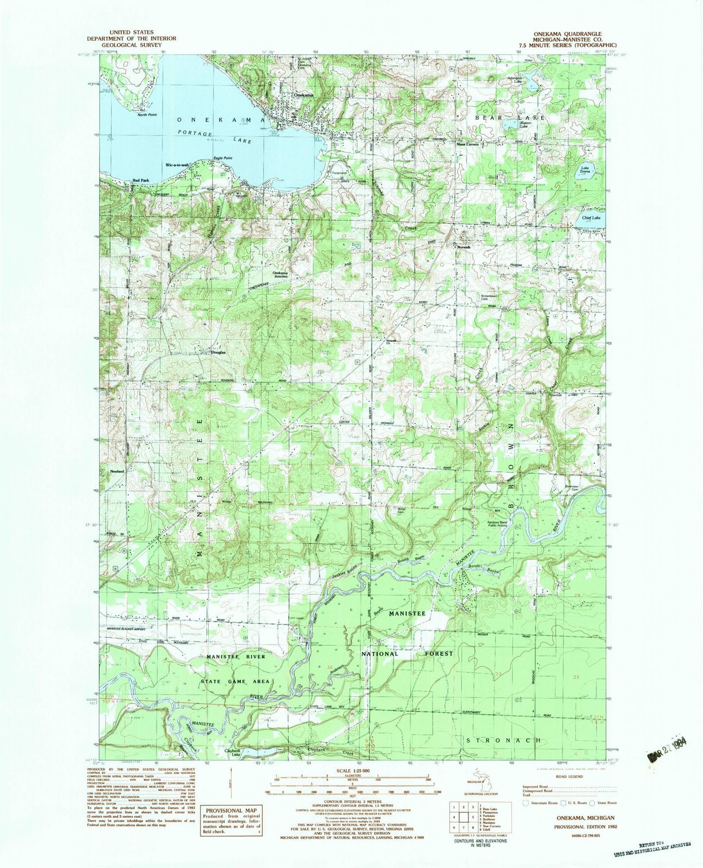
Classic USGS Onekama Michigan 7.5'x7.5' Topo Map
Couldn't load pickup availability
Historical USGS topographic quad map of Onekama in the state of Michigan. Map scale may vary for some years, but is generally around 1:24,000. Print size is approximately 24" x 27"
This quadrangle is in the following counties: Manistee.
The map contains contour lines, roads, rivers, towns, and lakes. Printed on high-quality waterproof paper with UV fade-resistant inks, and shipped rolled.
Contains the following named places: Adamson Lake, Anderson Bayou, Borski Bayou, Borski School, Brown Township Hall, Browns Bayou, Brownstown Cemetery, Chief Creek, Claybank Bayou, Claybank Creek, Claybank Lake, Coho Bend Campground, Douglas, Dunham Creek, Eagle Point, First Congregational Church, Hansen Creek, Heathlands Golf Course, Jenkins Bayou, Kenny School, Lake Emma, Larson Creek, Manistee County Fairgrounds, Matson's Big Manistee River Campground, Maue Corners, Merritt School, Miller Cemetery, Mineral Springs Park, Newland, Newland Station, North Point, Norwalk, Norwalk Church, Norwalk Lutheran Church Cemetery, Norwalk Post Office, Onekama, Onekama Area Health Center, Onekama Cemetery, Onekama Church of the Brethren, Onekama Consolidated Schools, Onekama Junction, Onekama Post Office, Onekama Public Library, Onekama Township Fire Department, Onekama Village Cemetery, Onekama Village Park, Portage Lake, Portage Lake RV Park, Rainbow Bend Public Access, Red Park, Riverview Cemetery, Saint John-Lake Episcopal Church, Saint Joseph Catholic Cemetery, Saint Joseph Church, Schimke Creek, Sickle Creek, Township of Manistee, Trinity Lutheran Church, Village of Onekama, Walton Pond, Watson Lake, Wic-a-te-wah