MyTopo
Classic USGS Onondaga Michigan 7.5'x7.5' Topo Map
Couldn't load pickup availability
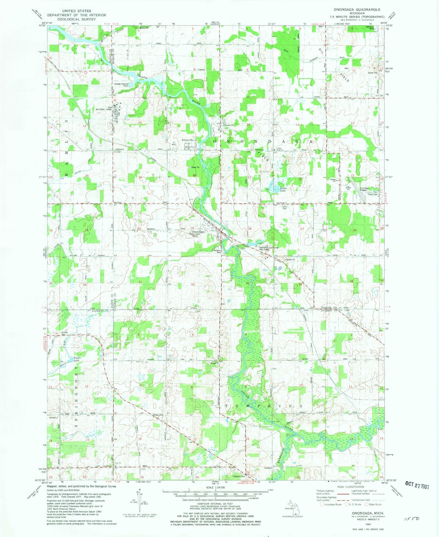
Historical USGS topographic quad map of Onondaga in the state of Michigan. Map scale may vary for some years, but is generally around 1:24,000. Print size is approximately 24" x 27"
This quadrangle is in the following counties: Eaton, Ingham, Jackson.
The map contains contour lines, roads, rivers, towns, and lakes. Printed on high-quality waterproof paper with UV fade-resistant inks, and shipped rolled.
Contains the following named places: Annis School, Arland Post Office, Arland School, Arland Station, Baldwin Park, Brown Cemetery, Butts School, Childs Bible Church, Childs School, Country Manor Mobile Home Park, Fuller Lake, Goold School, Griffith Cemetery, Griffith School, Hayden School, Highfields Community Boys Camp, Jameson Farm Historical Marker, Kettler and Norris Drain, Kinneville, Lane Cemetery, Lanes Lake, North Onondaga Drain, Onondaga, Onondaga Cemetery, Onondaga Community United Church, Onondaga Dragway, Onondaga Fire Department, Onondaga Post Office, Onondaga Station, Onondaga Township Fire Department, Ottercreek Post Office, Pope Cemetery, Pope Church, Sandstone Creek, School Number 6, Sherd School, Tompkins Cemetery, Tompkins School, Township of Onondaga, Township of Tompkins, VFW National Home, Walcott School, Williams Airport, WILX-TV (Onondaga), Winfield Post Office, Winfield School, WJXQ-FM (Jackson), WLAJ-TV (Lansing), ZIP Code: 49264