MyTopo
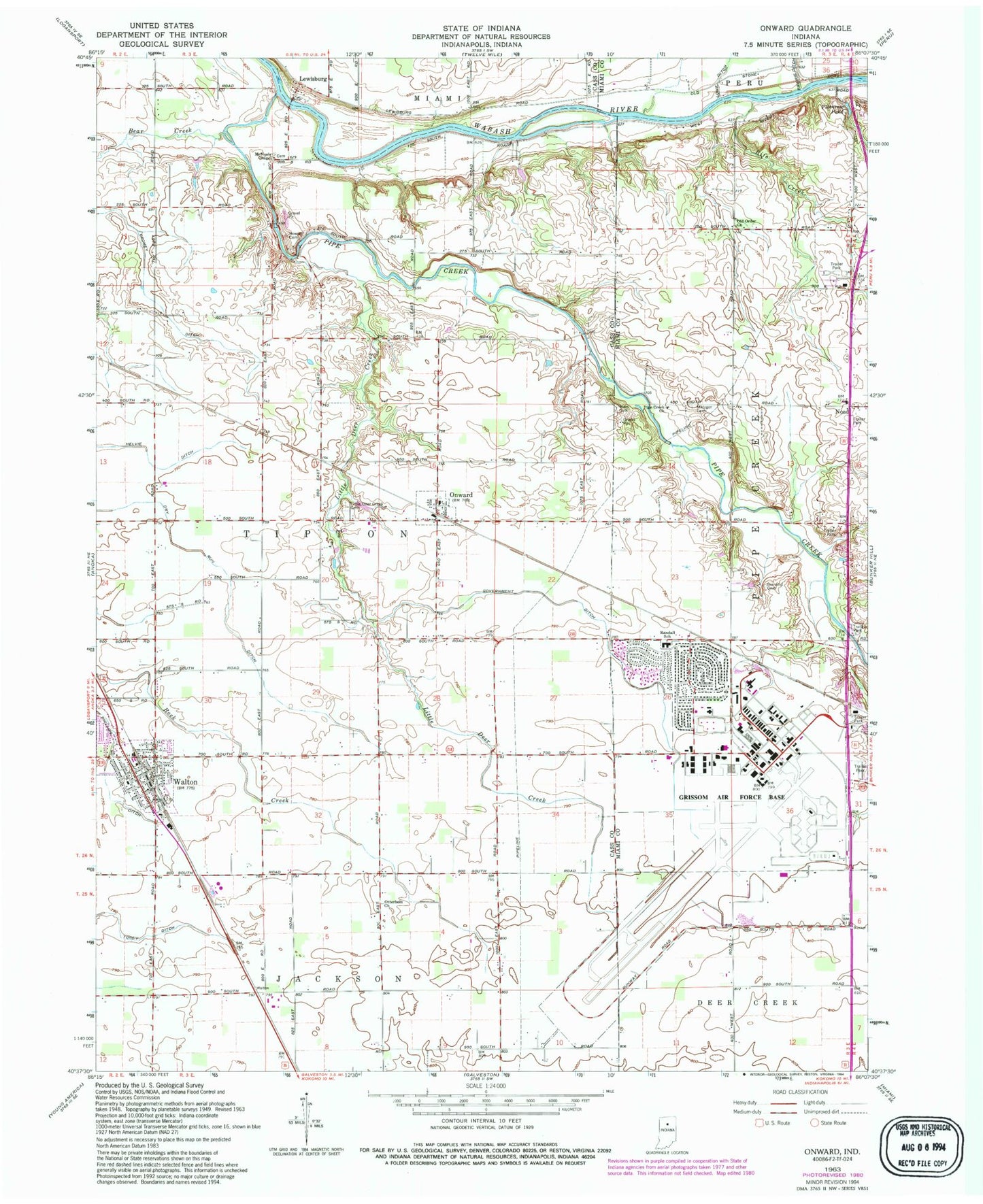
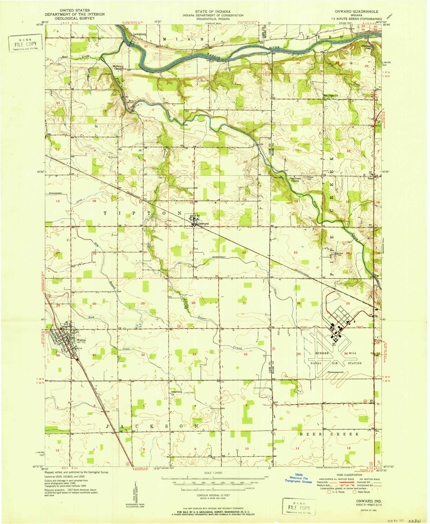
Classic USGS Onward Indiana 7.5'x7.5' Topo Map
Couldn't load pickup availability
Historical USGS topographic quad map of Onward in the state of Indiana. Map scale may vary for some years, but is generally around 1:24,000. Print size is approximately 24" x 27"
This quadrangle is in the following counties: Cass, Miami.
The map contains contour lines, roads, rivers, towns, and lakes. Printed on high-quality waterproof paper with UV fade-resistant inks, and shipped rolled.
Contains the following named places: Bear Creek, Bowyer Cemetery, Cromey Ditch, Dry Run Ditch, Garnand Cemetery, Government Ditch, Grissom Air Force Base, Grissom Air Force Base Census Designated Place, Grissom Air Reserve Base, Grissom Air Reserve Base Fire Department, Headland Airport, Lewisburg, Little Deer Creek, Little Deer Creek Cemetery, McNeely Chapel, Metzger Cemetery, Miami Correctional Facility, Milner Quarry, Naval Air Station Bunker Hill, Nead, Old Order Church, Onward, Onward Volunteer Fire Department, Otterbein Church, Phillips Ditch, Pipe Creek, Pipe Creek Church, Plothrow Pond, Randall Elementary School, Rife Creek, Sixby Ditch, Town of Onward, Town of Walton, Township of Pipe Creek, Township of Tipton, Walton, Walton Fire Department, Walton Post Office, ZIP Code: 46967