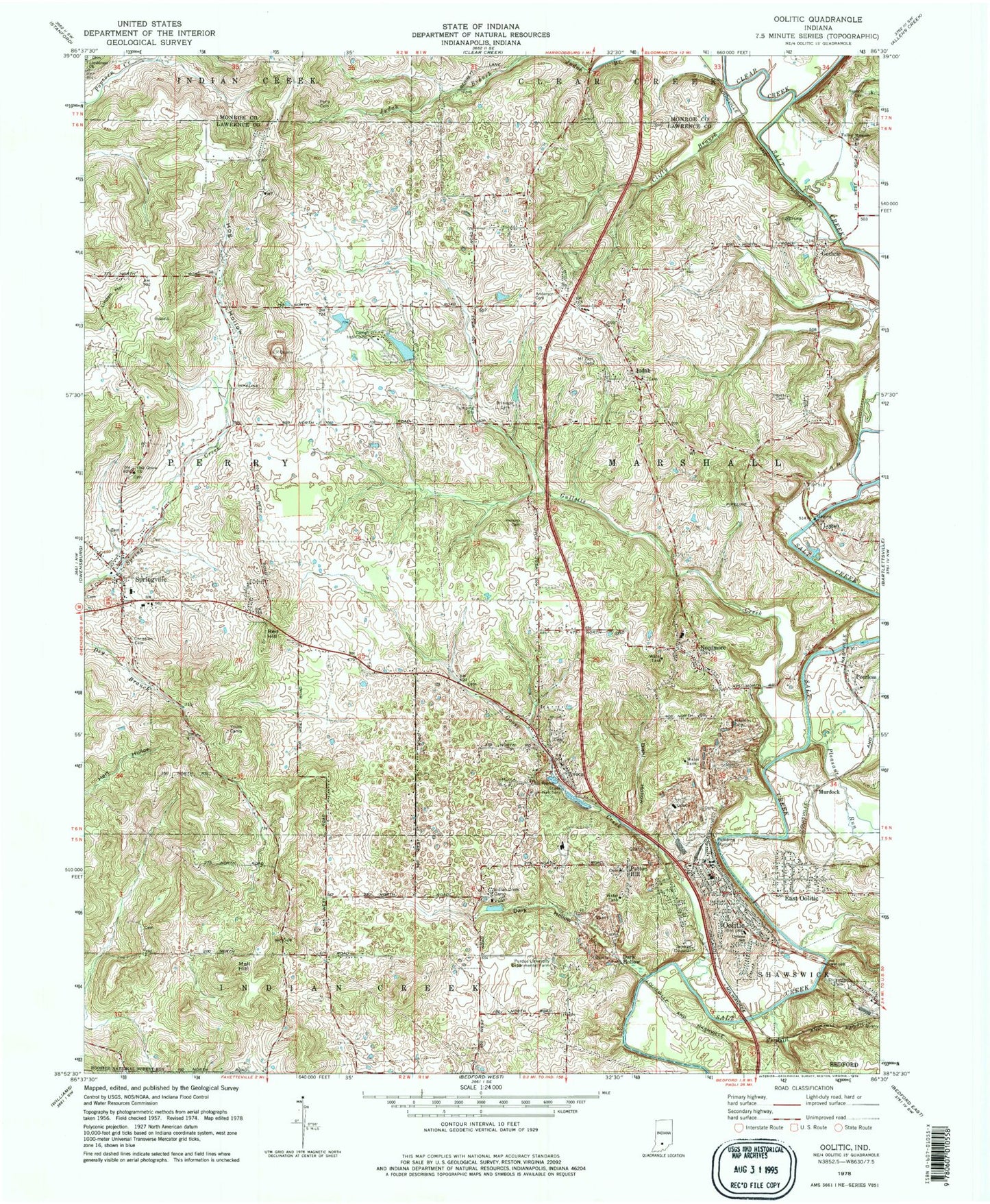
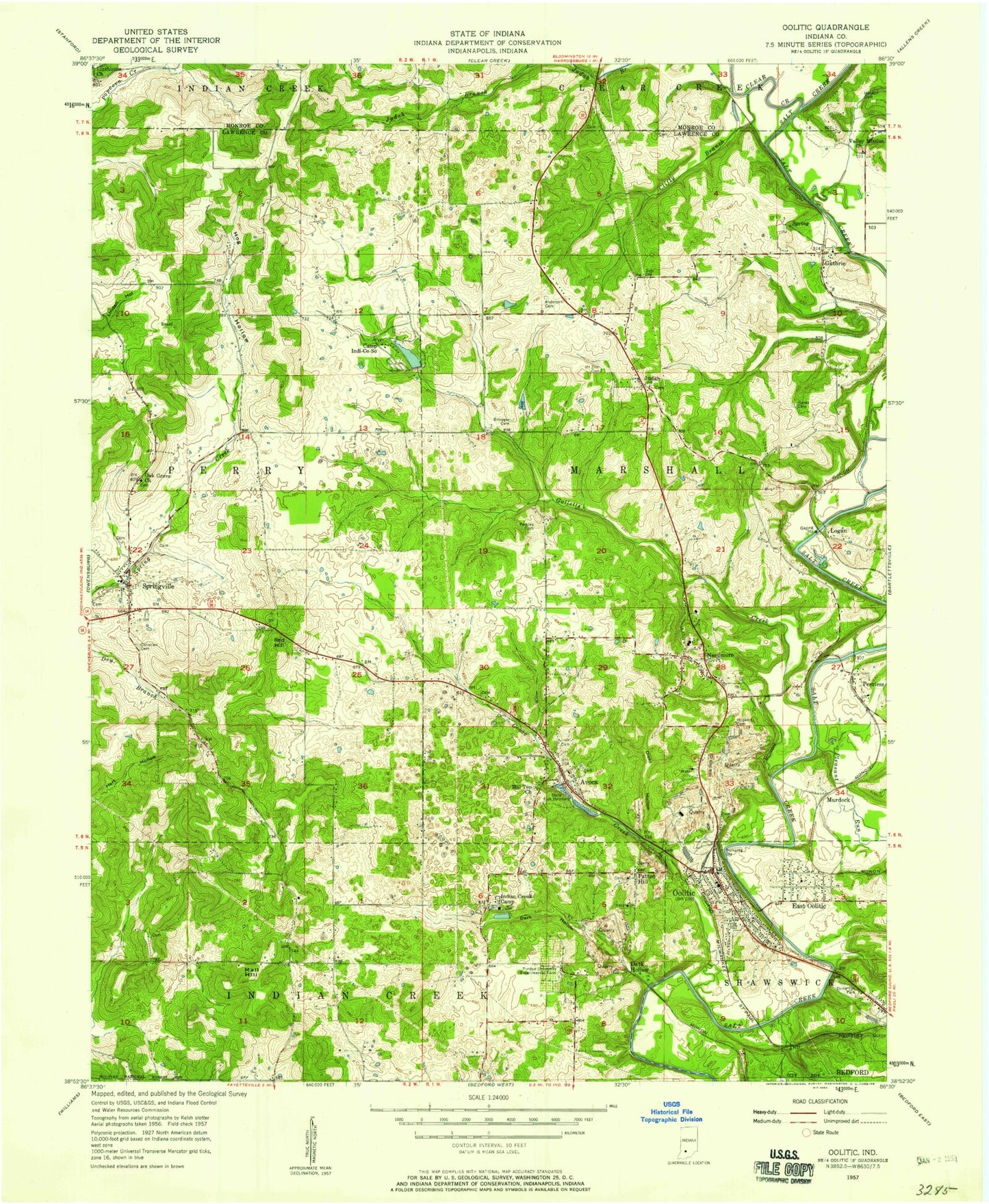
MyTopo
Classic USGS Oolitic Indiana 7.5'x7.5' Topo Map
Couldn't load pickup availability
Historical USGS topographic quad map of Oolitic in the state of Indiana. Map scale may vary for some years, but is generally around 1:24,000. Print size is approximately 24" x 27"
This quadrangle is in the following counties: Lawrence, Monroe.
The map contains contour lines, roads, rivers, towns, and lakes. Printed on high-quality waterproof paper with UV fade-resistant inks, and shipped rolled.
Contains the following named places: Anderson Cemetery, Avoca, Avoca Census Designated Place, Avoca Post Office, Brinegar Cemetery, Camp Indi-Co-So, Clear Creek, Clifty Branch, Dark Hollow, Dickinson Park, Diehl Hollow, Dollens Elementary School, East Oolitic, Farley Cemetery, Goose Creek, Gulletts Creek, Guthrie, Guthrie Quarry, Hanson Cemetery, Hays Cemetery, Hill Top Church, Hog Hollow, Hopkins Cemetery, Indian Creek Camp, Judah, Linthieum Church, Logan, Mall Hill, Marshall Township Volunteer Fire Department and Emergency Medical Services, McShain Quarry, Mount Zion Cemetery, Murdock, Needmore, Needmore Elementary School, Oak Grove Church, Oolitic, Oolitic Junior High School, Oolitic Police Department, Oolitic Post Office, Oolitic Volunteer Fire Department, P M and B Quarry, Patton Hill, Peerless, Perkins Cemetery, Perry Township Volunteer Fire Department and Emergency Medical Services, Pleasant Run, Purdue University Experimental Farm, Red Hill, Sieboldt Quarry, Springville, Springville Christian Cemetery, Springville Elementary School, Springville Post Office, Stemm, Thornton, Town of Oolitic, Township of Marshall, Valley Mission Church, ZIP Codes: 47420, 47451