MyTopo
Classic USGS Opal City Oregon 7.5'x7.5' Topo Map
Couldn't load pickup availability
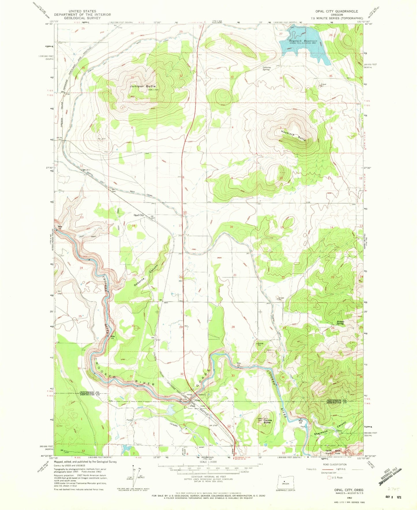
Historical USGS topographic quad map of Opal City in the state of Oregon. Typical map scale is 1:24,000, but may vary for certain years, if available. Print size: 24" x 27"
This quadrangle is in the following counties: Deschutes, Jefferson.
The map contains contour lines, roads, rivers, towns, and lakes. Printed on high-quality waterproof paper with UV fade-resistant inks, and shipped rolled.
Contains the following named places: Haystack Reservoir Recreation Site, Crooked River Ranch, Meralle Spring, Coyote Butte, East Springer Spring, Haystack Butte, Haystack Dam, Haystack Reservoir, Juniper Butte, Nichols Spring, Opal City, Osborne Canyon, Osborne Spring, Peter Skene Ogden State Park, Sherwood Canyon, Haystack Post Office (historical), Crooked River Ranch Post Office (historical), Opal City Post Office (historical), Opal City School (historical), Haystack West Shore Recreation Site, Haystack West Boat Ramp, Haystack Campground Boat Ramp, Crooked Wild and Scenic River, Haystack Reservoir Recreation Site, Crooked River Ranch, Meralle Spring, Coyote Butte, East Springer Spring, Haystack Butte, Haystack Dam, Haystack Reservoir, Juniper Butte, Nichols Spring, Opal City, Osborne Canyon, Osborne Spring, Peter Skene Ogden State Park, Sherwood Canyon, Haystack Post Office (historical), Crooked River Ranch Post Office (historical), Opal City Post Office (historical), Opal City School (historical), Haystack West Shore Recreation Site, Haystack West Boat Ramp, Haystack Campground Boat Ramp, Crooked Wild and Scenic River