MyTopo
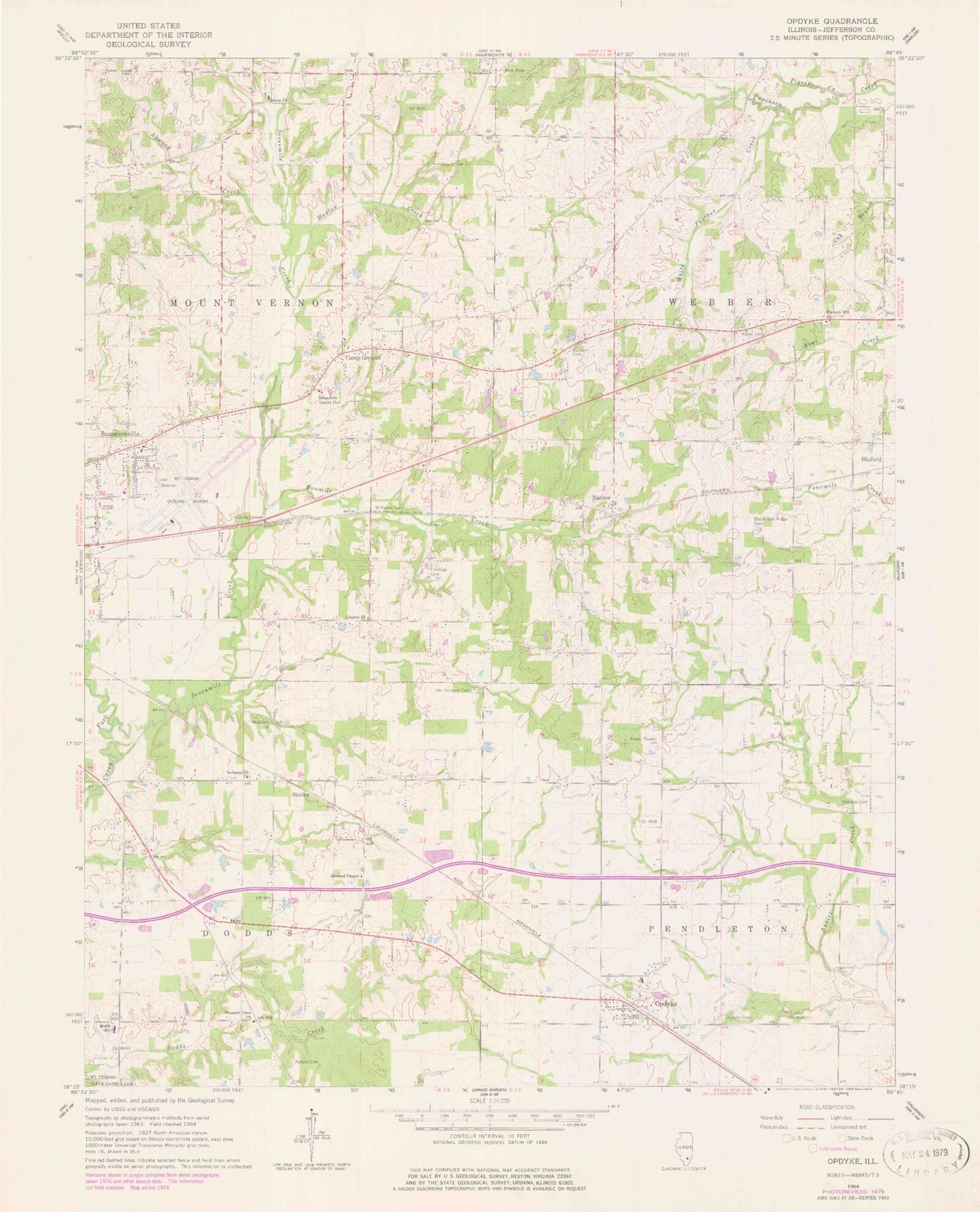
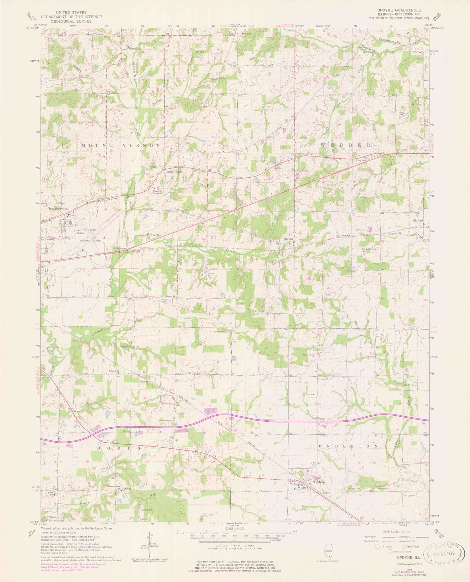
Classic USGS Opdyke Illinois 7.5'x7.5' Topo Map
Couldn't load pickup availability
Historical USGS topographic quad map of Opdyke in the state of Illinois. Map scale may vary for some years, but is generally around 1:24,000. Print size is approximately 24" x 27"
This quadrangle is in the following counties: Jefferson.
The map contains contour lines, roads, rivers, towns, and lakes. Printed on high-quality waterproof paper with UV fade-resistant inks, and shipped rolled.
Contains the following named places: Air Evac Lifeteam 11, Airport Park, Akward Creek, Arnold Cemetery, Atkinson Cemetery, Barren School, Black Oak Ridge Cemetery, Blackoak School, Block School, Camp Ground, Camp Ground Baptist Church, Camp Ground School, Centerville School, Dodds Elementary School, East Hickory Hill Cemetery, East Salem Baptist Church, East Salem Cemetery, Etheridge Cemetery, Green College School, Green Hills Country Club, Harlow Creek, Harlow School, Hebron School, Hickory Hill Church, Hickory Hill School, Hicory Hill Cemetery, Howard Chapel, Howard School, Jefferson Fire Protection District Station 4, Lebanon Baptist Church, Liberty Church, Liberty School, Lynchburg, Lynchburg School, Maple Grove School, Marlow, Meadowbrook Christian Church, Medders Cemetery, Mount Vernon Airport, Mount Vernon Fire Department Station 3, Newton Cemetery, Old Orchard Cemetery, Opdyke, Opdyke Attendance Center, Opdyke Cemetery, Opdyke Census Designated Place, Opdyke Post Office, Pigeon Creek, Pleasant View Church, Pleasant View School, Sevenmile Creek, Shelton Cemetery, Shirley, Summersville, Summersville Baptist Church, Summersville Grade School, Township of Dodds, Township of Mount Vernon, Township of Pendleton, Township of Webber, Twomile Creek, White Feather Creek, Williams Cemetery, ZIP Code: 62872