MyTopo
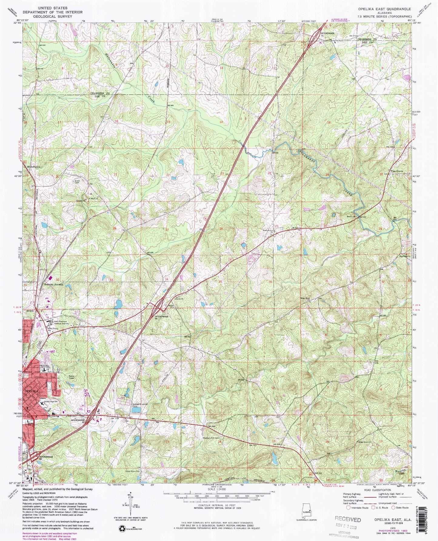
Classic USGS Opelika East Alabama 7.5'x7.5' Topo Map
Couldn't load pickup availability
Historical USGS topographic quad map of Opelika East in the state of Alabama. Map scale may vary for some years, but is generally around 1:24,000. Print size is approximately 24" x 27"
This quadrangle is in the following counties: Chambers, Lee.
The map contains contour lines, roads, rivers, towns, and lakes. Printed on high-quality waterproof paper with UV fade-resistant inks, and shipped rolled.
Contains the following named places: Alabama State Police Department, Alabama State Troopers Troop G, Andrews, Beans Mill, Bethel Church, Bethel School, Bethesda Baptist Church, Condy Dam, Condy Lake, Crooked Creek, Darden High School, Ferguson Christian Methodist Episcopal Chapel, Fox Run Industrial Park, Gethsemane Church, Halie Turner School, Hephzibah Primitive Baptist Church, Household of Faith Church, Jackie Osment Dam, Jefferson Church, Jeter Street Elementary School, Jimmerson Mill, Liberty Baptist Church, Liberty Cemetery, Little Halawaka Creek, Memory Hill Cemetery, Miriam Brown Elementary School, Morris Mine, Mount Jefferson, Mount Zion Church, Oak Dale, Opelika Fire Department Station 4, Opelika High School, Opelika Post Office, Opelika State Technical College, Open Door Church, Osment Pond, Pine Grove, Pine Grove United Methodist Church, Ridge Grove Church, Ridge Road Church, Roanoke Junction, Rocky Ridge School, Rough and Ready, Saint Mark Church, Saint Marks School, Saint Peter Church, Scott Cemetery, Shady Grove Cemetery, Shady Grove Christian Church, Sommerset Strip, Sweet Hope Cemetery, Sweet Pilgrim Church, Thompsons African Methodist Episcopal Zion Chapel, Union Grove Baptist Church, Union Grove Cemetery, Wallace Chapel Church, West Ridge