MyTopo
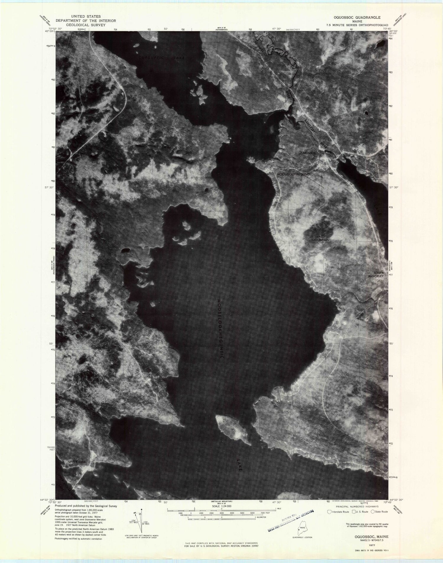
Classic USGS Oquossoc Maine 7.5'x7.5' Topo Map
Couldn't load pickup availability
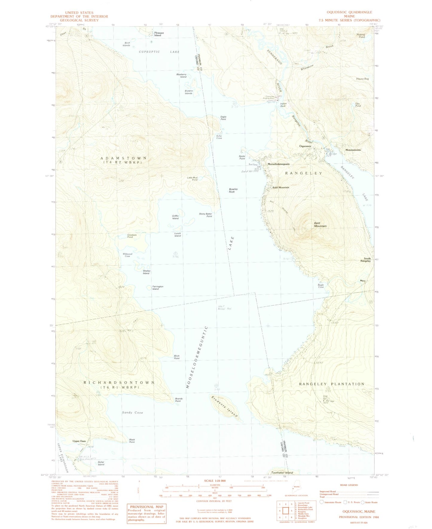
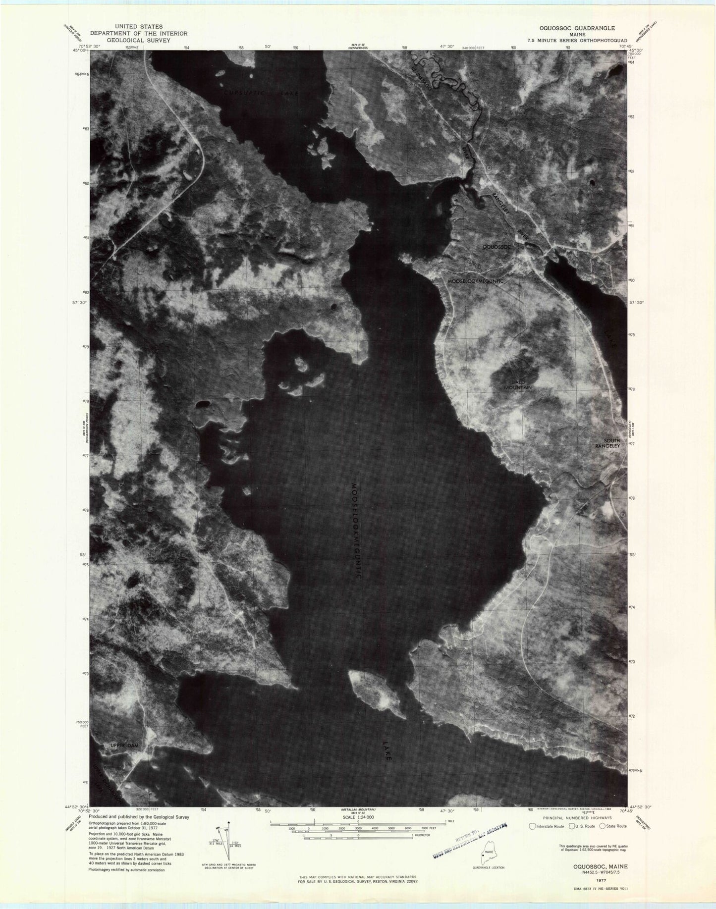
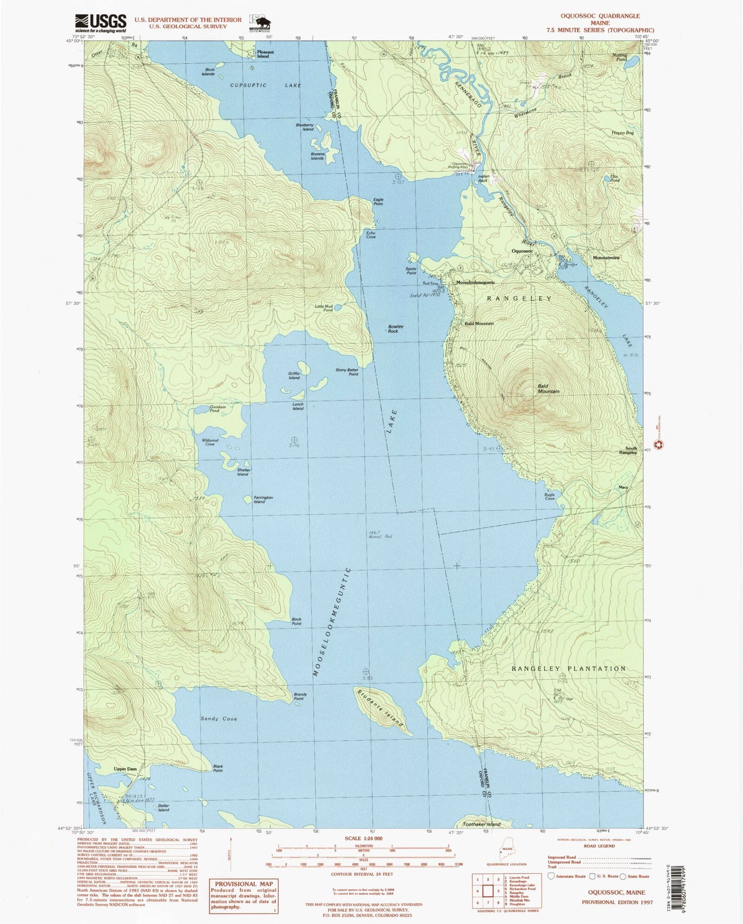
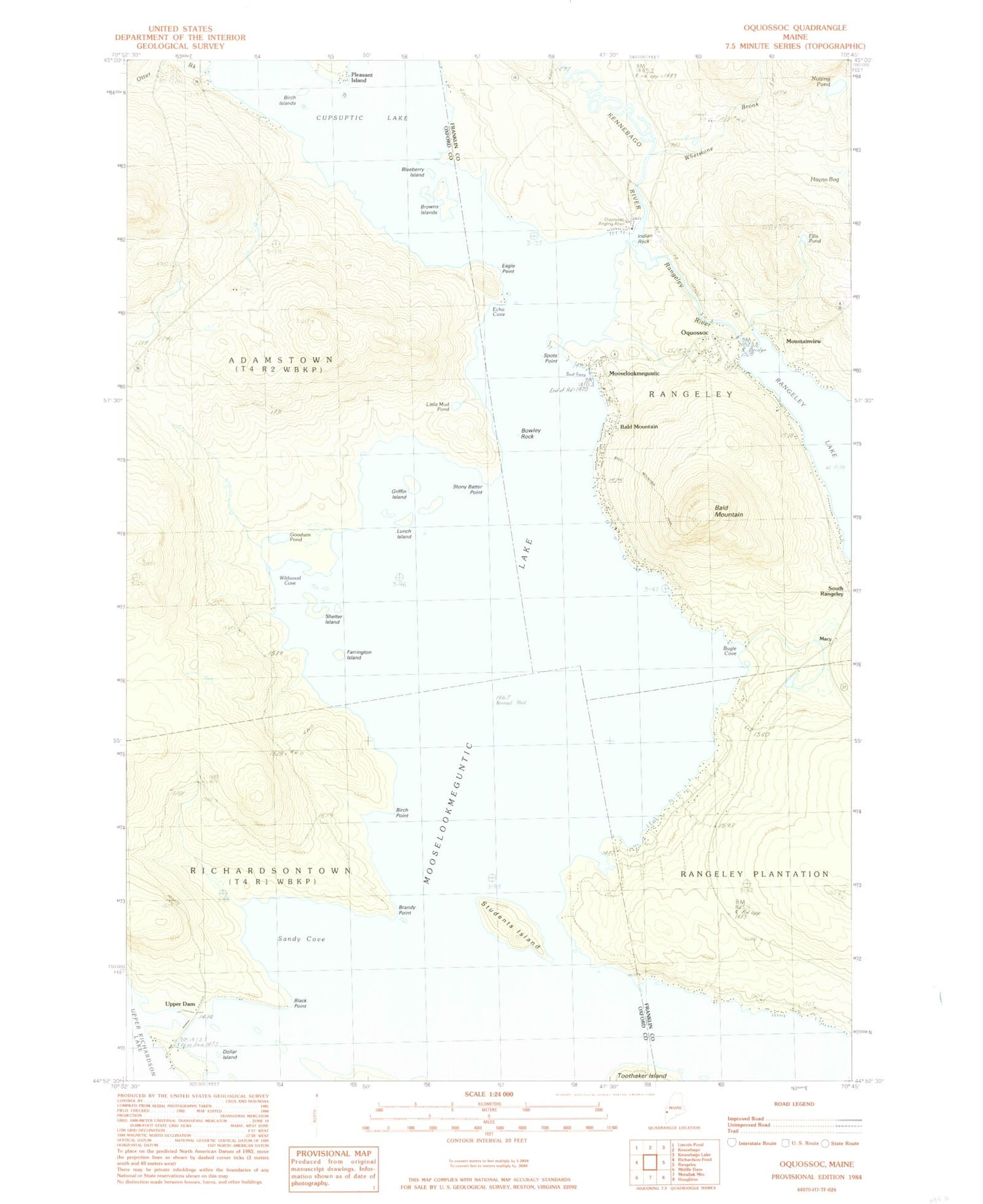
Historical USGS topographic quad map of Oquossoc in the state of Maine. Typical map scale is 1:24,000, but may vary for certain years, if available. Print size: 24" x 27"
This quadrangle is in the following counties: Franklin, Oxford.
The map contains contour lines, roads, rivers, towns, and lakes. Printed on high-quality waterproof paper with UV fade-resistant inks, and shipped rolled.
Contains the following named places: Bald Mountain, Bald Mountain, Birch Island, Birch Point, Black Point, Blueberry Island, Bowley Rock, Brandy Point, Browns Island, Cupsuptic Lake, Dollar Island, Eagle Point, Echo Cove, Ellis Pond, Farrington Island, Goodwin Pond, Griffin Island, Hayno Bog, Indian Rock, Kennebago River, Little Mud Pond, Lunch Island, Milrose Trail, Mooselookmeguntic, Mooselookmeguntic Lake, Nutting Pond, Oquossoc, Otter Brook, Rangeley River, Sandy Cove, Shelter Island, South Rangeley, Spots Point, Stony Batter Point, Students Island, Upper Dam, Whetstone Brook, Wildwood Cove, Wildwood Cove Church, Macy, Mountainview, Pleasant Island, Oquossoc Angling Association, Upper Dam, Rangeley Lake Dam, Johnson Island, Stephen Phillips Preserve, Turner Island, Bald Mountain Camps, Clear Water Sporting Camps, Haines Landing Marina, Mountain View Camps, Oquossoc Log Church, Oquossoc Post Office, Our Lady of the Lakes Catholic Church, Rangeley Volunteer Fire Department Company 2, Bald Mountain, Bald Mountain, Birch Island, Birch Point, Black Point, Blueberry Island, Bowley Rock, Brandy Point, Browns Island, Cupsuptic Lake, Dollar Island, Eagle Point, Echo Cove, Ellis Pond, Farrington Island, Goodwin Pond, Griffin Island, Hayno Bog, Indian Rock, Kennebago River, Little Mud Pond, Lunch Island, Milrose Trail, Mooselookmeguntic, Mooselookmeguntic Lake, Nutting Pond, Oquossoc, Otter Brook, Rangeley River, Sandy Cove, Shelter Island, South Rangeley, Spots Point, Stony Batter Point, Students Island, Upper Dam, Whetstone Brook, Wildwood Cove, Wildwood Cove Church, Macy, Mountainview, Pleasant Island, Oquossoc Angling Association, Upper Dam, Rangeley Lake Dam, Johnson Island, Stephen Phillips Preserve, Turner Island, Bald Mountain Camps, Clear Water Sporting Camps, Haines Landing Marina, Mountain View Camps, Oquossoc Log Church, Oquossoc Post Office, Our Lady of the Lakes Catholic Church, Rangeley Volunteer Fire Department Company 2