MyTopo
Classic USGS Orange Cove North California 7.5'x7.5' Topo Map
Couldn't load pickup availability
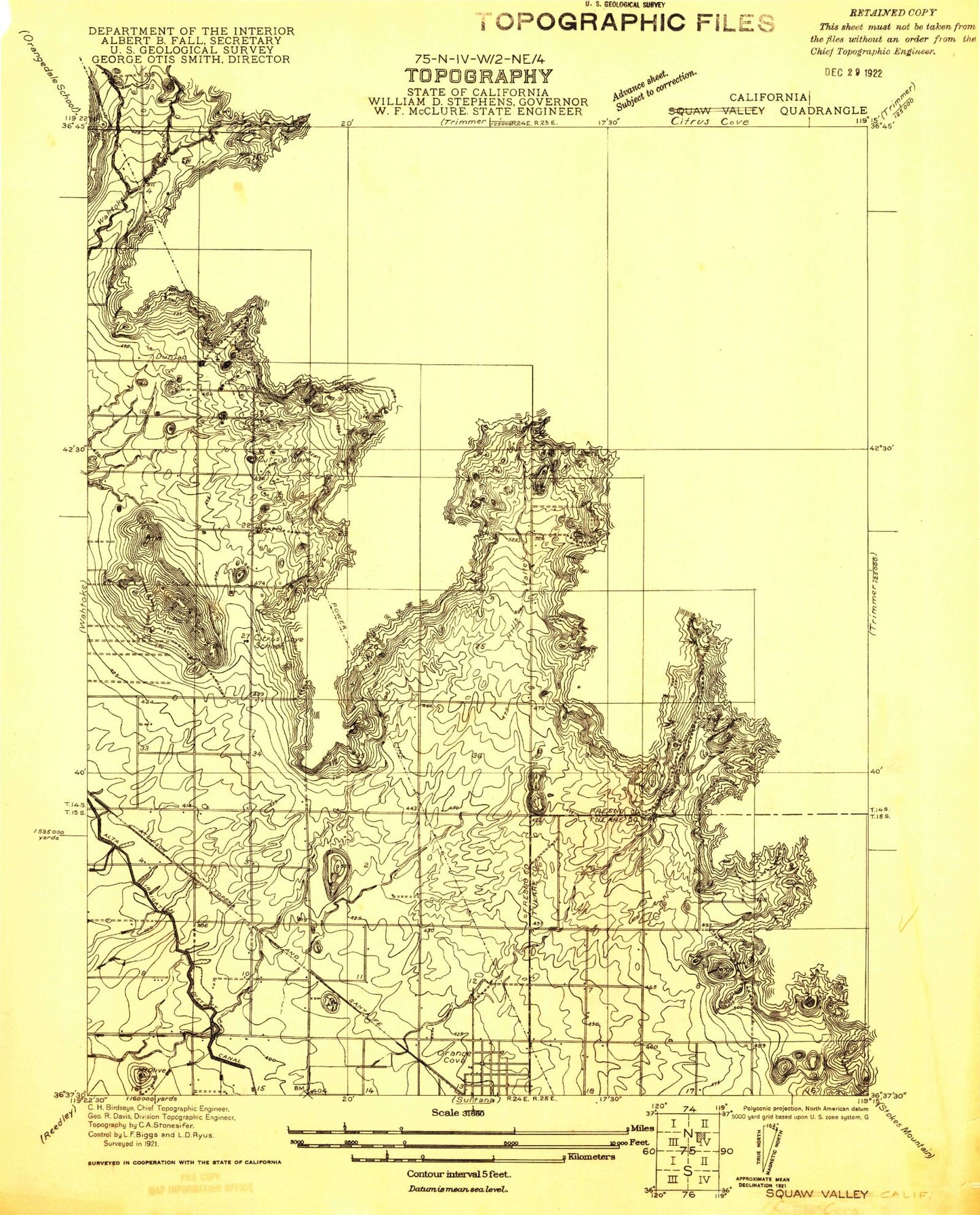
Historical USGS topographic quad map of Orange Cove North in the state of California. Map scale may vary for some years, but is generally around 1:24,000. Print size is approximately 24" x 27"
This quadrangle is in the following counties: Fresno, Tulare.
The map contains contour lines, roads, rivers, towns, and lakes. Printed on high-quality waterproof paper with UV fade-resistant inks, and shipped rolled.
Contains the following named places: Alta West Clark Ditch, Bear Mountain, Citrus Cove, Citrus Cove School, Citrus Middle School, Granite Hill, Hills Valley, Kaktus Korner, KMAK-FM (Orange Cove), KSEE-TV (Fresno), KVPT-TV (Fresno), KZJE-TV (Clovis), McCord Elementary School, Mount Olive, Orange Cove Fire Protection District of Fresno and Tulare Counties, Saint Rita Indian Mission, Squaw Valley, Wooten Creek, ZIP Code: 93646