MyTopo
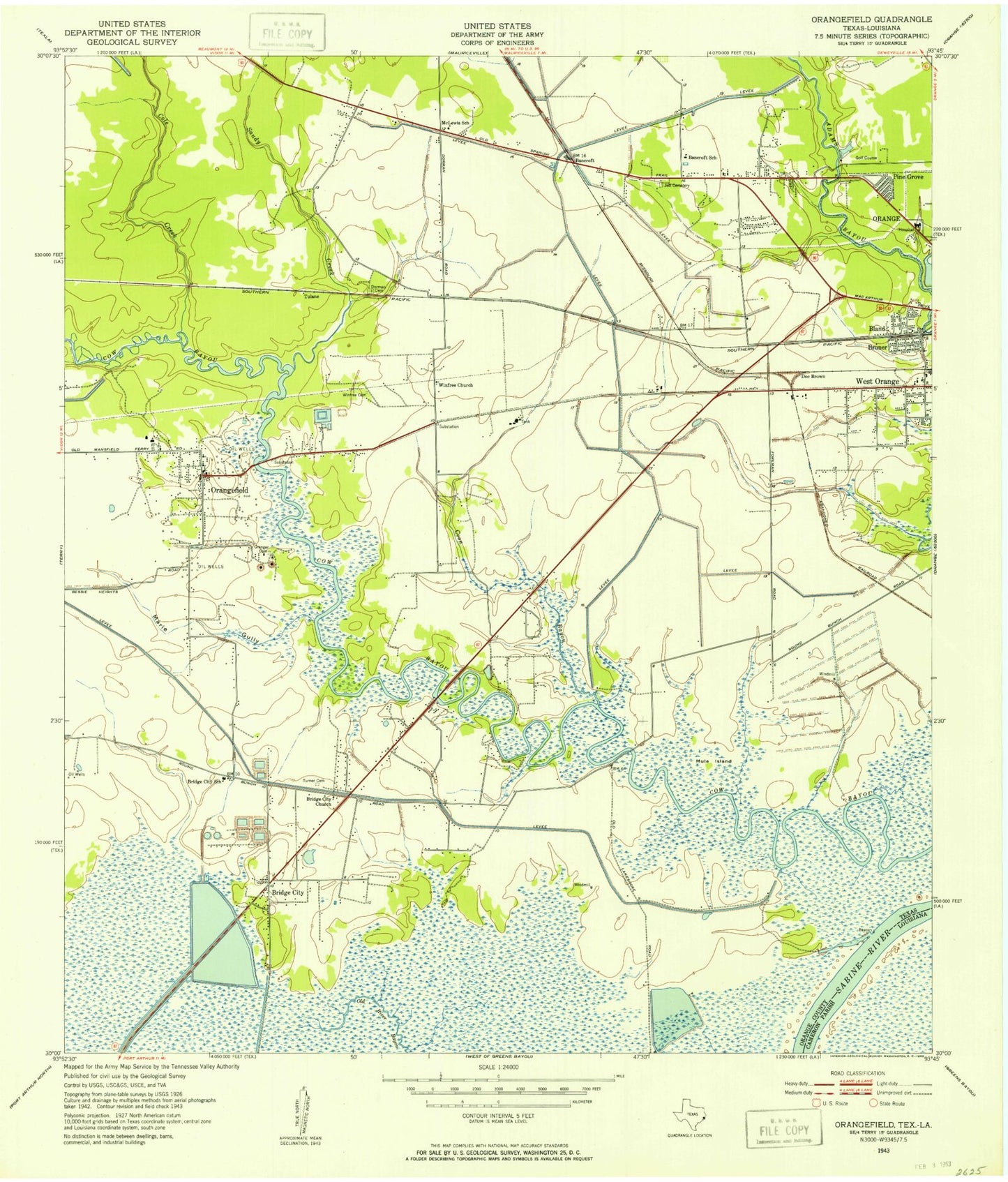
Classic USGS Orangefield Texas 7.5'x7.5' Topo Map
Couldn't load pickup availability
Historical USGS topographic quad map of Orangefield in the state of Texas. Map scale may vary for some years, but is generally around 1:24,000. Print size is approximately 24" x 27"
This quadrangle is in the following counties: Cameron, Orange.
The map contains contour lines, roads, rivers, towns, and lakes. Printed on high-quality waterproof paper with UV fade-resistant inks, and shipped rolled.
Contains the following named places: Acadian Ambulance Service, Bancroft, Bancroft Elementary School, Bancroft School, Baptist Hospitals of Southeast Texas Orange Campus, Bland, Bridge City, Bridge City Hall, Bridge City High School, Bridge City Intermediate School, Bridge City Junior High School, Bridge City Police Department, Bridge City Post Office, Bridge City Volunteer Fire and Rescue, Bridge City Volunteer Fire and Rescue Orangefield Station, Bruner, Chesson Airport, Church of Christ, Church of Christ in West Orange, Church of the Nazarene, Circle Drive Baptist Church, City of Bridge City, City of Orange, City of Pinehurst, City of West Orange, Cole Creek, Coon Bayou, Doc Brown, Dorman Cemetery, First Baptist Church of West Orange, Forest Lawn Memorial Park, Francis, Grace Baptist Church, Granger Cemetery, Greater New Rising Star Baptist Church, Harbor Hospital of Southeast Texas, Hatton Elementary School, Hillcrest Memorial Gardens, Jett Cemetery, KLVI-AM (Beaumont), Lower Neches Wildlife Management Area - Old River, Mac Arthur Heights Baptist Church, Marie Gully, McLewis School, McLewis Volunteer Fire Department, Memorial Field Park, Mule Island, Oates Elementary School, Orange County Airport, Orange County Constable's Office Precinct 2, Orange County Constable's Office Precinct 3, Orange Division, Orange Fire Department Station 3, Orangefield, Orangefield Pentecostal Church, Orangefield Post Office, Pine Grove, Pinehurst, Pinehurst City Hall, Pinehurst Police Department, Pinehurst Volunteer Fire Department, Plant Reservoir, Saint Mark Lutheran Church, Saint Paul United Methodist Church, Sandy Creek, Second Baptist Church, Shell Canal, Sims Elementary School, Sunset Grove Country Club, Texas Department of Public Safety - Highway Patrol Office, The W H Stark Home, Thomas Cemetery, Tulane, United Pentecostal Church of Pinehurst, West Orange, West Orange - Stark High School, West Orange - Stark Intermediate School, West Orange City Hall, West Orange Police Department, West Orange Volunteer Fire Department, West Park, Winfree Cemetery, Winfree Church, ZIP Codes: 77611, 77630