MyTopo
Classic USGS Orchard Nebraska 7.5'x7.5' Topo Map
Couldn't load pickup availability
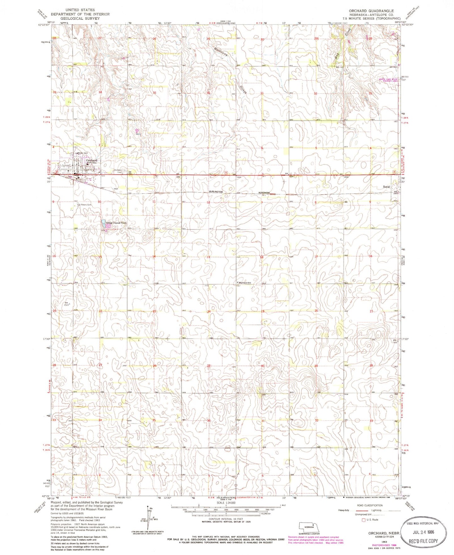
Historical USGS topographic quad map of Orchard in the state of Nebraska. Map scale may vary for some years, but is generally around 1:24,000. Print size is approximately 24" x 27"
This quadrangle is in the following counties: Antelope.
The map contains contour lines, roads, rivers, towns, and lakes. Printed on high-quality waterproof paper with UV fade-resistant inks, and shipped rolled.
Contains the following named places: Dennys Playground Airport, Evangelical Free Church, Highland School, North Star School, Orchard, Orchard Hill Cemetery, Orchard Medical Center, Orchard Medical Clinic, Orchard Post Office, Orchard Public Library, Orchard Public Schools, Orchard Volunteer Fire Department, Peavey Company Elevator, Prairie States Forestry Project Historical Marker, Royal, Royal Volunteer Fire Department, Saint Peters Cemetery, Saint Peters Lutheran Church, Schleusener Dam, Schleusener Reservoir, Township of Garfield, Township of Royal, United Methodist Church, Village of Orchard, Village of Royal