
MyTopo
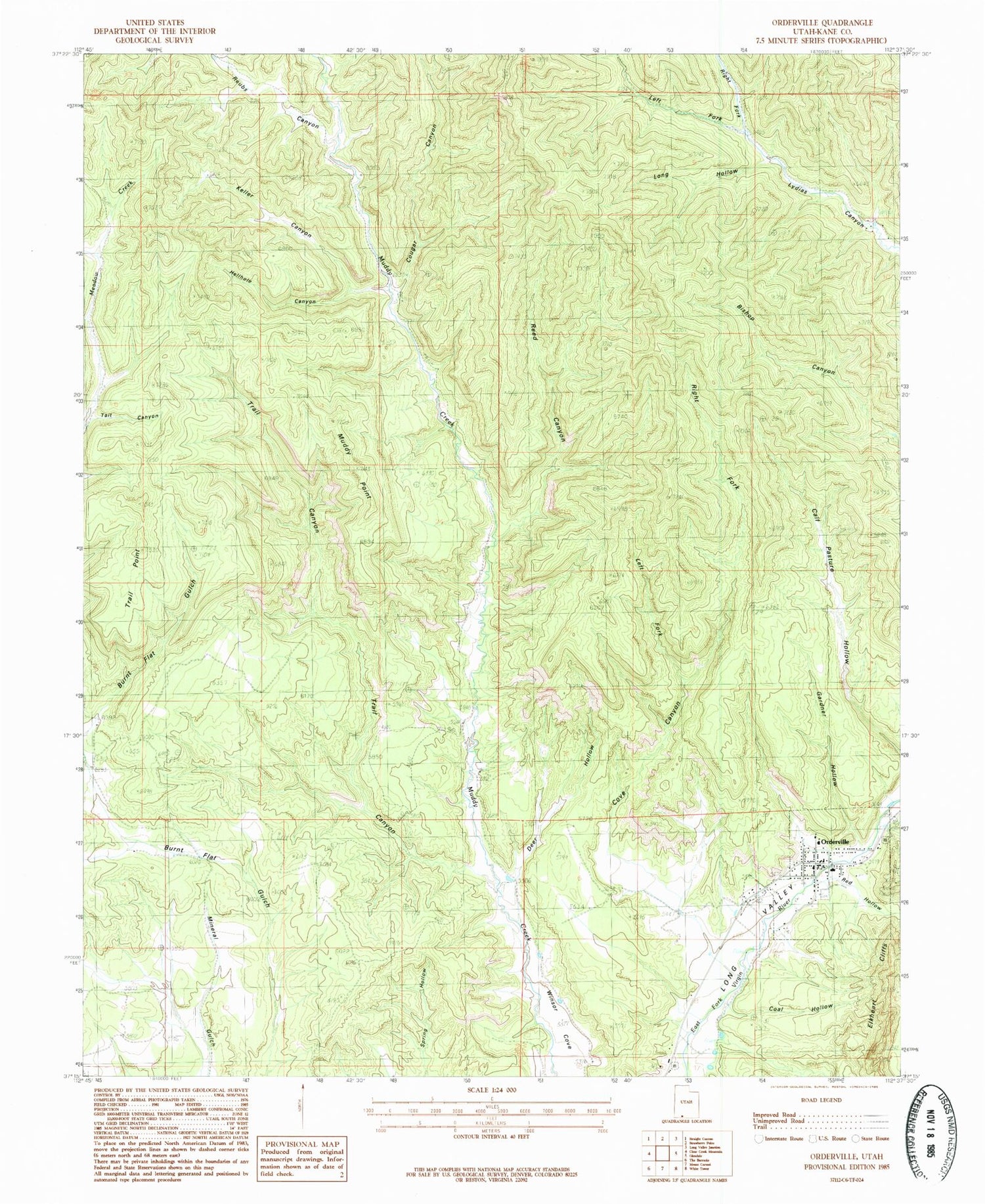
Classic USGS Orderville Utah 7.5'x7.5' Topo Map
Couldn't load pickup availability
Historical USGS topographic quad map of Orderville in the state of Utah. Map scale may vary for some years, but is generally around 1:24,000. Print size is approximately 24" x 27"
This quadrangle is in the following counties: Kane.
The map contains contour lines, roads, rivers, towns, and lakes. Printed on high-quality waterproof paper with UV fade-resistant inks, and shipped rolled.
Contains the following named places: Carmel Mountain Ranch Airport, Coal Hollow, Cougar Canyon, Cove Canyon, Deer Hollow, Gardner Hollow, Hellhole Canyon, Kane County Ambulance - Orderville, Keller Canyon, Left Fork Cove Canyon, Left Fork Lydias Canyon, Long Hollow, Long Valley - Orderville Fire Department, Muddy Point, Orderville, Orderville Cemetery, Orderville Division, Orderville Post Office, Red Hollow, Reed Canyon, Reubs Canyon, Right Fork Cove Canyon, Right Fork Lydias Canyon, Tait Canyon, The Church of Jesus Christ of Latter Day Saints, Town of Orderville, Trail Canyon, Trail Point, Valley Elementary School, Valley High School, Winsor Cove, ZIP Codes: 84729, 84758


