MyTopo
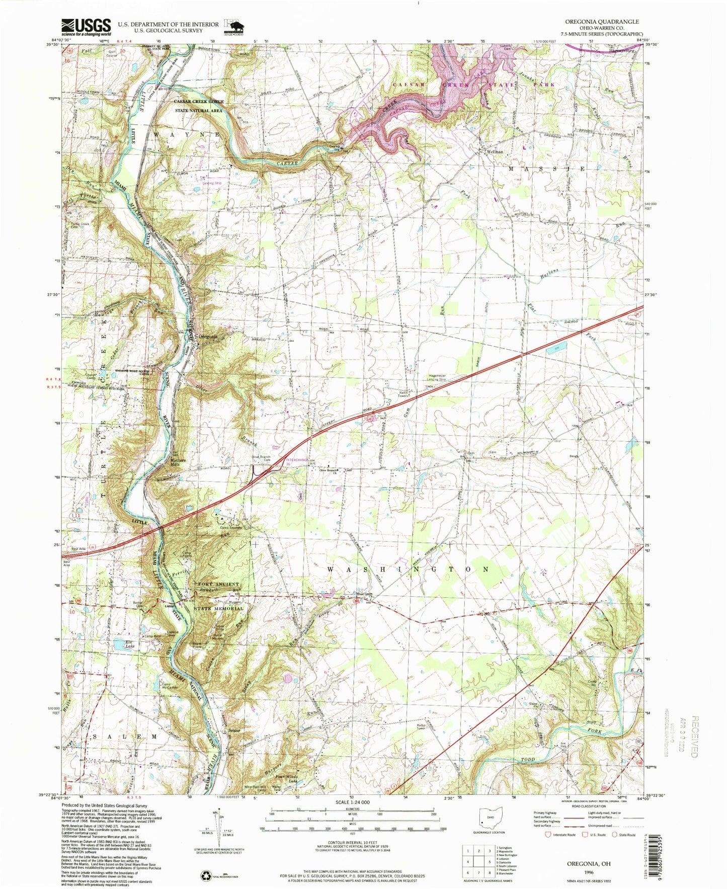
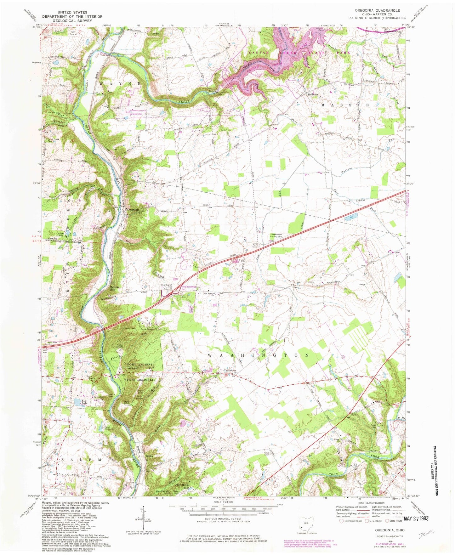
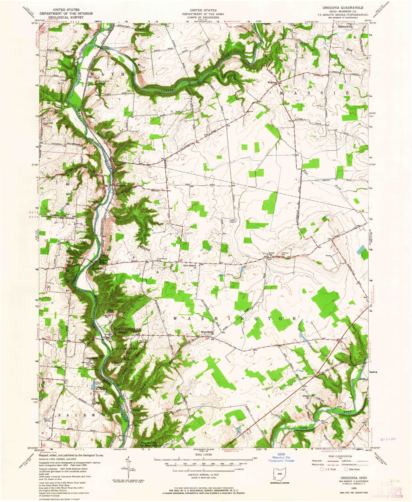
Classic USGS Oregonia Ohio 7.5'x7.5' Topo Map
Couldn't load pickup availability
Historical USGS topographic quad map of Oregonia in the state of Ohio. Typical map scale is 1:24,000, but may vary for certain years, if available. Print size: 24" x 27"
This quadrangle is in the following counties: Warren.
The map contains contour lines, roads, rivers, towns, and lakes. Printed on high-quality waterproof paper with UV fade-resistant inks, and shipped rolled.
Contains the following named places: Bethel Cemetery, Camp Firefly, Camp Joy, Camp Kern, Camp Swoneky, Camp Wy-ca-key, Cedar Branch, Dry Run, East Turtle Creek, East Fork Todd Fork, Elk Lake, Fall Run, Ferris Run, Flat Fork, Four Winds Lake, Gum Run, Hawleys Run, Knoll Brook, Lukens Cemetery, Olive Branch, Olive Branch Cemetery, Randall Run, Richs Run, Silver Grove Church, Turtle Creek Cemetery, Union Church, Harlans Run, Flat Fork School (historical), Greenbrier School (historical), Gum Grove School (historical), Olive Branch School (historical), Redoak School (historical), Silver Grove School (historical), Spring Hill School (historical), Turtle Creek School (historical), Wellman School (historical), Whiteoak School (historical), Little Miami Wild and Scenic River, Caesar Creek Lake, Cowen Run, Fort Ancient State Memorial, Jonahs Run, Wellman, Oregonia, Caesar Creek Gorge State Natural Area, Mathers Mills, Senior, Caesar Creek, Stony Run, Olive Branch United Methodist Church, Gray Pond Dam, Gray Pond, Elk Lake Dam, Harper Pond Dam, Harper Pond, Murphy Pond Dam, Murphy Pond, Hagemeyer Airport (historical), Caesar Creek Gliderport, Township of Massie, Township of Washington, Brannock Cemetery, Union Cemetery, Caesar Creek State Park, Jeremiah Morrow Bridge, Usrey Mobile Home Park, Wilkerson Cemetery, Bethel Cemetery, Camp Firefly, Camp Joy, Camp Kern, Camp Swoneky, Camp Wy-ca-key, Cedar Branch, Dry Run, East Turtle Creek, East Fork Todd Fork, Elk Lake, Fall Run, Ferris Run, Flat Fork, Four Winds Lake, Gum Run, Hawleys Run, Knoll Brook, Lukens Cemetery, Olive Branch, Olive Branch Cemetery, Randall Run, Richs Run, Silver Grove Church, Turtle Creek Cemetery, Union Church, Harlans Run, Flat Fork School (historical), Greenbrier School (historical), Gum Grove School (historical), Olive Branch School (historical), Redoak School (historical), Silver Grove School (historical), Spring Hill School (historical), Turtle Creek School (historical), Wellman School (historical), Whiteoak School (historical), Little Miami Wild and Scenic River, Caesar Creek Lake, Cowen Run, Fort Ancient State Memorial, Jonahs Run, Wellman, Oregonia, Caesar Creek Gorge State Natural Area, Mathers Mills, Senior, Caesar Creek, Stony Run, Olive Branch United Methodist Church, Gray Pond Dam, Gray Pond, Elk Lake Dam, Harper Pond Dam, Harper Pond, Murphy Pond Dam, Murphy Pond, Hagemeyer Airport (historical), Caesar Creek Gliderport, Township of Massie, Township of Washington, Brannock Cemetery, Union Cemetery, Caesar Creek State Park, Jeremiah Morrow Bridge, Usrey Mobile Home Park, Wilkerson Cemetery