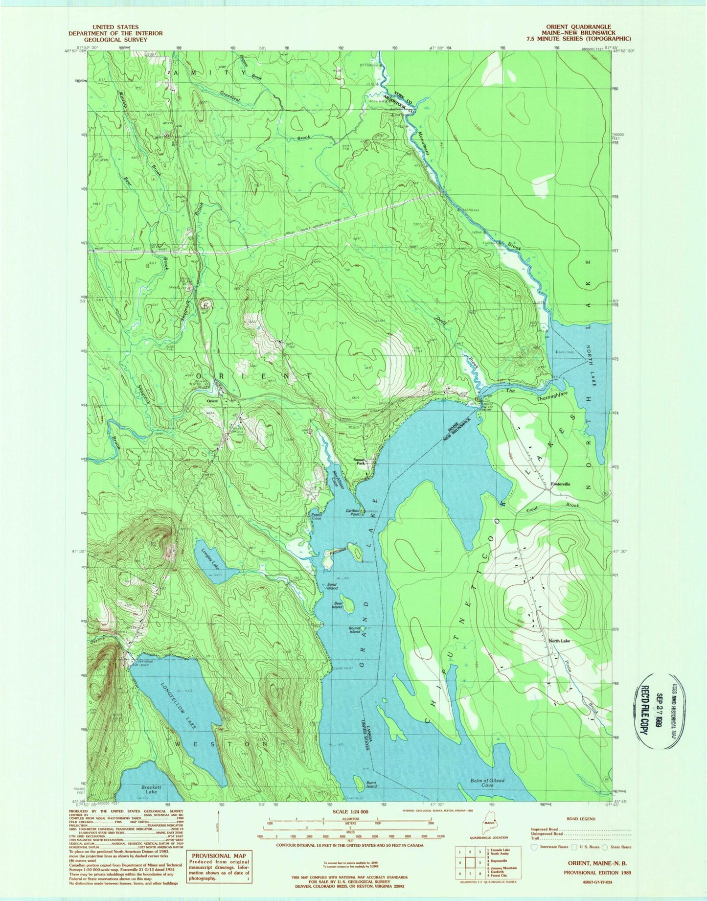
MyTopo
Classic USGS Orient Maine 7.5'x7.5' Topo Map
Couldn't load pickup availability
Historical USGS topographic quad map of Orient in the state of Maine. Map scale may vary for some years, but is generally around 1:24,000. Print size is approximately 24" x 27"
This quadrangle is in the following counties: Aroostook.
The map contains contour lines, roads, rivers, towns, and lakes. Printed on high-quality waterproof paper with UV fade-resistant inks, and shipped rolled.
Contains the following named places: Bear Brook, Bear Island, Burnt Island, Caribou Point, Daggett Brook, Dead Brook, Deering Brook, Elliot School, Greenleaf Brook, Halfmoon Island, Longfellow Lake, Longley Lake, MacAllister Cove, Monument Brook, Orient, Peters Cove, Peters Cove Cemetery, Round Island, Sand Island, Sunset Park, The Thoroughfare, Town of Orient, Winship Brook