MyTopo
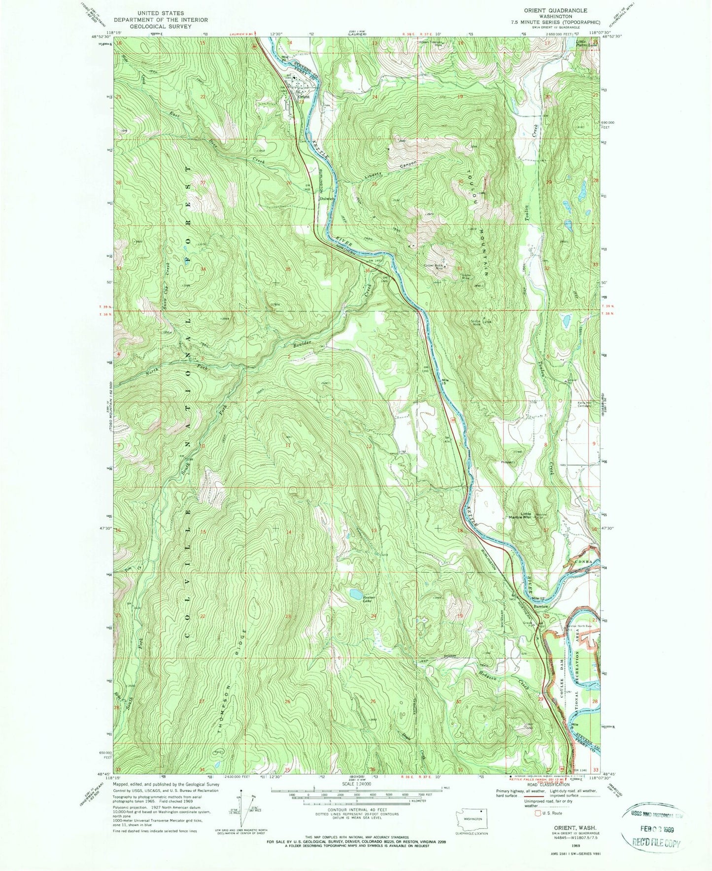
Classic USGS Orient Washington 7.5'x7.5' Topo Map
Couldn't load pickup availability
Historical USGS topographic quad map of Orient in the state of Washington. Map scale may vary for some years, but is generally around 1:24,000. Print size is approximately 24" x 27"
This quadrangle is in the following counties: Ferry, Stevens.
The map contains contour lines, roads, rivers, towns, and lakes. Printed on high-quality waterproof paper with UV fade-resistant inks, and shipped rolled.
Contains the following named places: Barstow, Barstow Bridge, Barstow Census Designated Place, Boulder Creek, Cooper Butte Mine, Doyle Creek, Dulwich, East Deer Creek, Echo Creek, Globe Mine, Hidden Treasure Mine, Hodgson Creek, Joint Protection Ferry County Fire District 3 - Stevens County Fire District 8 Barstow, Joint Protection Ferry County Fire District 3 - Stevens County Fire District 8 Orient, Kelly Hill Cemetery, Kettle River Community Health Center, Liberty Canyon, Little Marble Mountain, North Fork Boulder Creek, Orient, Orient Census Designated Place, Orient Community Church, Orient Elementary School, Orient Post Office, Renner Lake, Scotia Mine, Slide Creek, Snow Cap Creek, South Fork Boulder Creek, Tom Creek, Toulou Creek, Toulou Mountain