MyTopo
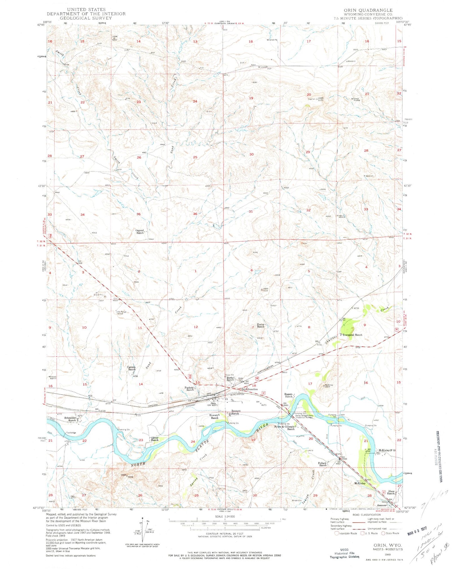
Classic USGS Orin Wyoming 7.5'x7.5' Topo Map
Couldn't load pickup availability
Historical USGS topographic quad map of Orin in the state of Wyoming. Map scale may vary for some years, but is generally around 1:24,000. Print size is approximately 24" x 27"
This quadrangle is in the following counties: Converse.
The map contains contour lines, roads, rivers, towns, and lakes. Printed on high-quality waterproof paper with UV fade-resistant inks, and shipped rolled.
Contains the following named places: Ammon, Barkdoll Pit Number One, Bennett Ranch, Burke Ranch, CAA Range Station, Cactus Four Claim, Carmin Ranch, Foster Ranch, Howery Ranch, Indian Creek, James Bridger Ferry, McKinley, McKinley Post Office, Nylen and Gillespie Ranch, Oliver Ranch, Orin, Orin Census Designated Place, Orin Junction, Orin Junction Pit, Osgood Ranch, Pollack Ranch, Puckett Ranch, Rogers Ranch, Sand Creek, Sand Creek Mine, Schneider Ranch, Shaw Ranch, Shawnee Creek, Shawnee Creek Area Mine, Smith Creek, Spring Creek, Townsend Ranch