MyTopo
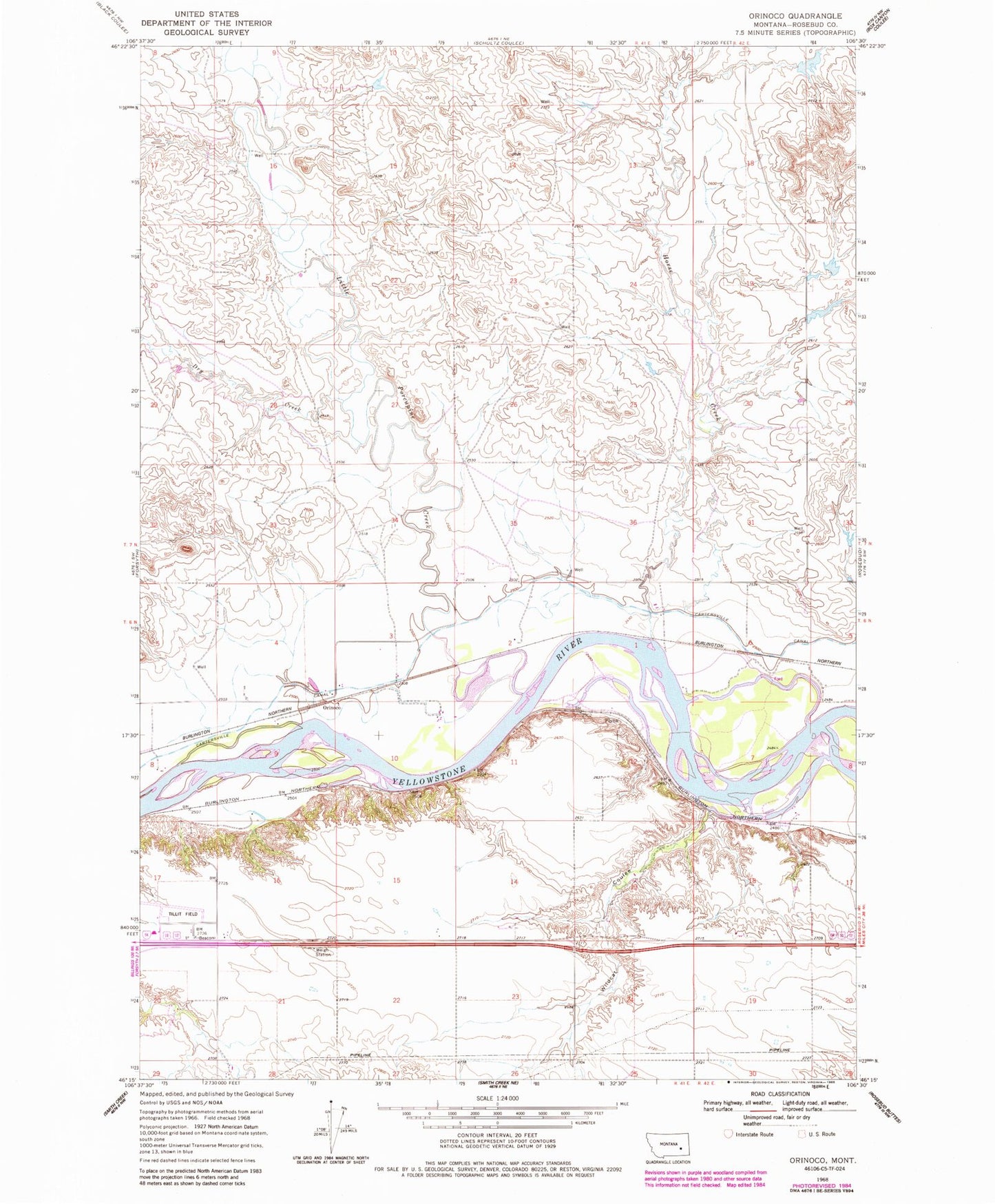
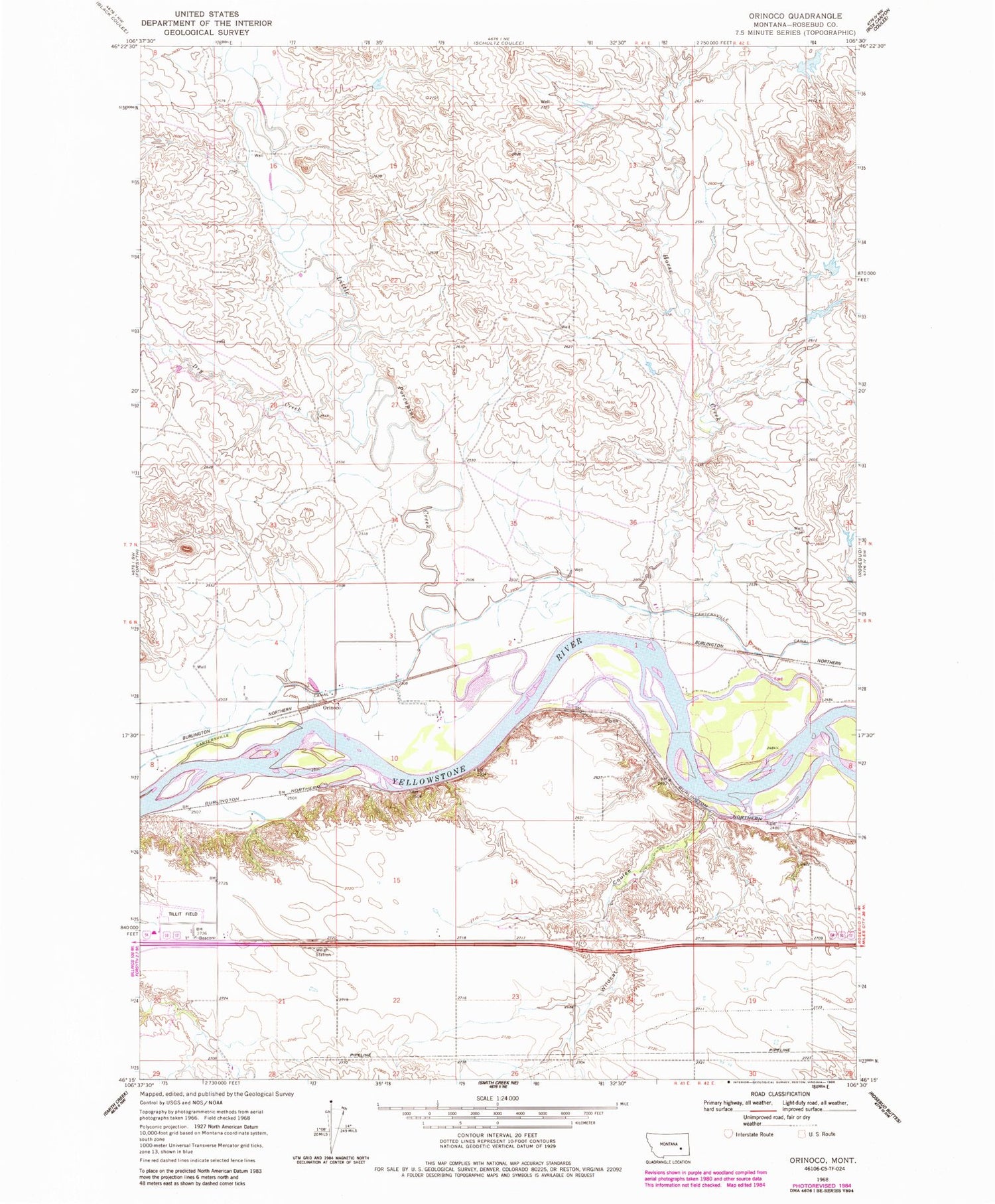
Classic USGS Orinoco Montana 7.5'x7.5' Topo Map
Couldn't load pickup availability
Historical USGS topographic quad map of Orinoco in the state of Montana. Map scale may vary for some years, but is generally around 1:24,000. Print size is approximately 24" x 27"
This quadrangle is in the following counties: Rosebud.
The map contains contour lines, roads, rivers, towns, and lakes. Printed on high-quality waterproof paper with UV fade-resistant inks, and shipped rolled.
Contains the following named places: 06N41E08D___01 Well, 06N41E10BB__01 Well, 06N41E10C___01 Well, 06N41E16C___01 Well, 07N41E35C___01 Well, Camp Alarm, Dewey, Dry Creek, Flynn, Hayden School, Horse Creek, Lantry, Little Porcupine, Little Porcupine Creek, Montgomery Number 1 Dam, Orinoco, Orinoco School, Tillitt Field, Wildcat Coulee