MyTopo
Classic USGS Orla Texas 7.5'x7.5' Topo Map
Regular price
$16.95
Regular price
Sale price
$16.95
Unit price
per
Couldn't load pickup availability
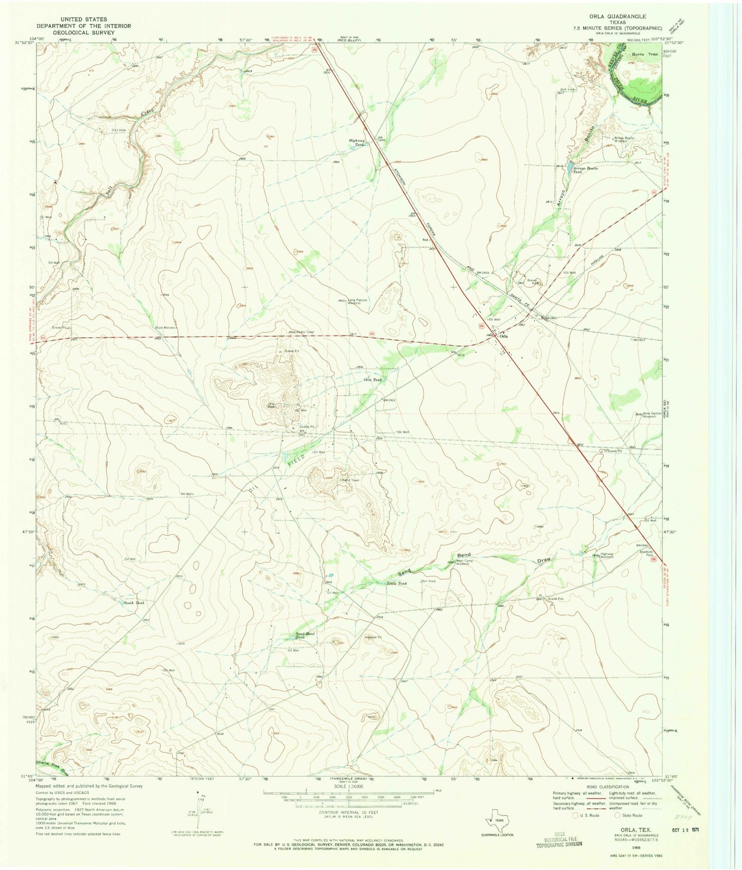
Historical USGS topographic quad map of Orla in the state of Texas. Map scale may vary for some years, but is generally around 1:24,000. Print size is approximately 24" x 27"
This quadrangle is in the following counties: Loving, Reeves.
The map contains contour lines, roads, rivers, towns, and lakes. Printed on high-quality waterproof paper with UV fade-resistant inks, and shipped rolled.
Contains the following named places: Arroyo Bonito, Arroyo Bonito Tank, Arroyo Bonito Windmill, Burro Trap, East Windmill, Highway Tank, Highway Windmill, Little Tank, Long Pasture Windmill, Nine Section Windmill, Orla, Orla Post Office, Orla Tank, Sand Bend Tank, South Tank, West Camp Windmill