MyTopo
Classic USGS Orland California 7.5'x7.5' Topo Map
Couldn't load pickup availability
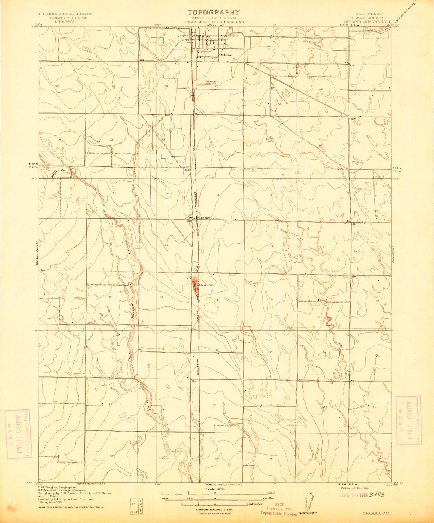
Historical USGS topographic quad map of Orland in the state of California. Map scale may vary for some years, but is generally around 1:24,000. Print size is approximately 24" x 27"
This quadrangle is in the following counties: Glenn.
The map contains contour lines, roads, rivers, towns, and lakes. Printed on high-quality waterproof paper with UV fade-resistant inks, and shipped rolled.
Contains the following named places: Alta Schmidt House Museum, Artois Cemetery, Artois Census Designated Place, Carnegie Community Center, Church of Christ, City of Orland, Evangelical Free Church, Fairview Elementary School, Federated Church, First Apostolic Lighthouse of Jesus Christ Church, First Baptist Church, First Christian Church, Foursquare Christian Fellowship, Glenn County Fairground, Glenn County Sheriff's Office, Grapit, Greenwood, Haigh Field, Lely Aquatic Park, Library Park, Mill Street Elementary School, North Fork Walker Creek, Orland, Orland Catholic Cemetery, Orland City Fire Department / Orland Rural Fire Protection District, Orland City Hall, Orland Free Library, Orland IOOF Cemetery, Orland Police Department, Orland Post Office, Orland Southern Baptist Church, Price Intermediate School, Saint Dominics Roman Catholic Church, South Fork Walker Creek, Westside Ambulance Association