MyTopo
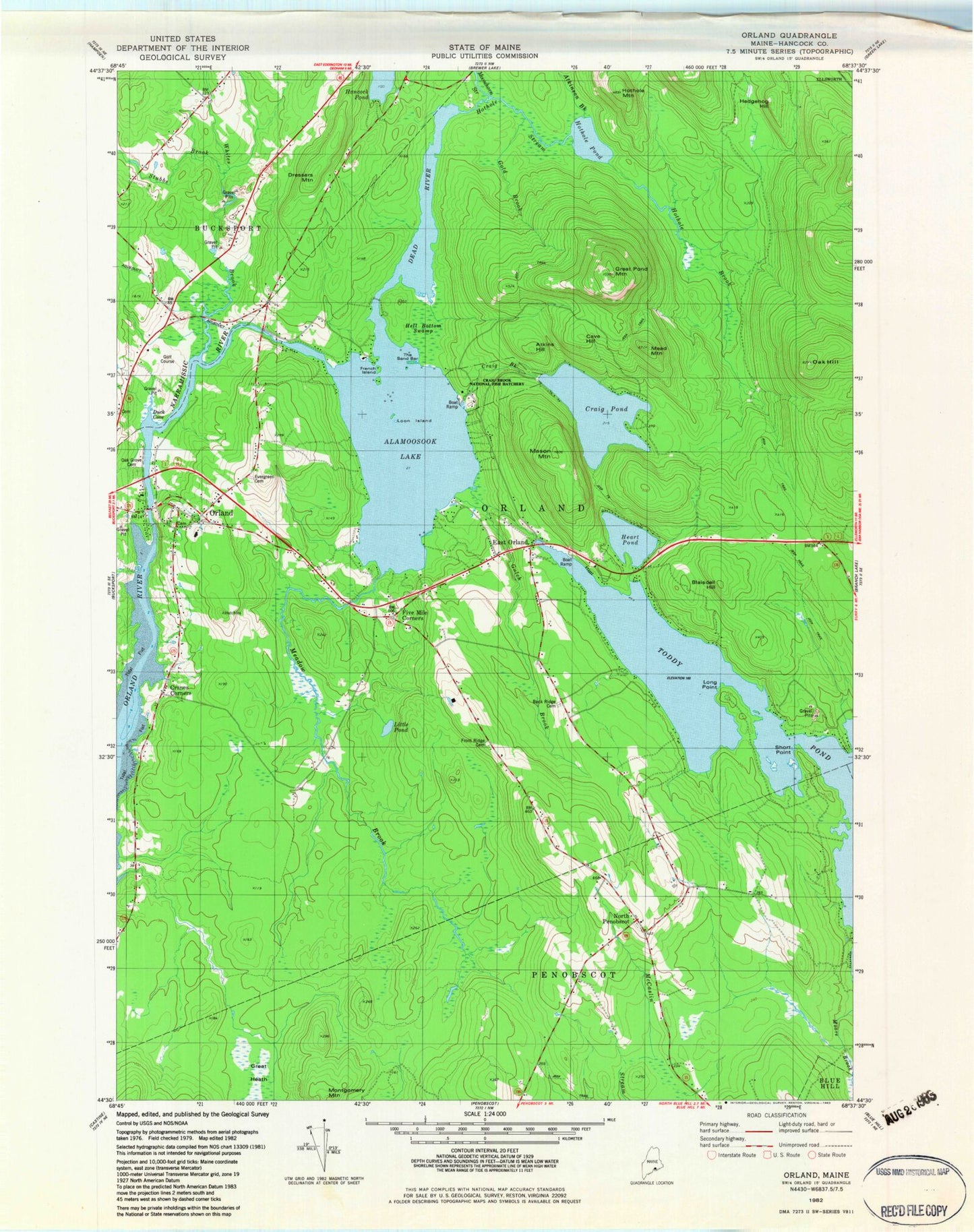
Classic USGS Orland Maine 7.5'x7.5' Topo Map
Couldn't load pickup availability
Historical USGS topographic quad map of Orland in the state of Maine. Typical map scale is 1:24,000, but may vary for certain years, if available. Print size: 24" x 27"
This quadrangle is in the following counties: Hancock.
The map contains contour lines, roads, rivers, towns, and lakes. Printed on high-quality waterproof paper with UV fade-resistant inks, and shipped rolled.
Contains the following named places: Alamoosook Lake, Annear Copper Mine, Atkins Hill, Atkinson Brook, Back Ridge Cemetery, Blaisdell Hill, Cave Hill, Condon Hill, Craig Pond, Cranes Corners, Dead River, Dressers Mountain, Duck Cove, East Orland, Evergreen Cemetery, French Island, Front Ridge Cemetery, Gold Brook, Great Heath, Great Pond Mountain, Gulch Brook, Heart Pond, Hedgehog Hill, Hell Bottom Swamp, Hothole Brook, Hothole Mountain, Hothole Pond, Little Pond, Long Point, Loon Island, Mason Mountain, Mead Mountain, Meadow Brook, Montgomery Mountain, Moosehorn Stream, Mountain Brook, Narramissic River, North Penobscot, Oak Grove Cemetery, Orland, Patton Hill, Short Point, Stubbs Brook, The Sand Bar, Whites Brook, Five Mile Corners, Craig Pond Brook, Hothole Brook, Craig Brook National Fish Hatchery, Oak Hill, Town of Orland, Alamoosook Dam, Craig Pond Dam, Toddy Pond Dam, Orland Village Dam, Main Stem Orland River Reservoir, Balsam Cove Campground, Bucksport Golf Club, East Orland Post Office, Orland Consolidated School (historical), Orland Post Office, Shady Oaks Campground, Whispering Pines Campground, Orland Fire Station, Hillside Cemetery, Page Eldridge Cemetery, Dark Mountain Road Cemetery