MyTopo
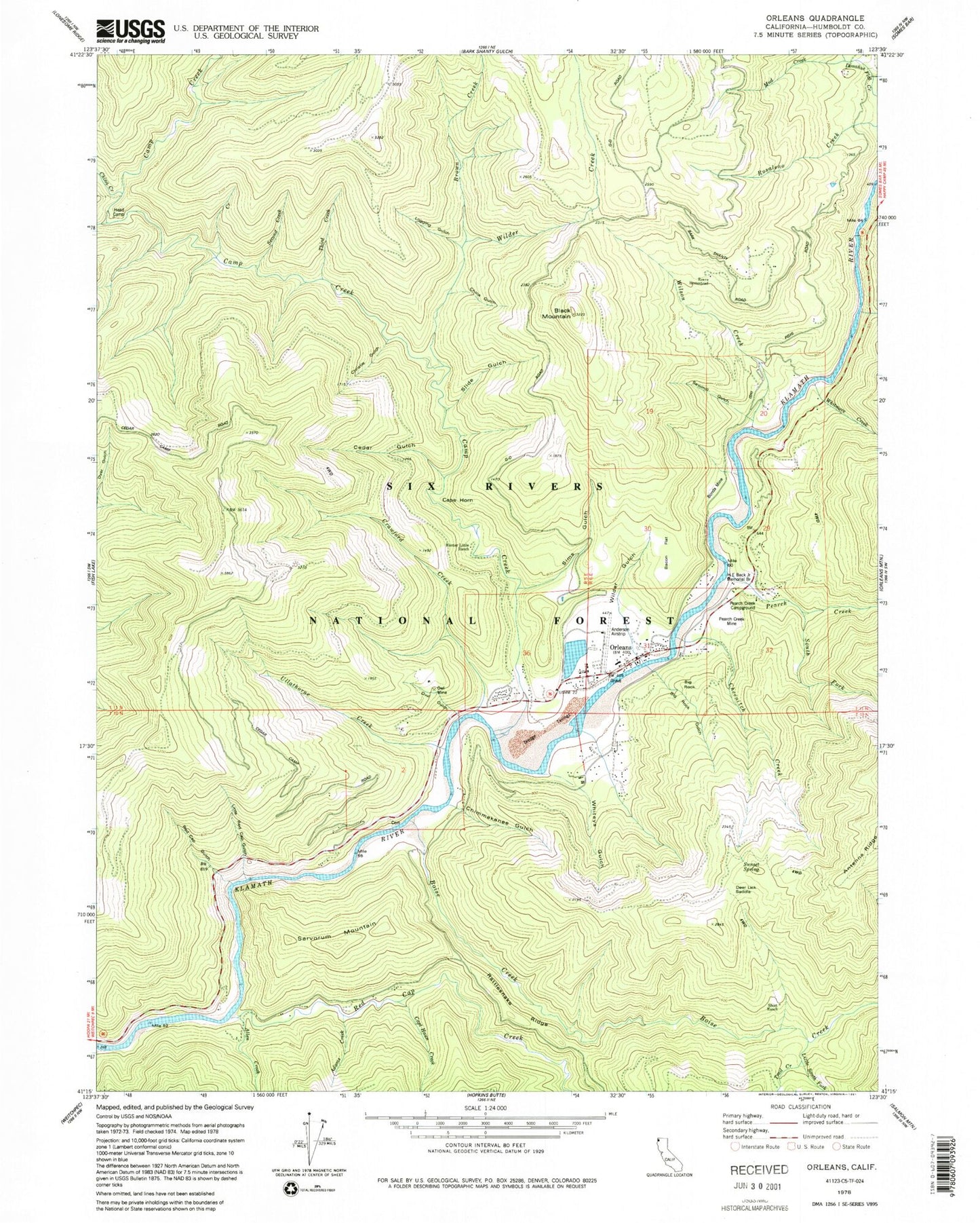
Classic USGS Orleans California 7.5'x7.5' Topo Map
Couldn't load pickup availability
Historical USGS topographic quad map of Orleans in the state of California. Map scale may vary for some years, but is generally around 1:24,000. Print size is approximately 24" x 27"
This quadrangle is in the following counties: Humboldt.
The map contains contour lines, roads, rivers, towns, and lakes. Printed on high-quality waterproof paper with UV fade-resistant inks, and shipped rolled.
Contains the following named places: Adams Creek, Allen Creek, Bacon Flat, Big Rock, Big Rock Gulch, Black Mountain, Boise Creek, Bonda Mine, Brown Creek, Camp Creek, Cape Horn, Captain Haun Creek, Cedar Creek, Cedar Gulch, Cheenitch Creek, Chimmekanee Gulch, China Creek, China Gulch, Christie Gulch, Crawford Creek, Deer Lick Saddle, Dyer Place, First Creek, Fivemile Creek, H E Beck Junior Memorial Branch, Head Camp, Hunter Little Ranch, Little Red Cap Gulch, Little South Fork Boise Creek, Logging Gulch, McHale Mine, Mud Creek, Opegoi, Orleans, Orleans Cemetery, Orleans District Ranger Station, Orleans Elementary School, Orleans Post Office, Orleans Volunteer Fire Department, Owl Gulch, Owl Mine, Panamenik, Pearch Creek, Pearch Creek Campground, Pearch Creek Mine, Rattlesnake Ridge, Red Cap Creek, Red Cap Gulch, Reece Homestead, Sarvorum Mountain, Sawmill Gulch, Second Creek, Short Ranch, Sims Gulch, Slide Gulch, South Fork Pearch Creek, Sunset Spring, Third Creek, Trail Creek, Ullathorne Creek, Whiteys Gulch, Whitmore Creek, Wilder Creek, Wilder Gulch, Wilson Creek, ZIP Code: 95556